Airstrip Info
| Frequency | 122.90 |
|---|---|
| Elevation | 6787 ft |
| Lat/Long |
37.8855, -111.4634 37° 53.13' , -111° 27.804' |
| Runway 14/32 |
3500 ft
x 60 ft
Dirt Rwy 32 Uphill 2.8% |
| Ownership | USFS (NW) / BLM NM (SE) |
Amenities
Weather
See more at the National Weather Center
Information updated May 7, 2024 @ 5:12pm
<<< NOTICE >>>
The Boulder Airstrip will be closed on Friday, May 17, 2024. There will be personnel and vehicles using the southern part of the airstrip which may impede aircraft use. Please avoid the airstrip for that date. Any questions please contact the Board at 385-220-5313
<<< NOTICE >>>
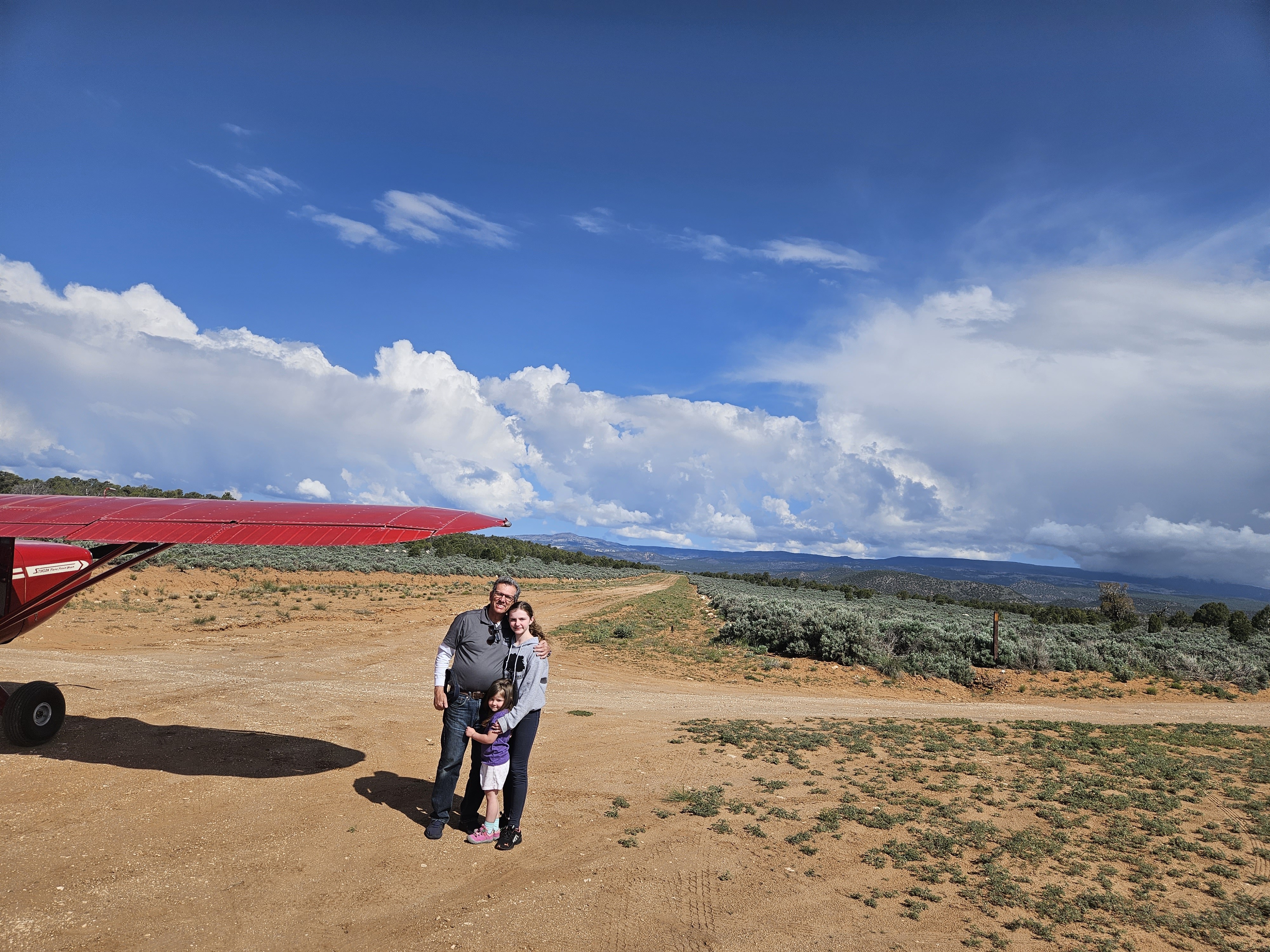
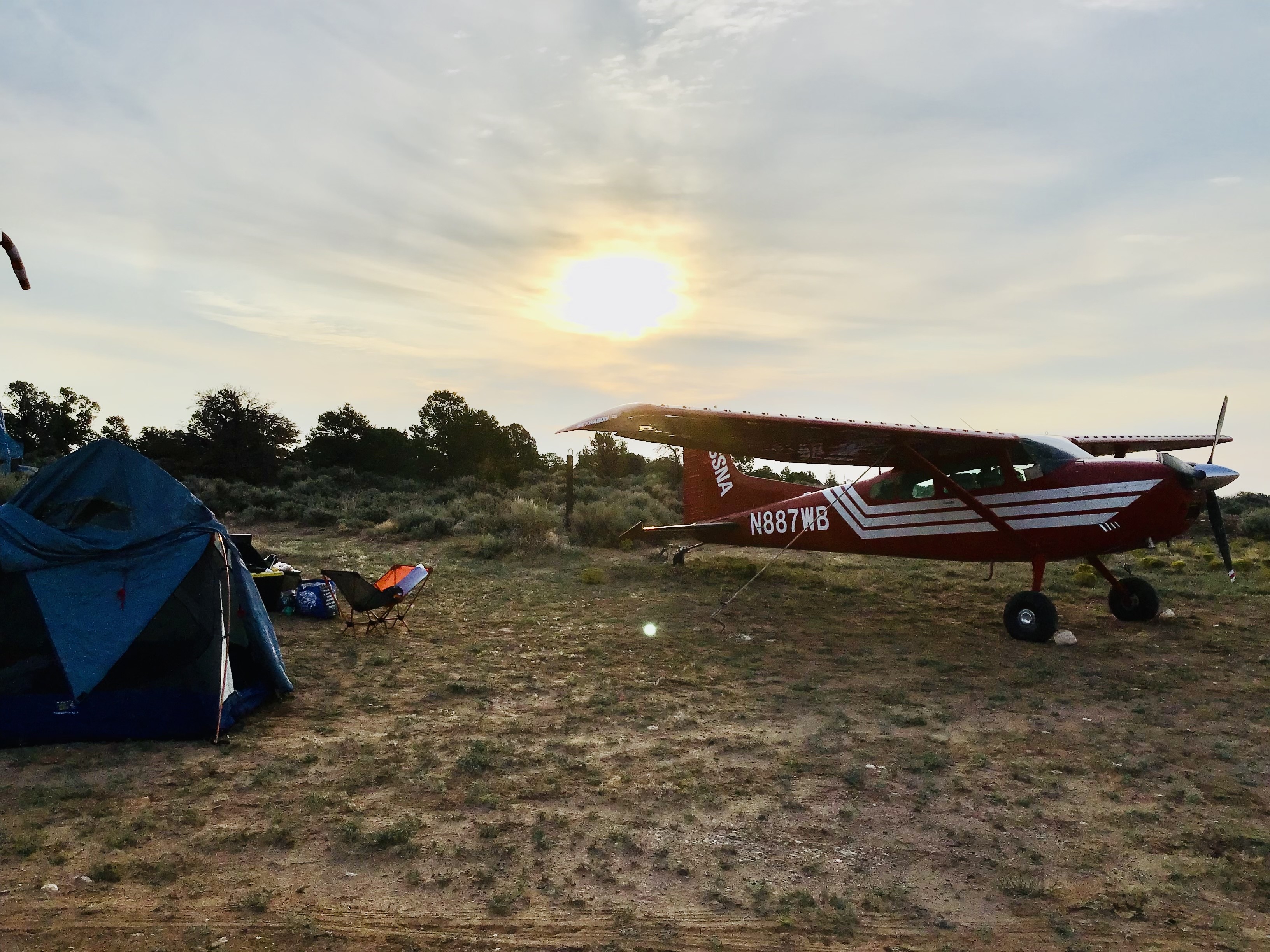
The Boulder Airstrip is located just a few miles from the town of Boulder Utah, near the intersection of State Route/Scenic Byway 12 and Hell's Backbone road. Hell's Backbone Grill in the town is possibly the best farm-to-table experience in all of Utah. This entire area, stretching from Boulder Mountain toward Capital Reef, is filled with spectacular scenery and wonderful flying opportunities. There is no ground transportation available at all in the town, so ground crew support will be important if you wish to visit the Grill or any of the other restaurants there. There is nice hiking and rudimentary camping available at the airstrip, but bring your own water and pack out your own waste.
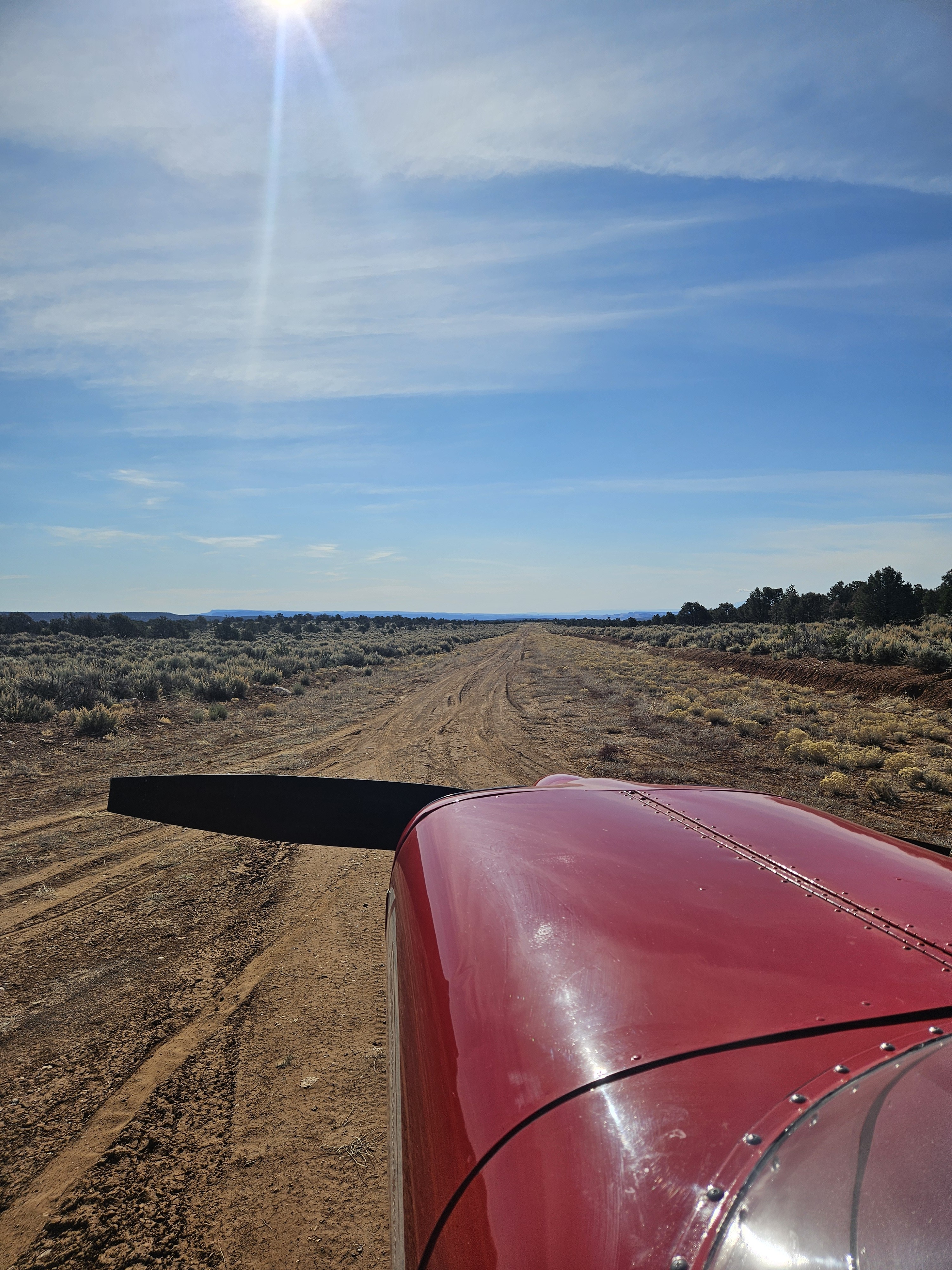
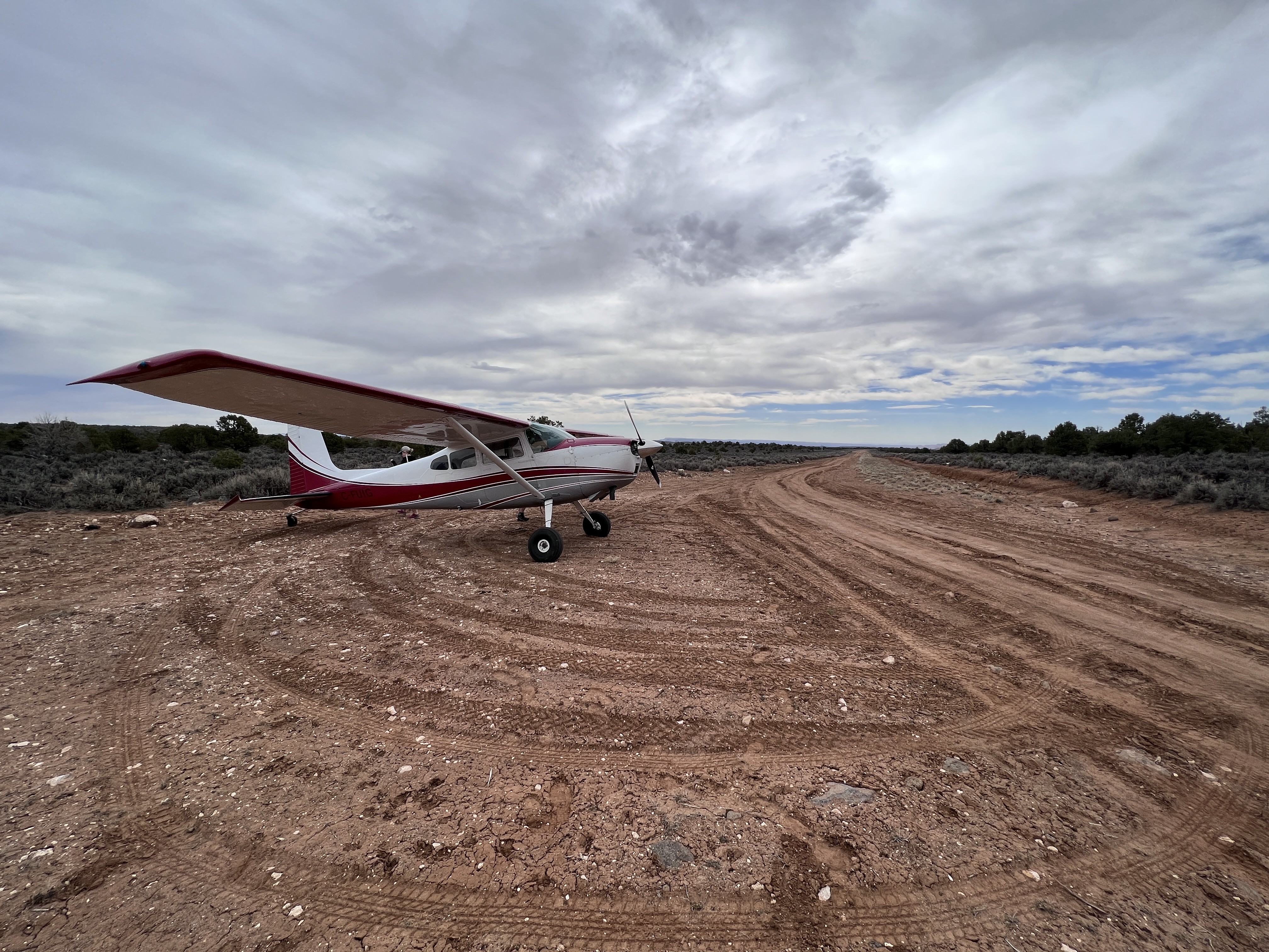
The southeast end of the runway can be accessed by car from SR 12. A longer, but easier-to-find track leads from the Hell's Backbone road to the middle of the runway. The airstrip is also the trailhead for the Old Mail Trail that lead from the town of Boulder to Escalante. Because of this, the runway is heavily rutted from vehicular use. Due to rising terrain to the northwest, there is no takeoff or go-around opportunity in that direction for most airplanes. Generally, landing to the northwest and takeoff to the southeast will be preferred.
Approaching from the southeast, the first 500 feet of the runway is very rough and rocky, making it unsuitable for aircraft without big bush tires. The next section up to the midpoint is probably the least heavily rutted, but the area around the midpoint (where the track from Hell's Backbone road intersects) has very deep ruts. If landing on the southeast end it is advisable to get stopped before the midpoint. It is also possible to land beyond the midpoint on the northwest half of the runway, where it is fairly easy to stop due to the uphill grade. That section also is rutted, but it has been done successfully on 850 tires. Takeoffs normally start straddling the ruts on the northwest end, rolling downhill, with the intent to be airborne well before the midpoint. It is all but impossible to avoid the ruts entirely. In high performance aircraft a takeoff could possibly be initiated from the midpoint, toward the southeast.
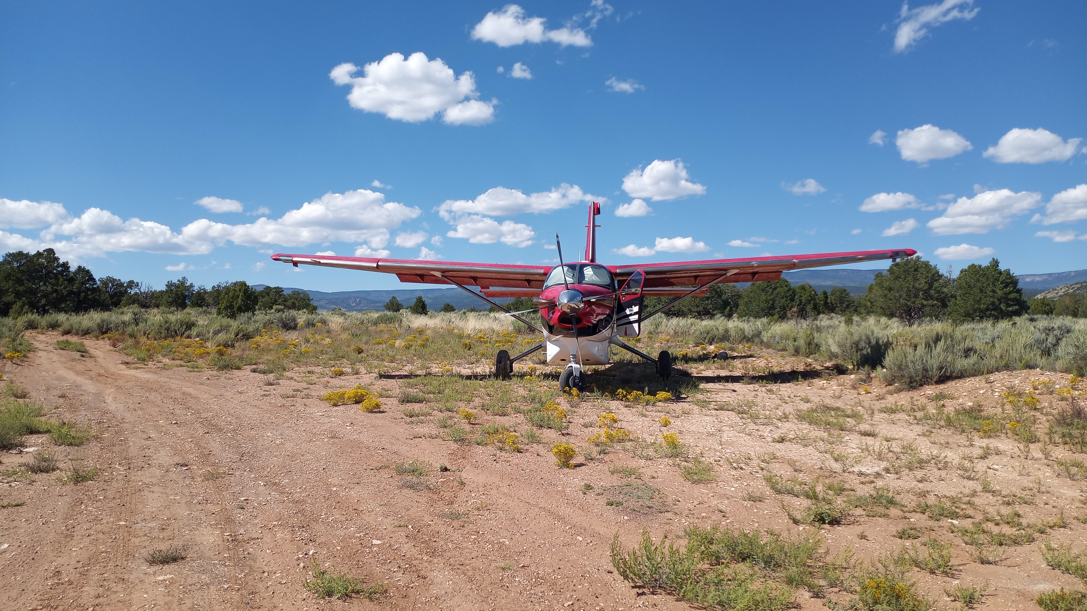
The fuselage of a wrecked airplane stuck on its nose serves as the base of the windsock mast, but the windsock itself is often in disrepair. Perhaps the wreck also serves as a warning to those not fully prepared for the challenges of this interesting strip!
The runway was nearly completely dry, but the softer dirt was just damp enough to keep the prop-induced dust away. As has been mentioned before, the runway is pretty badly rutted. There is an especially treacherous place with very deep crossing ruts right about midfield where a car track intersects the runway. In the past, I have landed 32 and stopped before the midfield crossing. Having noticed that the ruts on the approach (south) end of 32 have gotten worse, this time I elected to touch down beyond the midfield crossing. This worked just fine -- since I was going uphill in dirt that was slightly soft there was no problem at all stopping. Taking off downhill on 14 was easy too, but it is really important to be airborne before the midfield ruts. I think this means about 1800 feet or so of usable runway. Boulder could be so much more accessible if we could somehow just run a blade over it or roll the biggest ruts out.
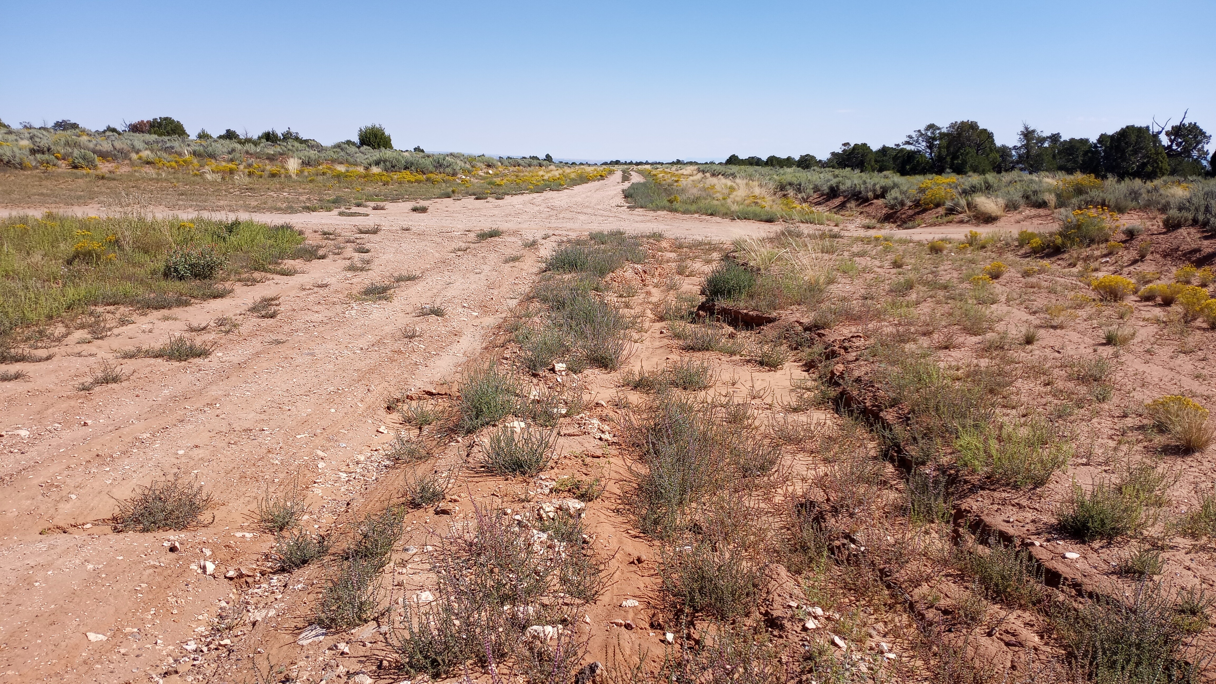
Windsock is actually pretty OK, but has become detached from the hoop about halfway around. As others have mentioned, the runway is rutted, especially at midfield near the intersection between the runway and the road. Unless you have really big tires, you need to be stopped by that point. This makes the usable runway about 1500 feet long when landing uphill on 32. I did fine on my 850s taking off downhill on 14, making sure to be airborne before the midfield ruts. The runway really does need to be graded. Wonder if UBCPA could help facilitate that in some way.
Landed north of the crossing road in a C-180 with 8.5 tires. As previous comments have said we we walked the strip and. I found the SOUTH portion is actually in better condition than the north. Numerous 10 inch ruts. If I was to do it over again I would land on the south portion PRIOR to the road.
11 months ago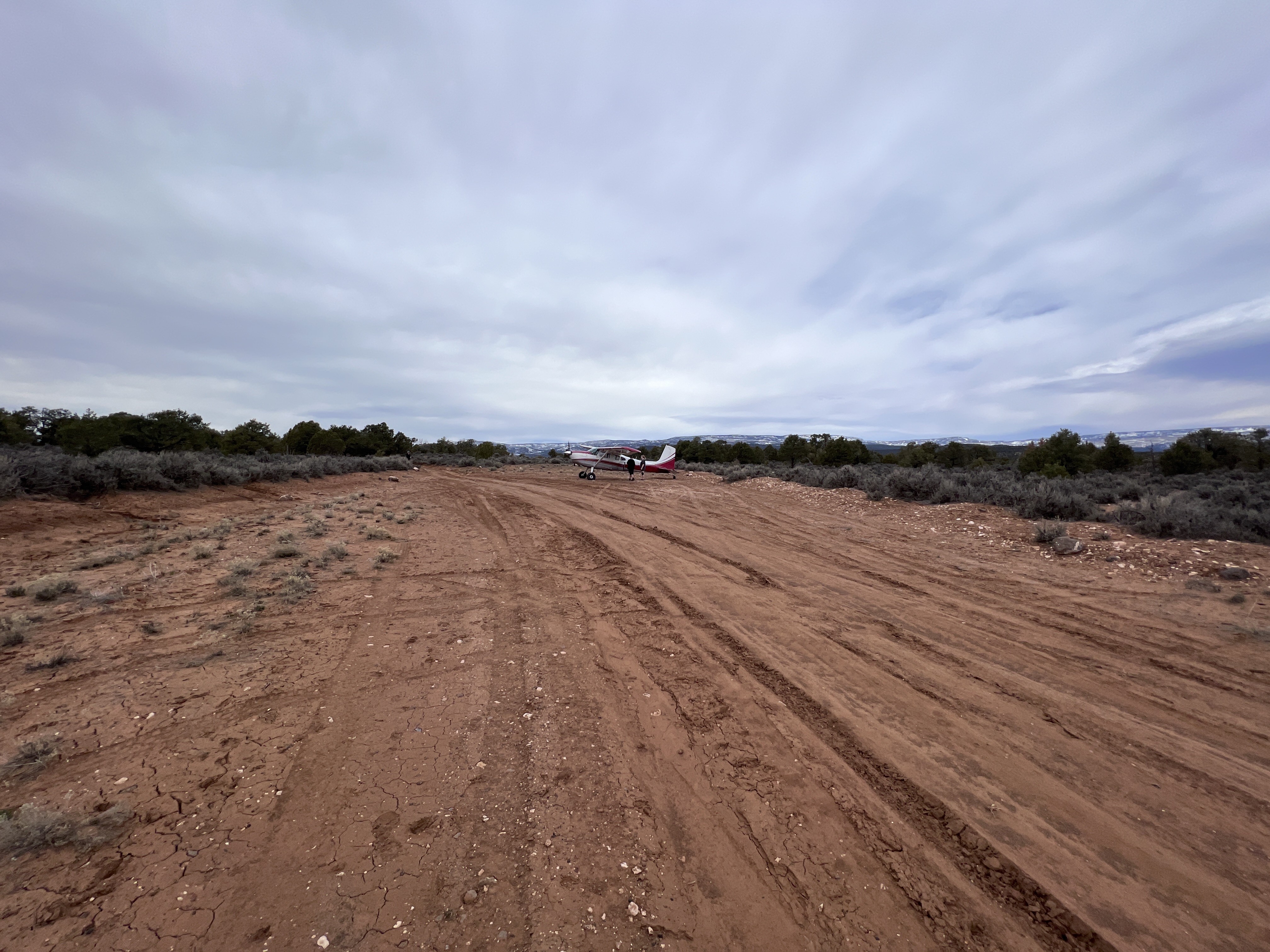
Landed northwest to south east with a couple survey passes before hand. In the middle by the windsock there in a decent size rut probably from water runoff or traffic on a dirt road that cuts across from the east to west there. North side seems to be a bit smoother and more straight. There are some tie down anchors near windsock. the boulder male trail and a couple other trails nearby which brings in a few hikers so exercise caution with traveling vehicles. A couple locals were very happy to see a plane there also.
Boulder Mail Trail is a 15.4 mile moderately trafficked point-to-point trail located near Escalante, Utah that features a river and is rated as difficult. Beginning in 1902, pack mules clattered along a carved sandstone trail, hauling letters and packages between Escalante and Boulder Town. The Boulder Mail Trail was a vital link between Boulder and the outside world until 1940 when Highway 12 was completed. https://www.alltrails.com/trail/us/utah/boulder-mail-trail
Upper Calf Creek Falls Trail is a 2.1 mile heavily trafficked out and back trail located near Boulder, Utah that features a waterfall. https://www.alltrails.com/trail/us/utah/upper-calf-creek-falls-trail
We haven't written a history for this airstrip yet. If you would like to provide us with some information about this strip, please contact us today!