Airstrip Info
| Frequency | 122.90 |
|---|---|
| Elevation | 6700 ft |
| Lat/Long |
38.8728, -110.5697 38° 52.368' , -110° 34.182' |
| Runway 14/32 |
3200 ft
Dirt No Slope |
| Ownership | BLM |
Weather
See more at the National Weather Center
Information updated May 27, 2021 @ 8:33pm
Cliff Dweller Flat
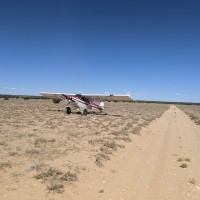
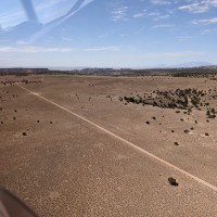
Description: The Cliff Dweller Flat airstrip is oriented northwest/southeast. Herds of wild burros live in this area and caution should be used. There is vehicle access to the airstrip, so watch out for cars, trucks, animals, and people.
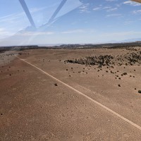
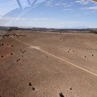
Runway: The original runway was approximately 4,100’ long and 100’ wide. Current useable landing area is approximately 3,200’ utilizing the two track road running the Northeast side of the airstrip. Watering troughs are located approximately 1,100’ from the southeast end of the strip, leave approximately 1,100’ to the southeast for landing and 2,200’ northwest of the troughs for landing. The section to the northwest of the troughs appears to be the better section to land on, with uniformly flat surface the width of the two track road.
Approach Considerations: The airstrip lies in an open, flat area with good approaches from both directions. The Northwest section of the two track road looks to be the better section of the strip for landing. Numerous wild burros have been observed along the strip, so caution should be used when landing.
Amenities: Primitive camping areas are available along the strip. Eardley Canyon is roughly a mile and a half south of the southeast end of the airstrip. This strip offers opportunities to mountain bike to the slot canyons and numerous hikes to explore the area.
Windsock: No.
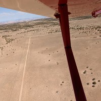
As mentioned, this is basically a narrow dirt road barely wider than my gear is wide. he double track road is about 1 foot deeper than the surrounding area and had mud holes in a few areas from recent rains. Still, there was enough useable room between mud holes to land & T/O. Didn't see any wildlife. Needs some grading, but still useable and fun.
Sounds awesome! If you’re ever looking for a Co-Pilot. I’d love to learn a bit more about backcountry flyin. Thanks!
2 years agoPretty rough surface with clump grass and some rutting. 4"-6" mounds. It would take a pretty large work party to get this open for all aircraft. Not much here, but that's kind of the point!
How was the road? The BLM rec planner I flew said there is great trail/ canyon access about a mile south of the strip.
2 years agoI took off on the road, its pretty narrow, my gear barely fit. also about 1ft lower then everything around it.
2 years agoDid a couple of fly-bys today. It appeared land-able particularly towards the center and south east end of the runway. From the air the NW end looked to have some rocks that I would try to avoid until I could see them up close. The strip is very narrow and a part of a two track road. I did not see a windsock. It looks like you could probably pull the plane off in couple of places along the edges, and especially in the middle around the troughs.
We haven't written a history for this airstrip yet. If you would like to provide us with some information about this strip, please contact us today!
