Features
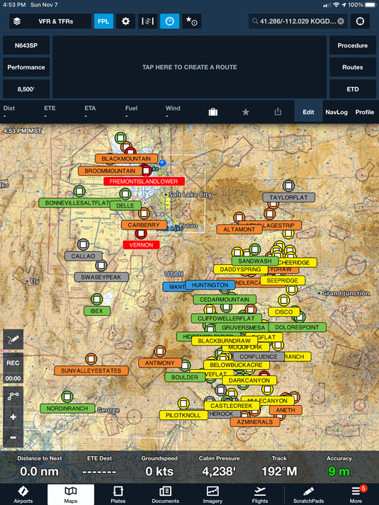
Airstrip Map
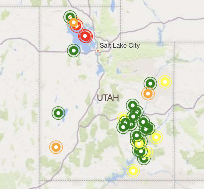
The UBCP Airstrip Map is your gateway to Utah's backcountry airstrips. We've spent countless hours compiling data on the vast network of airstrips in Utah's backcountry and have put it all in one convenient, easy to access place.
The Airstrip Map (and related Airstrip List) make it easy to find your next destination. Sort by runway length, elevation, runway surface, and more. We'll show you which strips are open to the public, which strips are privately owned, and which strips we recommend avoiding.
Condition Reports
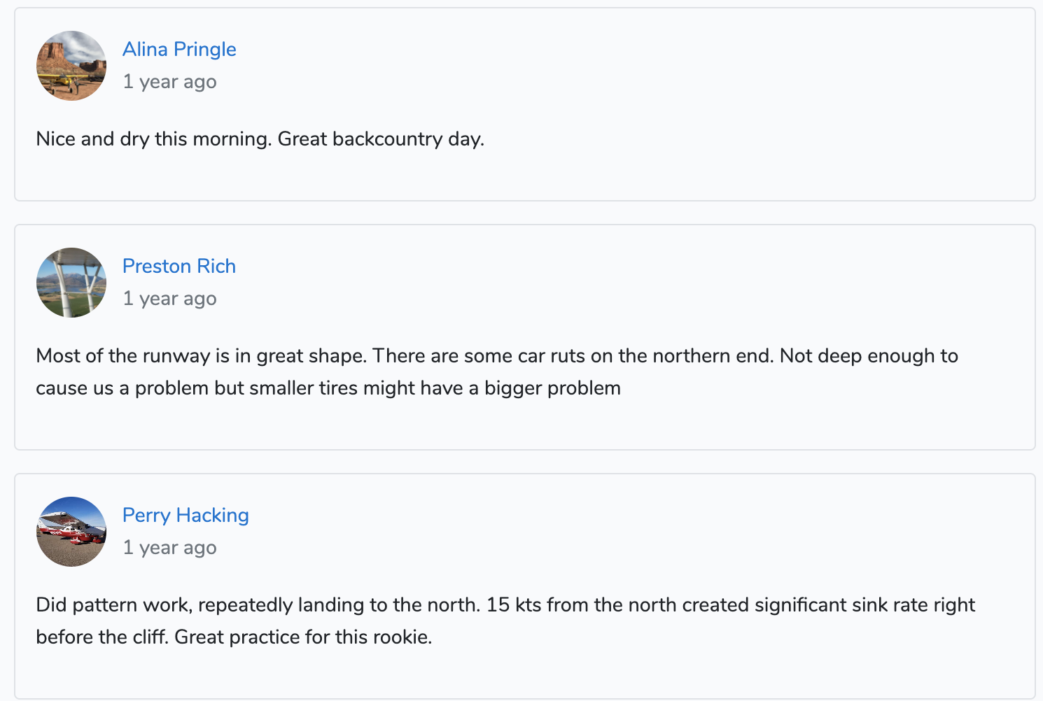
Condition Reports enable you to get the latest information about Utah's airstrips, straight from the mouths of fellow backcountry pilots.
See reports and photos submitted by other pilots detailing the condition and safety of all of Utah's backcountry strips. If you're planning a trip to Utah's backcountry, recent condition reports can be a crucial component to your flight plan.
FlightShare
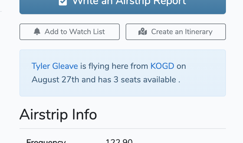
FlightShare allows you to split time with other pilots visiting the backcountry. If you're flying out and have an open seat, you can advertise it by posting a FlightShare.
If you're looking to gain some experience flying in the backcountry and are willing to split costs, you can find pilots with available seats using FlightShare.
Email Updates
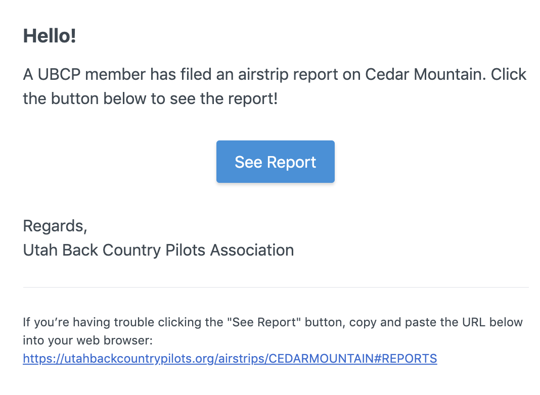
UtahBackCountryPilots.org offers several varieties of email updates. You can sign up to receive our newsletter, notifications about upcoming events, and reminders about upcoming fly-ins.
If you have a paid membership, you can also receive email updates when new Condition Reports are posted about airstirps you're following, and can be notified when other pilots have filed itineraries to airstrips you want to visit.
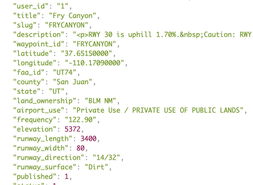
ForeFlight Content Packs
The UBCP ForeFlight Content Pack allows you to downlaod the full UBCP airstrip database directly into ForeFlight.
The UBCP provides the following information for nearly 200 backcountry airstrips:
- Runway length, width, and direction
- Airstrip elevation
- Runway surface type
- Recent airstrip reports by fellow pilots
- Links to local weather data
Available exclusively to members of the Utah Back Country Pilots Association, the ForeFlight Content Pack is a must-have for safe, effective flight planning in the Utah backcountry.
Developer API
The UBCP API cannot be used for commercial purposes. Any data you consume from the API must be for personal use only, or made available for free to your users with a citation indicating that the UBCP is the origin of this data.
The API is currently in a very limited alpha release. As of Jul 13, 2026, the following endpoints are available:
GET https://utahbackcountrypilots.org/api/airstrips-- reteive a list of all airports currently published in the UBCP directoryGET https://utahbackcountrypilots.org/api/airstrips/{slug}-- reteive the details of a specific airstrip, including all airstrip reports. Use the {slug} column from the /airstrips API endpointGET https://utahbackcountrypilots.org/api/airstrips/{slug}/reports-- reteive all of the condition reports for a specific airstrip. Use the {slug} column from the /airstrips API endpointGET https://utahbackcountrypilots.org/api/reports-- reteive a list of all reports in the UBCP database
The UBCP makes no guarantee that these endpoints will be available at any time, now or in the future. You may cache information retrieved from the API and use it at any time, so long as you adhere to the rules stated above.