Utah Airstrips ForeFlight Content Pack
Download the full UBCP Airstrip Database directly into ForeFlight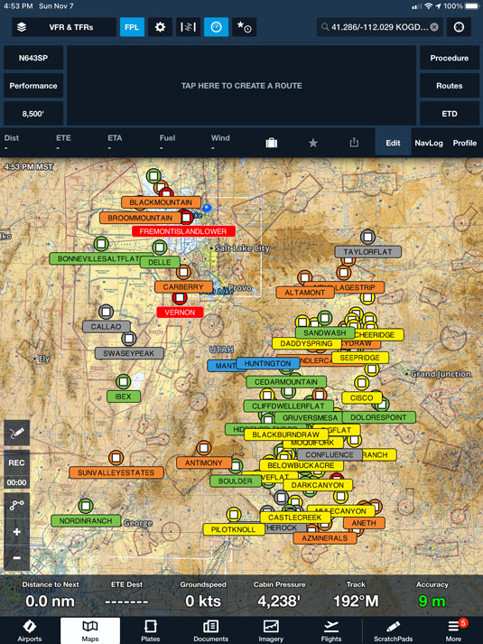
ForeFlight Waypoints
The UBCP Content Pack allows you to see all of Utah's backcountry airstrips in a convenient ForeFlight layer.
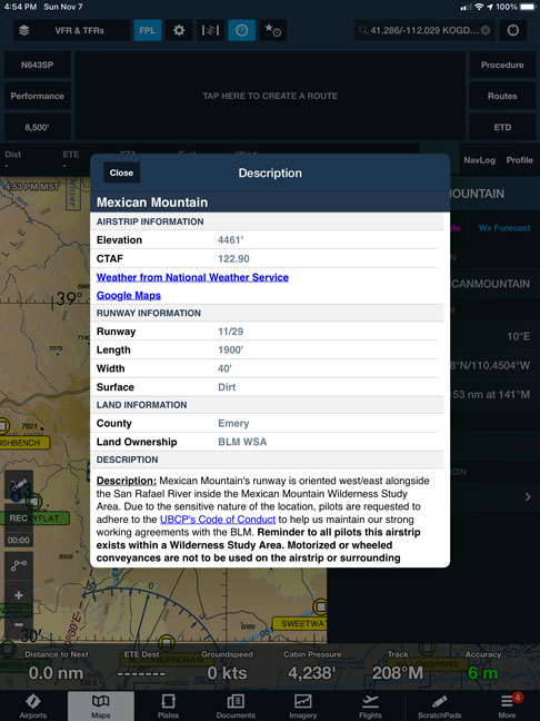
Airstrip Details & Reports
Click on any airstrip in the ForeFlight layer to see details about that particular strip.
The UBCP provides the following for nearly 200 backcountry airstrips:
- Runway length, width, and direction
- Airstrip elevation
- Runway surface type
- Recent airstrip reports by fellow pilots
- Links to local weather data
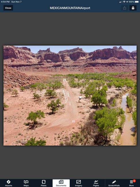
Approach Images
For select high-traffic airstrips, the Utah Back Country Pilots association has created "approach plates" that provide a pilots-eye view of the approach.
Attention: In order to have the most up-to-date airstrip information, the UBCP Content Pack must be manually updated. To update the UBCP Content Pack, you must manually delete and re-install it. This is a ForeFlight limitation that we are currently working to resolve.
To delete an outdated content pack:
- In ForeFlight, navigate to Settings -> Custom Content.
- Under Content Packs, select the "Utah Airstrips" content pack. Scroll to the bottom and select "Delete Content Pack".