Airstrip Info
| Frequency | Unknown |
|---|---|
| Elevation | Unknown |
| Lat/Long |
38.0933, -109.616 38° 5.598' , -109° 36.96' |
| Runway |
|
| Ownership | BLM NM |
Weather
See more at the National Weather Center
Information updated July 9, 2025 @ 5:26pm
Dry Fork Canyon Airstrip is TEMPORARILY CLOSED. The airstrip is within the Bears Ears National Monument and the airstrip use is not allowed until the BLM has completed a NEPA evaluation of the airstrip.
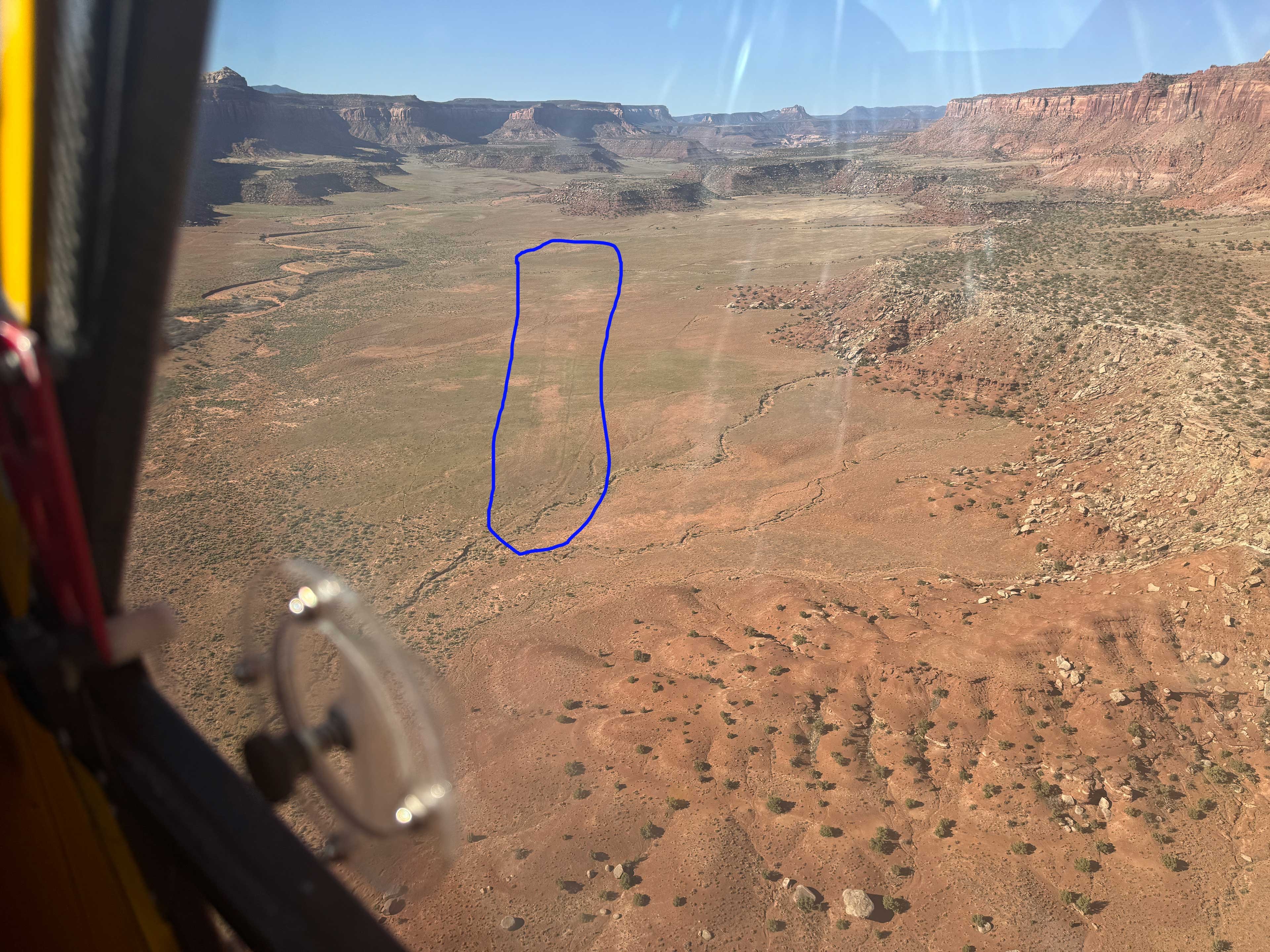
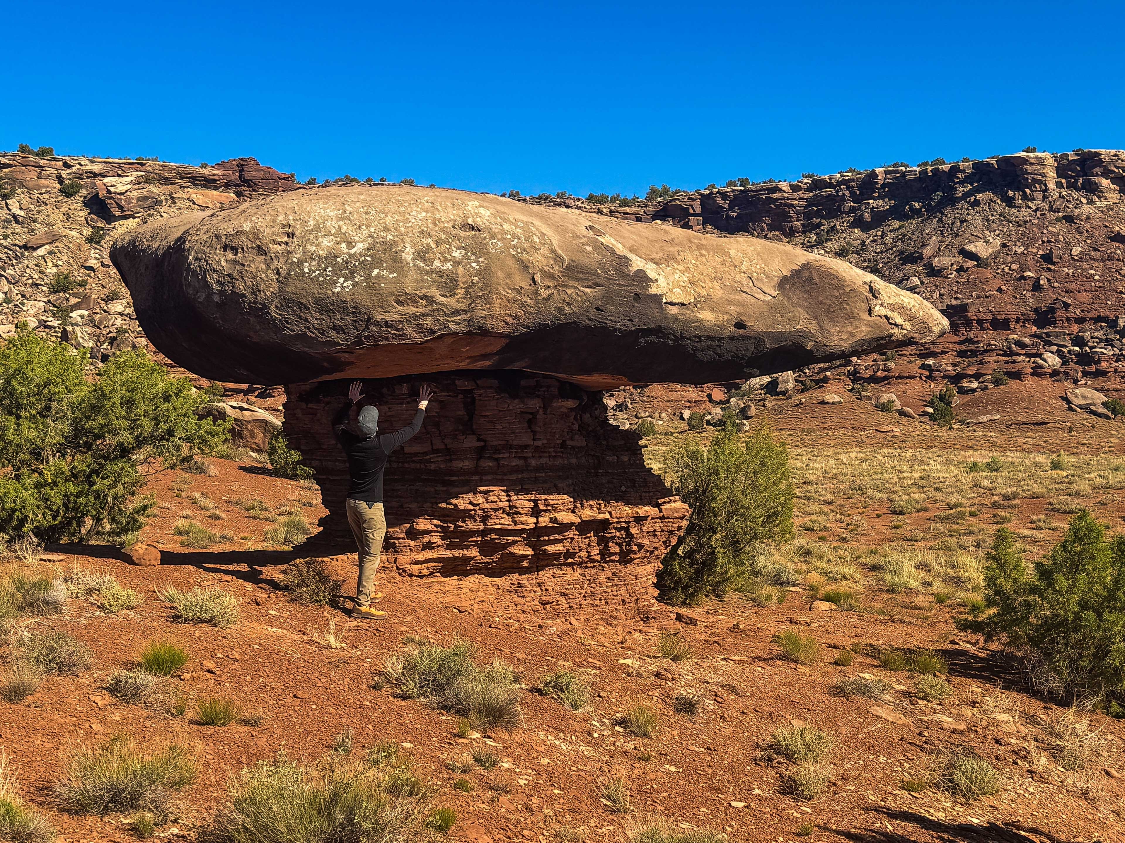
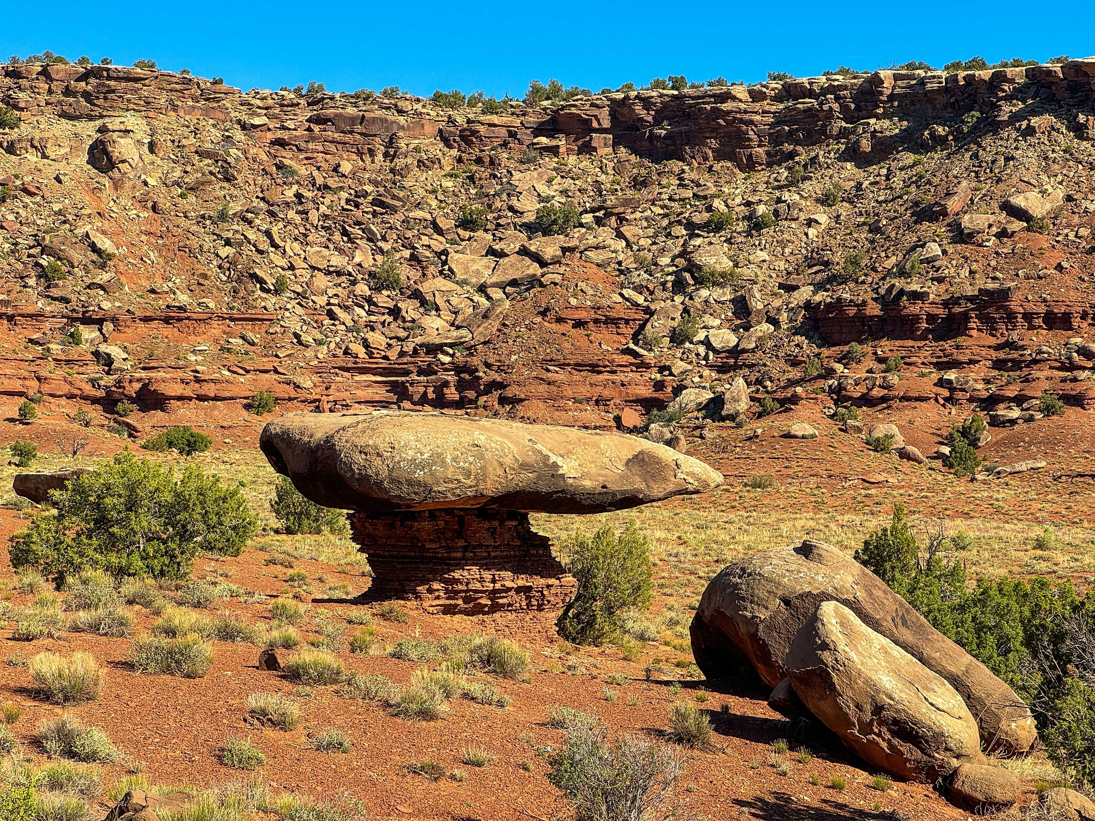
Airstrip is faint but identifiable. Firm surface with numerous “clumps” of cactus. Surface currently suitable for 8.5 x 6 tires (rough due to cactus). A very few small rocks (can see my tailwheel roll over one taxiing at start of below video link). No windsock. A couple of (currently no factor) “water ruts” developing—overfly & check before committing to landing. As seen in the attached overview video, no nearby “track” or road access that would permit strip maintenance without disturbing currently untracked desert soil/flora. Awesome Hoodoo (link) nearby (15 minute walk). One of the most spectacular examples of a Hoodoo that I’ve ever seen. Park Hwy 211 (link) visible in the distance with sparse traffic, but one cannot hear the cars. Canyon walls would make a wonderful backdrop for sunrise and sunset pictures. This is a 360° video. Use your mouse, trackpad, tilt your mobile device or tablet, or use your finger on your mobile device or trackpad to view different perspectives. Video (takeoff) link: https://youtu.be/jOjkwbfDGMc In short, in my opinion, Dry Fork Canyon is a “keeper,” well worth visiting and possibly camping at.
Dry Fork Canyon's airstrip has been identified on USGS maps since 1954. You can view this historic map below or download it by clicking here.