Backcountry airstrips are inherently dangerous. It is the sole responsibility of the Pilot in Command to ascertain airstrip conditions prior to use. Be certain to consider environmental, aircraft, and personal factors when determining suitability.
Use of the airstrips is at the sole discretion of the Pilot in Command. Fly safe!
Information updated April 25, 2024 @ 5:31pm
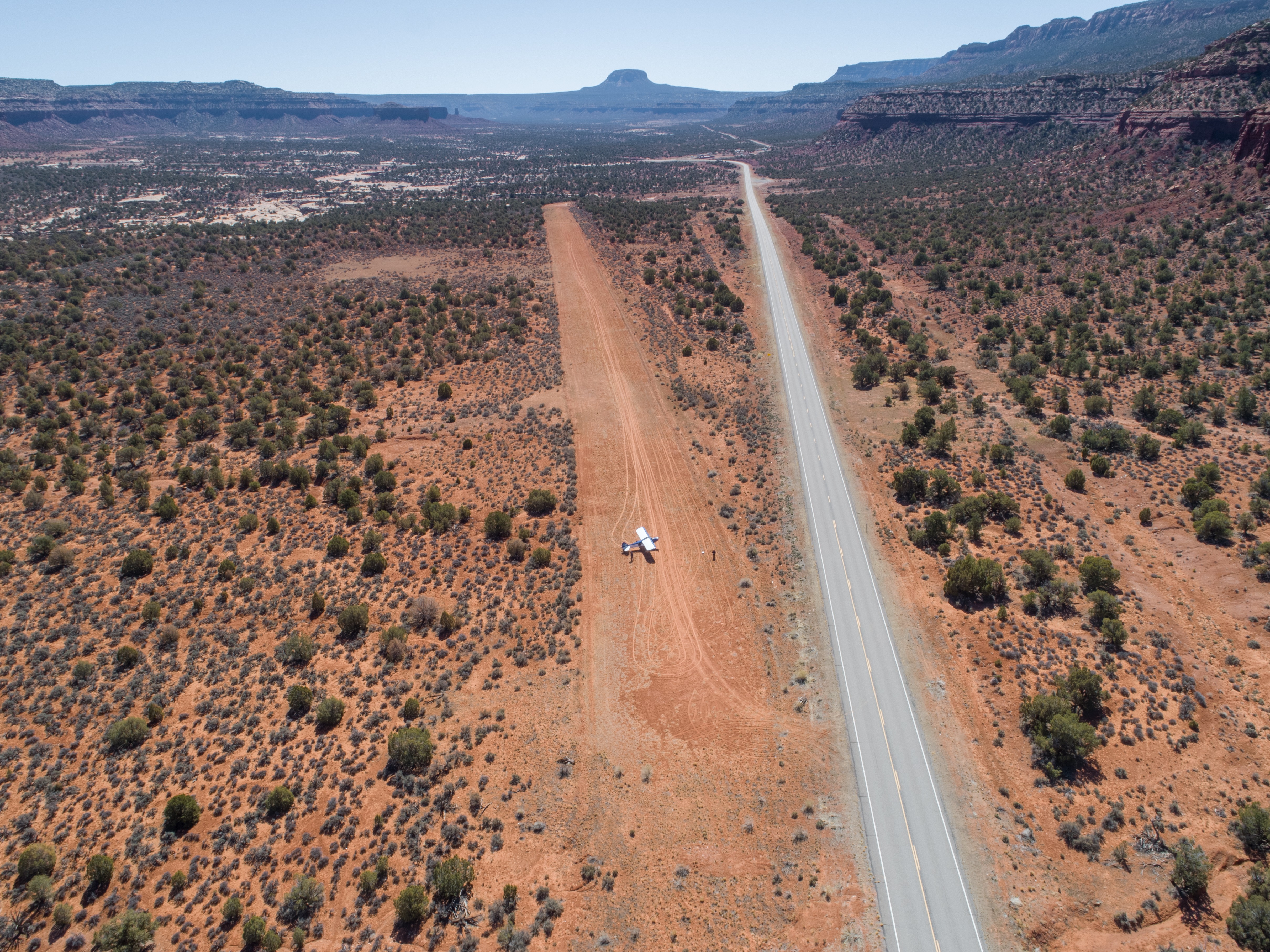
Description: Fry Canyon would be a great start to your Utah backcountry flying adventures. As one of the longer and wider airstrips in the collection it still offers a great opportunity to explore slot canyons, cliff dwellings, and camp with relative ease.
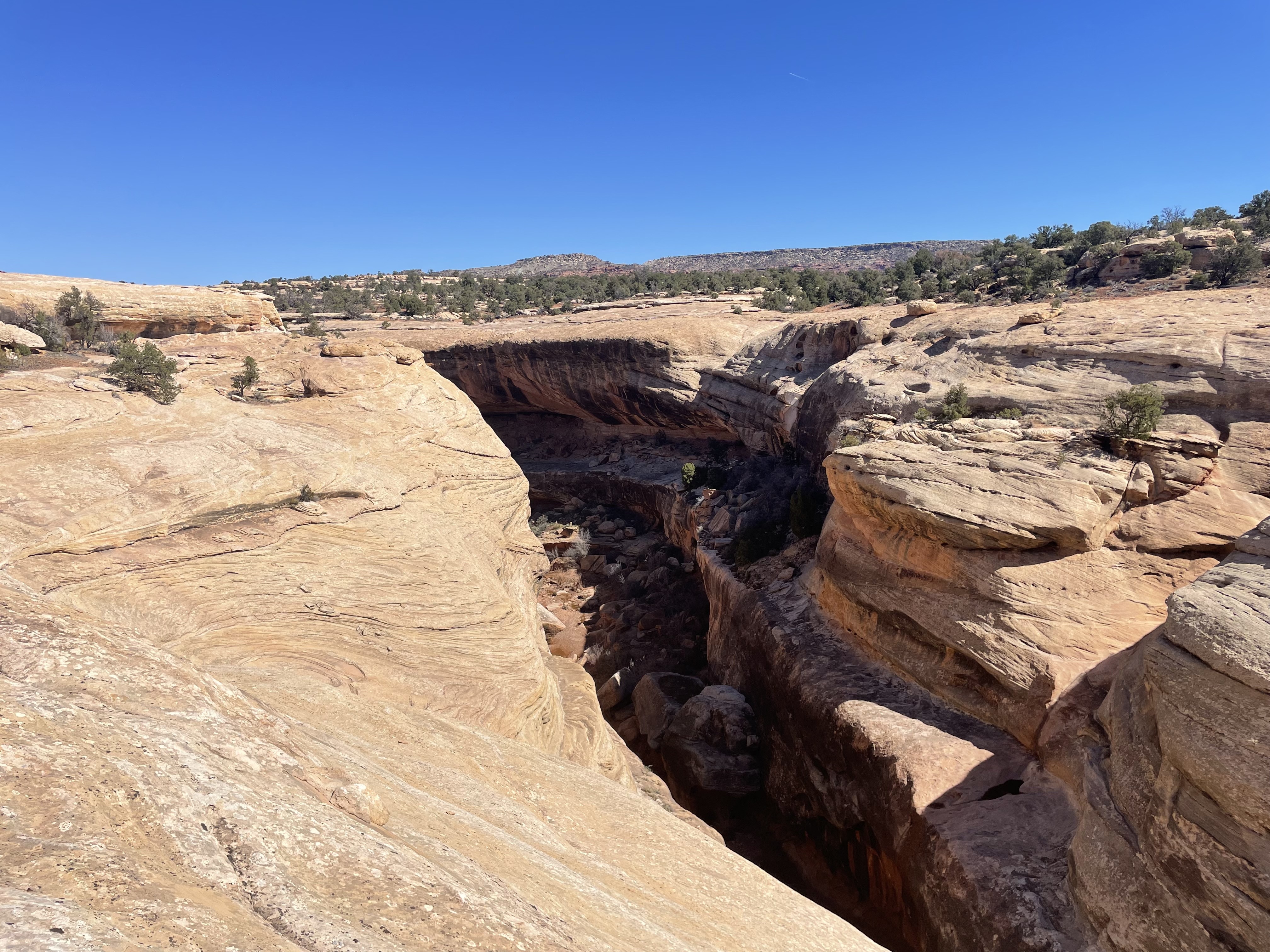
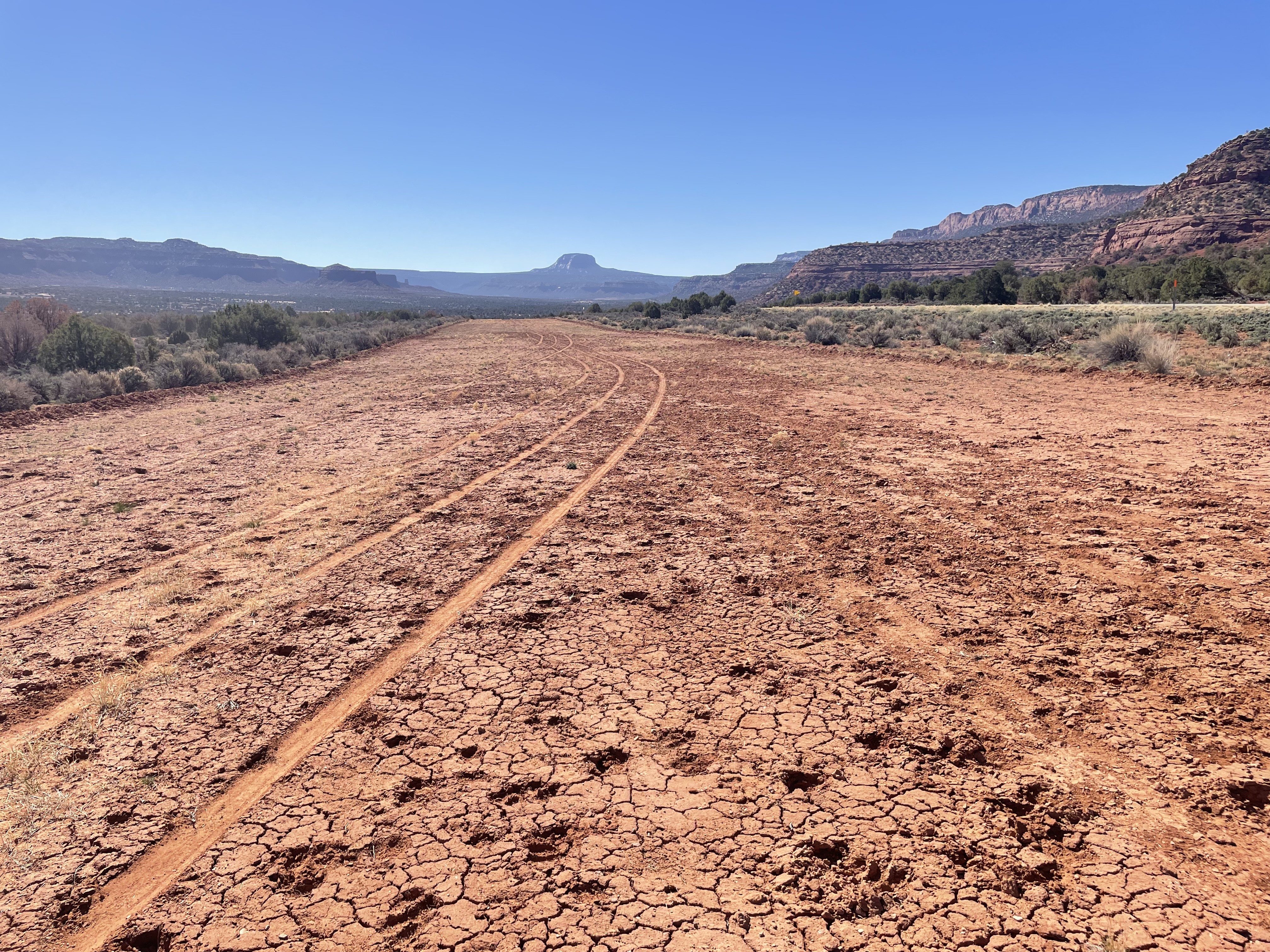
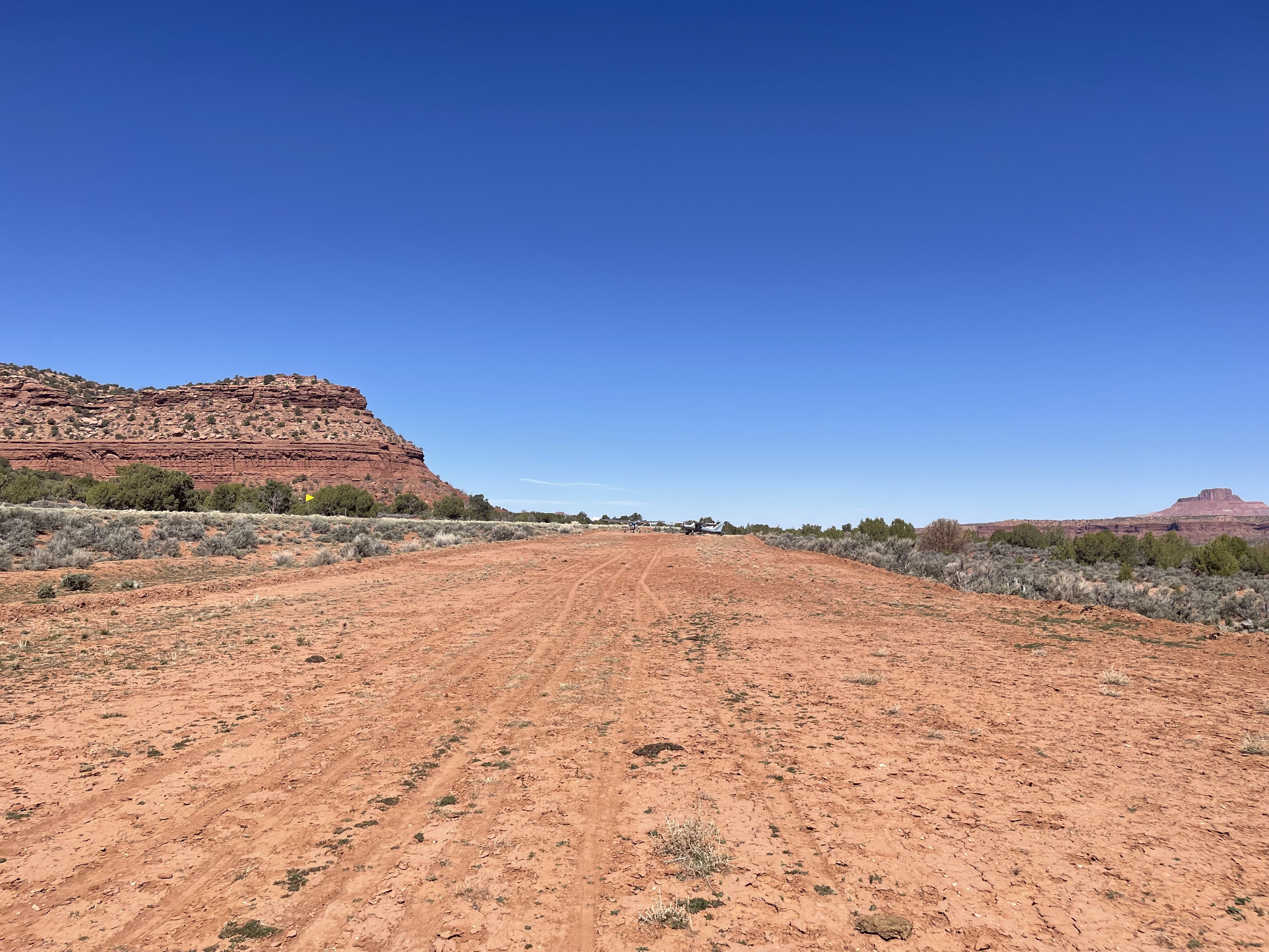
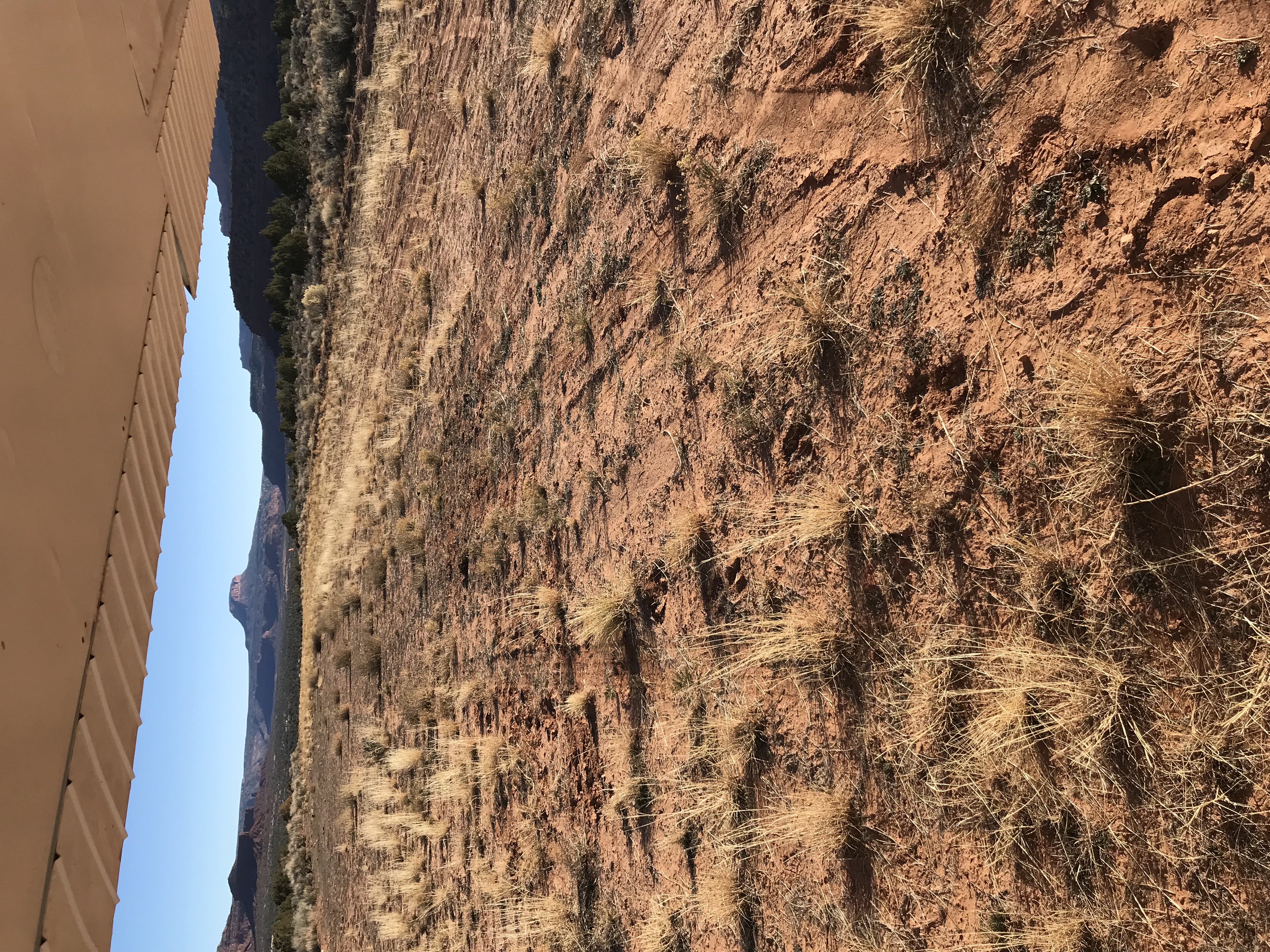
Runway: This runway tends to be soft in the spring and late fall as the frost heaves up the ground. A bit of wind erosion near the base of the grass has made the runway more rough than normal. A little more use and this may correct itself. A important note is an access road crossing the airstrip near the first third landing north but a nice 2,382 feet of airstrip remain after the road. This road has seen increasing activity as the camping and cliff dwellings have grown in popularity and could become more hazardous as ruts deepen. The runway is sloped uphill 1.7% headed to the north. Landings and takeoffs can be accomplished in both directions. If taking off uphill into the wind it may appear your aircraft has reduced performance as the slope of the runway will create this illusion.
Approach Considerations: If you have never landed on a upslope runway I can almost guarantee you’ll find yourself low on approach here. A downhill landing is possible but the prevailing winds tend to favor an uphill landing. Plan your touchdown after the access road unless your aircraft performance and skill level allows for short landing distances. Before the road the runway has a few larger shrubs and rocks that need to be considered. There is also a large washout near the west side of the runway running the length of this section.
Parking: Large enough for a small fly-in there is no shortage of parking on the south end of the strip. Multiple fire rings can be found here with flat and smooth ground for camping. Some of the ground here is dirt covered rock so plan your tent stakes and tie downs according. No cell phone coverage.
Cory Wolf
visited
3 years agoin a C205with 850 tires
Fry was not as soft as I expected. Maybe 1/4 to a 1/2 inch give to foot prints. It’s been graded somewhat recently and recent moisture has firmed it up. Hiked down to look at the cliff dweller ruins across the canyon.
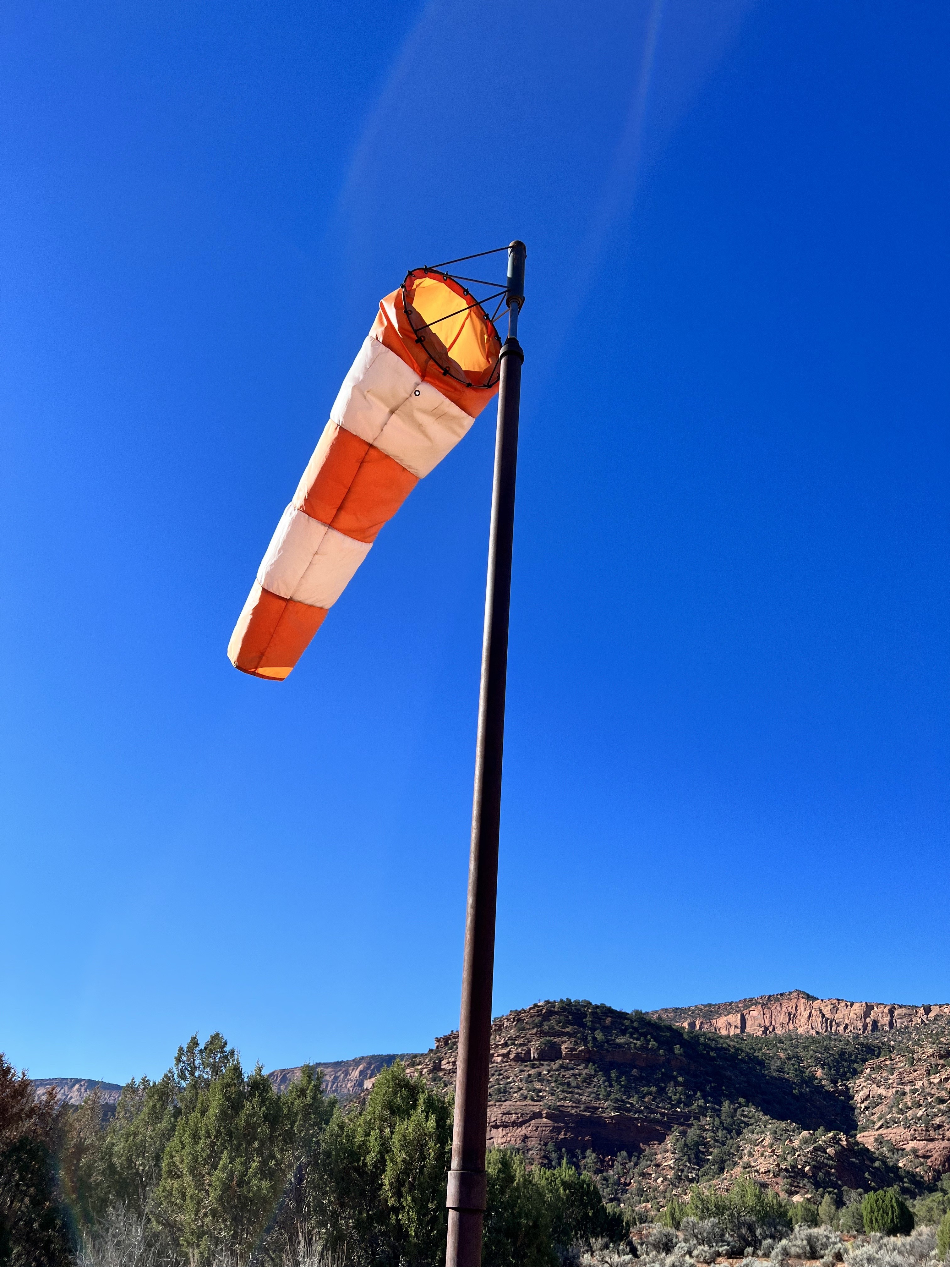
Repaired windsock. Some runoff and erosion on centerline of strip from recent rains. Landing past the road intersection is still the best section of runway. The erosion there is less than a couple inches.
Joseph Barrett
visited
4 years agoin a Cessna 140with 8.50x6 tires
For the most part, the runway was in great shape. As previous reports have stated, a road intersects the runway effectively splitting it into thirds. The southern third below the road is becoming more overgrown and has a deep washout area from a previous rain storm. The Northern two thirds are in great condition. There are small clumps of grass on the runway which was fairly firm considering the the temps that the area has been experiencing. Overall, a great strip to check out. You will definitely feel the 1.7% slope. I recommend a minimum tire size of 8.00 x 6 going into this one due to the grass clumps.
Eric Berg
visited
4 years agoin a C182with 8.0/8.5 tires
Clump grasses made it surprisingly bumpy. Next time I’ll reduce pressure in the tires. Erosion not bad on last 2/3 of Rwy 30, lower 1/3 strip to east(not recommended) has significant erosion on the south edge. Take off tail wind came up fairly quickly. Thanks for the sock!