Airstrip Info
| Frequency | 122.90 |
|---|---|
| Elevation | 5880 ft |
| Lat/Long |
37.8717, -110.6199 37° 52.302' , -110° 37.194' |
| Runway 12/30 |
3440 ft
x 40 ft
Dirt Rwy 30 Uphill 4.2% |
| Ownership | BLM |
Amenities
Weather
See more at the National Weather Center
Information updated May 7, 2025 @ 10:42pm
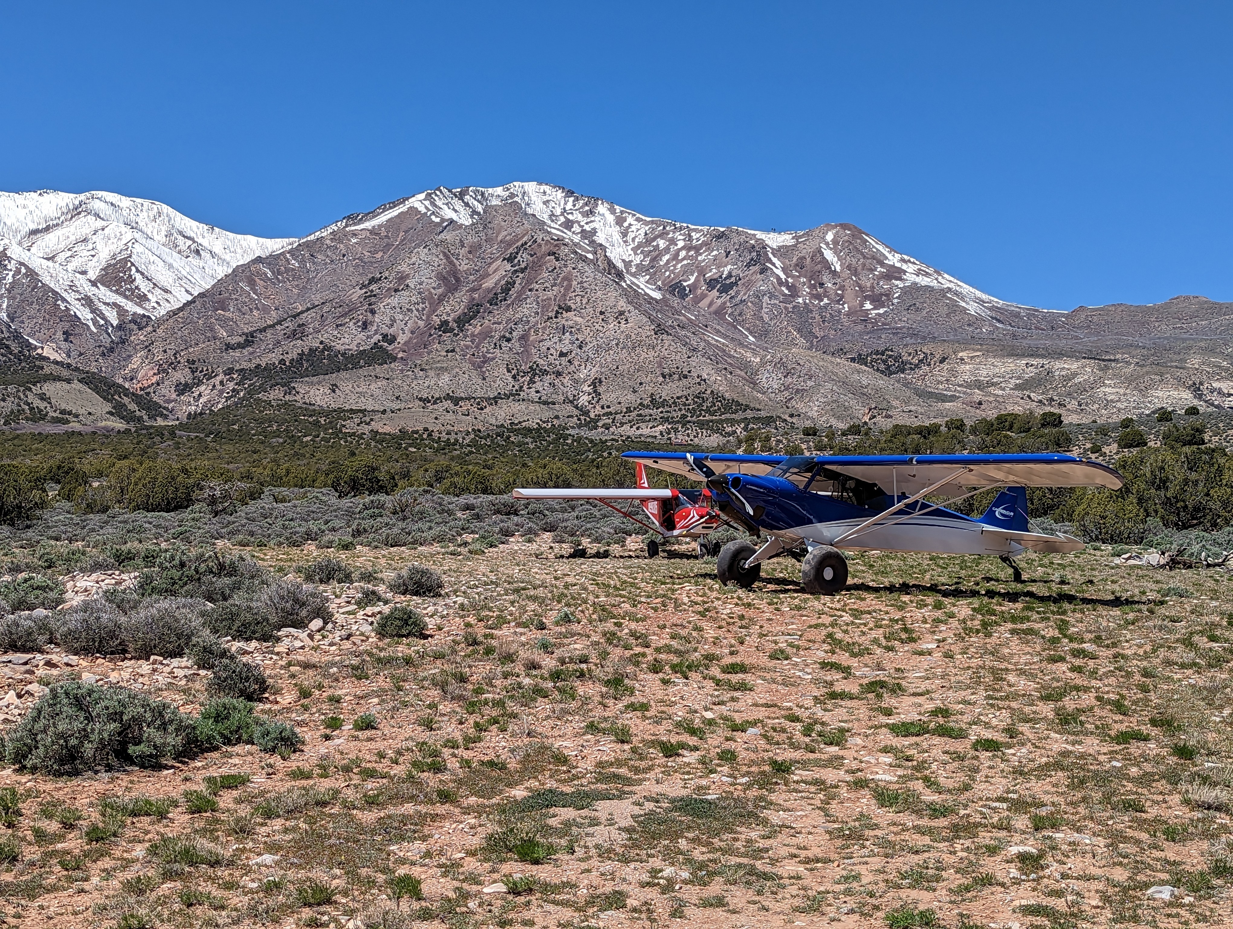
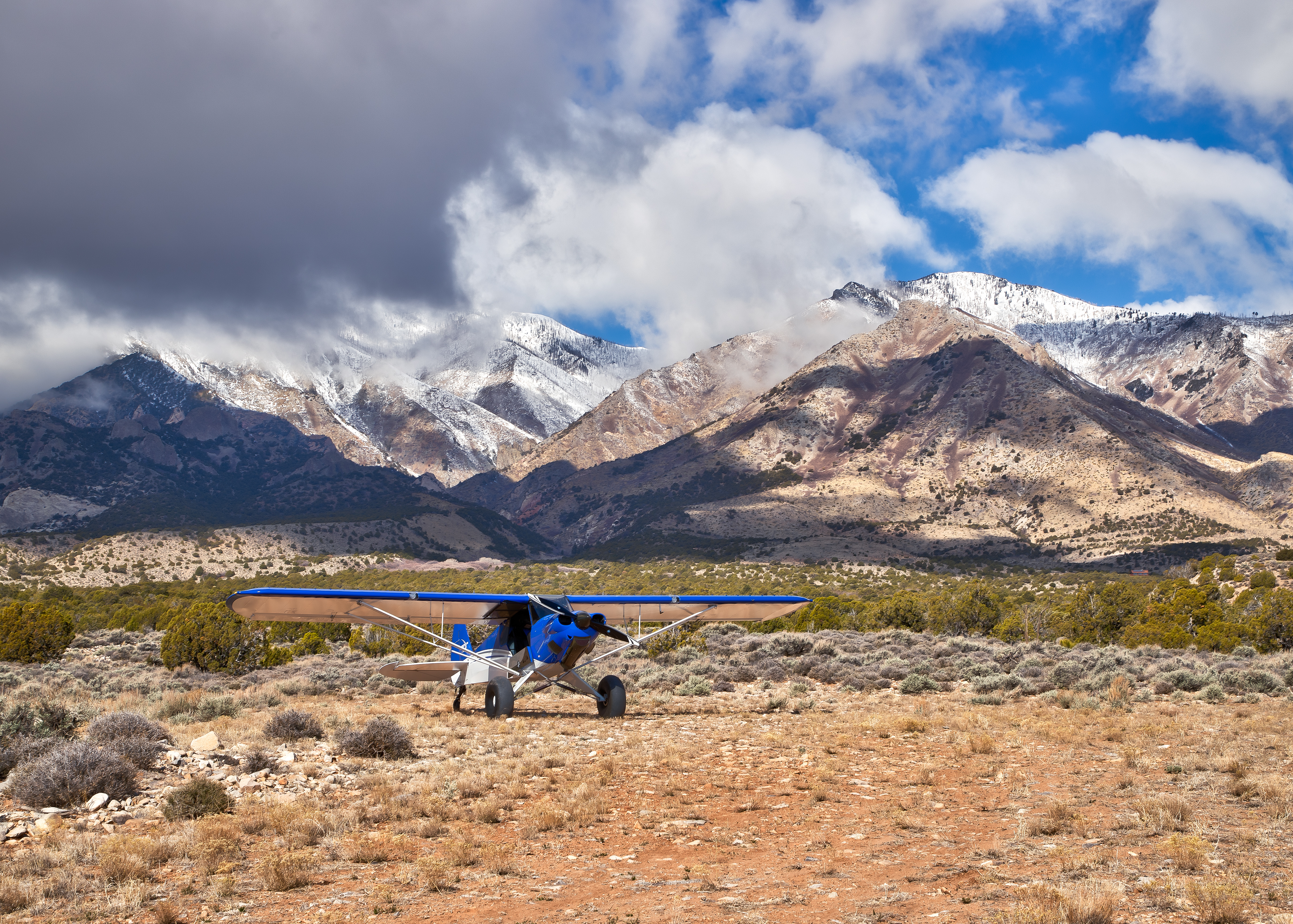
Description: A high altitude get away for the hotter days, Gold Creek overlooks Glen Canyon, Canyonlands, and the Lake Powell area. This is a spectacular camping spot nearly at the base of Mt. Hillers known for its abundant wildlife and gold deposits. This airstrip allows access to the Wilderness Study Area that encompasses most of the mountain area. The location of this strip is subject to significant winds created from the venturi effect of Mt. Hiller and the smaller Mt Holmes just to the south. Also, the upsloping and down sloping winds between day and night here are nearly textbook in nature. It would be wise during your initial landing survey to keep a comfortable pattern altitude to determine if any adverse wind phenomena might be present.
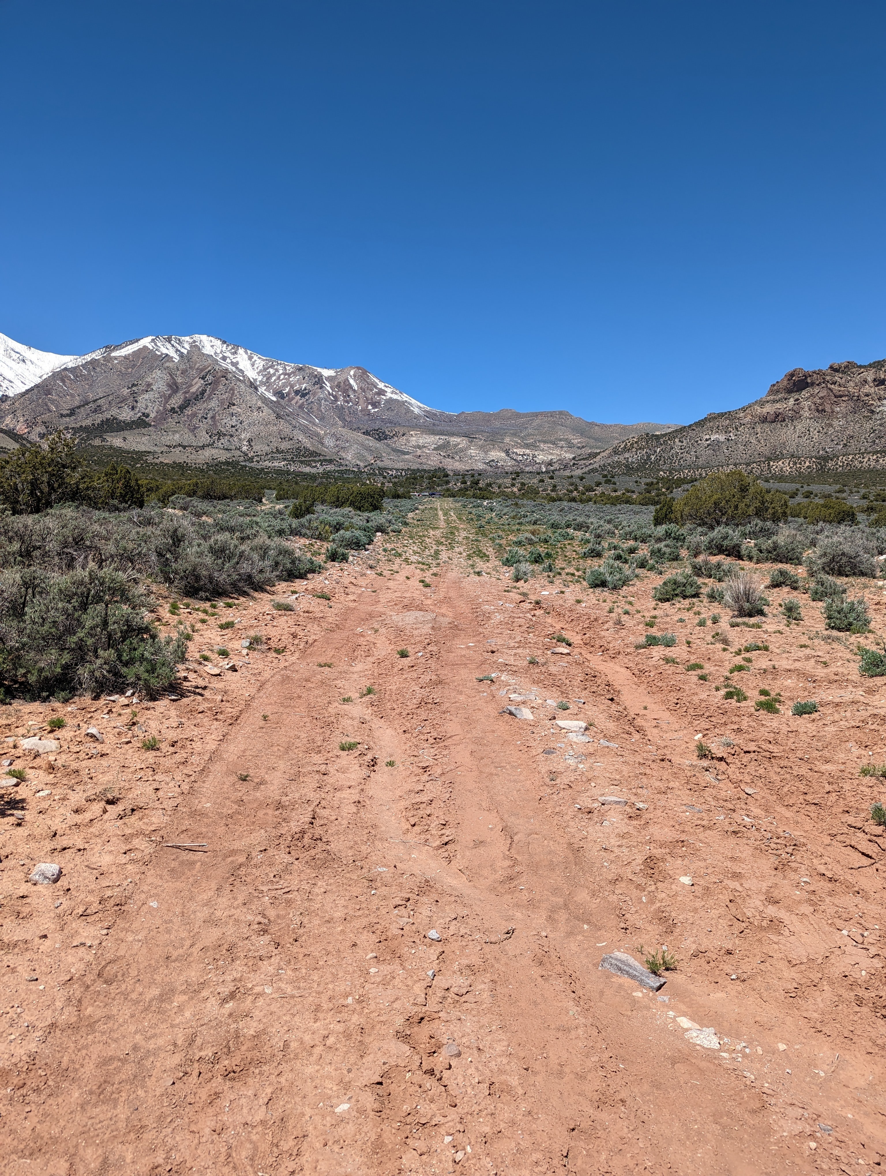
Runway: The runway has a major washout near the top third, easily spotted where the road crosses the airstrip. There’s adequate distance before the washout for most type aircraft, after the washout has about 850ft of usable runway. Passage through the washout to the camping area is possible with most bush type aircraft however it would be better to land above the wash if your aircraft type allows. If not, a mostly flat area on the south end of the strip would also make for excellent camping. The usable portions of the runway are in great condition and mostly rock/gravel in nature. The airstrip slopes uphill about 4% (guess) toward the north, landing downhill will require a significant amount of wind to overcome the slope of the runway. Be cognizant of the winds. A late go around with a large tailwind component may result in the inability to outclimb the rising terrain.
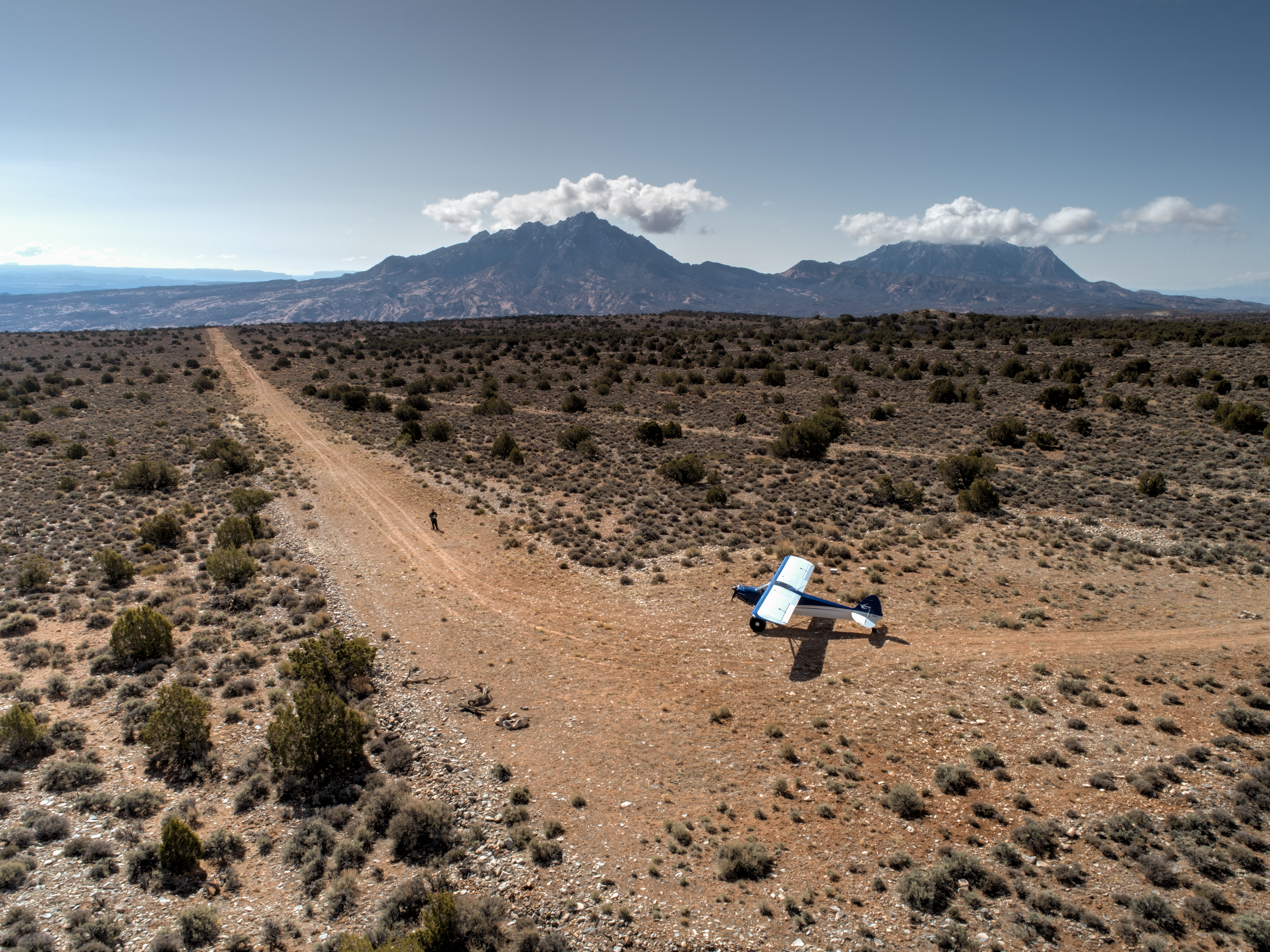
Parking: A large parking area to the north can accommodate multiple aircraft. Two fire circles and a mostly flat camping surface can be found here too. Good cell phone coverage is also available.
Approach Considerations: The tendency to become low on final may be a threat as the upslope of the runway can create that visual illusion. Again, be careful with adverse winds and late go arounds.
Very unique and beautiful place to land an airplane and hike around. Any wind can make approach and departure rather squirrelly as this airstrip sits in a mountainous area with terrain on three sides. Landing uphill to the north is recommended, on the northern third of the runway. There may be 800 feet usable but it is the smoothest section. Airstrip surface is covered in small rocks and clumpy grass. Two fire rings at north parking area.


The washout area still exists as mentioned in previous reports and is about 1/3 of the way down the runway from the northwest. The southeast portion of the runway is in okay shape with some vegetation. The northwest portion of the runway slopes uphill and is a little rocky but not bad. I landed on the northwest portion uphill and there was easily over a thousand feet usable. I would probably choose the southeast section for landing next time because it's not as sloped.
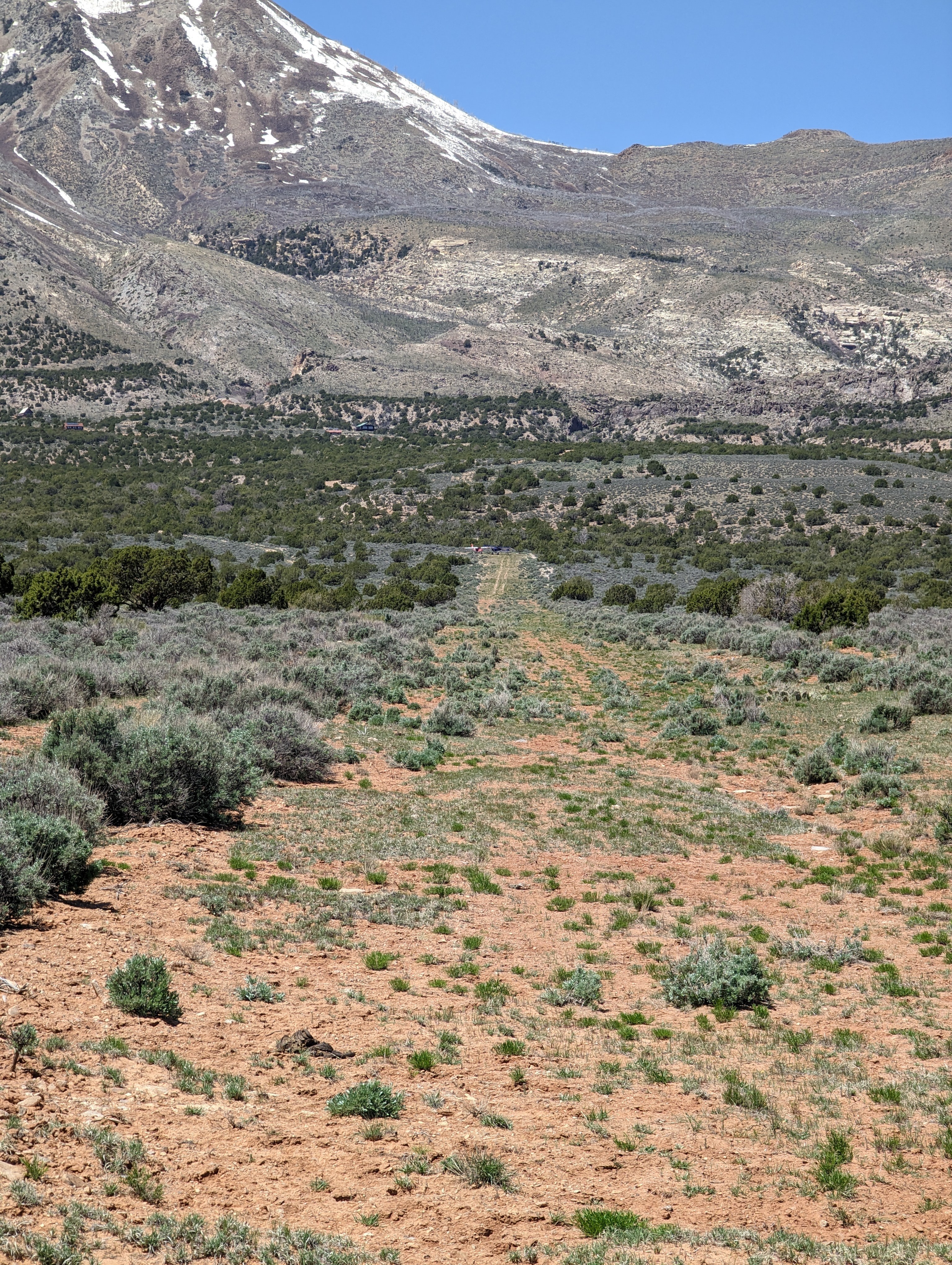
This is one of my favorite strips. Runway has a major washout near the top third, easily spotted where the road crosses the strip. Runway slopes uphill about 4% (guess) toward the Henry Mountains. There’s adequate distance before the washout for most type aircraft, after the washout has about 850ft of usable runway. The useable portions of the runway are in great condition. The camping area on the north side has two well used fire circles and is mostly flat. Star Springs BLM campground is a couple miles away and has water and pit toilets. Use caution here as the winds can be wild. I have experienced sink many times and an early go around is necessary as the terrain rises rapidly towards the north. Enjoy!

The Gold Creek / Shootering airstrip was recognized as a Primitive Road in the 2025 Henry Mountains and Fremont Gorge TMP given the designation GAHM0373a as OHV-OPEN. You can view this TMP by clicking here.