Airstrip Info
| Frequency | 122.90 |
|---|---|
| Elevation | 5070 ft |
| Lat/Long |
37.2493, -113.2082 37° 14.9603' , -113° 12.489' |
| Runway 15/33 |
4860 ft
|
| Ownership | Private |
Weather
See more at the National Weather Center
Information updated September 16, 2023 @ 2:13pm
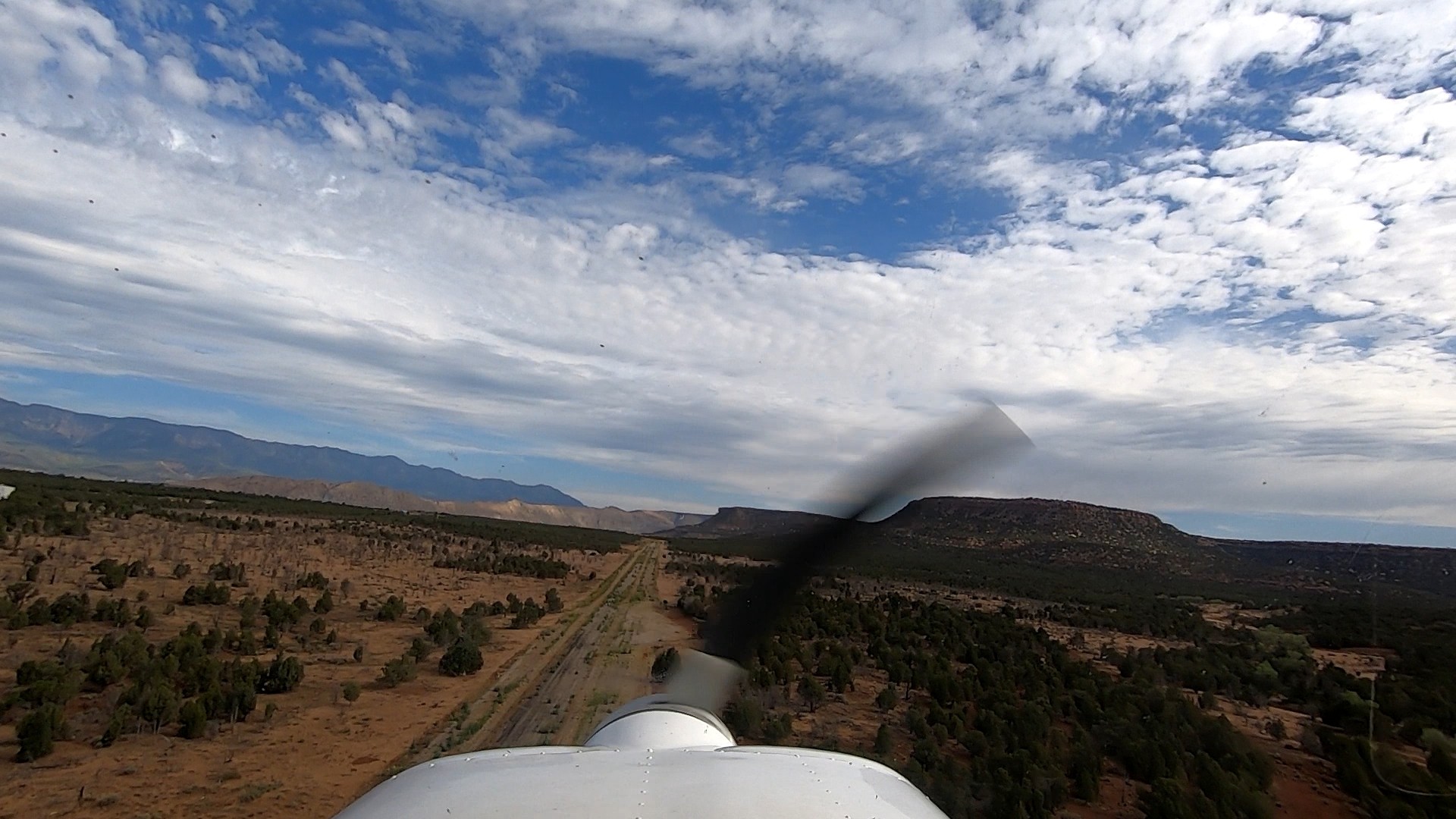
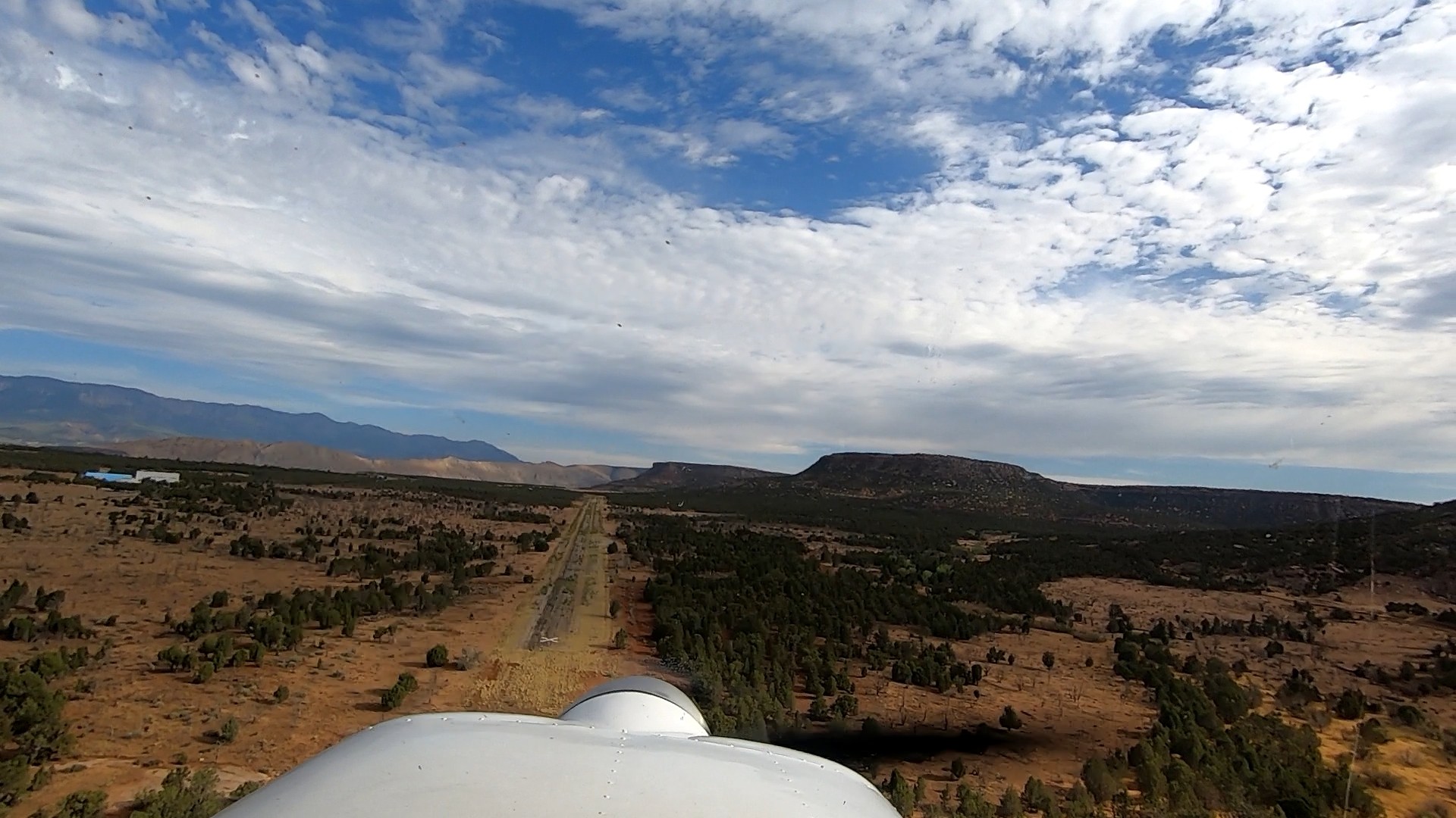
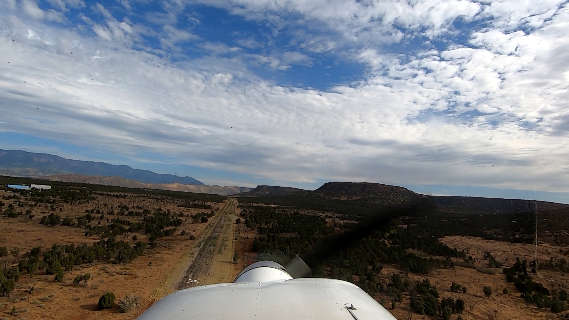
Private runway associated with the Hurricane Mesa Test Facility.
The Hurricane Mesa airstrip is closed. I flew over it and captured some videos and photos. It is in extremely poor condition with weeds growing up through the asphalt the entire length of the runway. The neat thing about it is that in the 1950s the mesa was use by the air force as a test site for supersonic ejection systems. The rail system for the rocket sleds they used in the tests still exists, as do several buildings and various types of towers. A search for Hurricane Mesa rocket sled will turn up some interesting videos of those tests. I have included three photos of the airstrip as viewed from south to north. A fourth photo show the overall mesa top from the north. The landing strip is just below the nose of the airplane and the long brown strip on the right side is the rail system for the rocket sleds.

That's some cool history! I bet that would be an awesome place to check out.
3 years agohttps://www.youtube.com/watch?v=RZtdGEbqek4
We haven't written a history for this airstrip yet. If you would like to provide us with some information about this strip, please contact us today!