Airstrip Info
| Frequency | 122.90 |
|---|---|
| Elevation | 4461 ft |
| Lat/Long |
39.0188, -110.4504 39° 1.128' , -110° 27.024' |
| Runway 11/29 |
1900 ft
x 40 ft
Dirt Rwy 29 Uphill 0.3% |
| Ownership | BLM WSA |
Amenities
Weather
See more at the National Weather Center
Information updated November 13, 2024 @ 8:31am
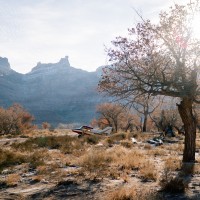
Description: Mexican Mountain's runway is oriented west/east alongside the San Rafael River inside the Mexican Mountain Wilderness Study Area. Due to the sensitive nature of the location, pilots are requested to adhere to the UBCP's Code of Conduct to help us maintain our strong working agreements with the BLM. Reminder to all pilots this airstrip exists within a Wilderness Area. Motorized or wheeled conveyances are not to be used on the airstrip or surrounding areas.
Please read wilderness Leave no Trace practices for Mexican Mountain. The use of WAG bags is encouraged.
Runway: 1900 ft long x 40 ft wide dirt runway in good condition. Slopes uphill slightly to the west. First 500' from the east is more soft than the rest of the runway and has a "dark spot" that appears wet throughout the year.
Approach Considerations: Tall trees (30+ ft) on both sides of the runway present a hazard when landing to the east (downhill). Typically land to the west and depart to the east. Tall trees alongside the runway as well.
Amenities: Campgrounds and fire rings (please use already established camping/parking areas and fire rings).
Windsock: Yes, located east of the runway.
This was my first time landing at this gorgeous location. Thanks to all the volunteers who put in so much hard work repairing the airstrip and making it as nice and smooth as it is today. I landed with a friend visiting from the UK, and he was blown away by the majesty of the location and the fact we have airstrips like this one in the middle of the wilderness. We are truly blessed. Thank you UBCP!
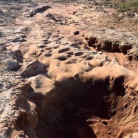
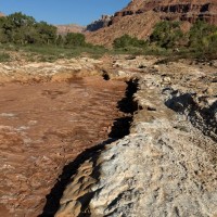
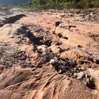
Got boots on the ground on a perfect, cool, day. Airstrip should be considered unsafe to operate out of as a ditch has been created by water after the airstrip was flooded, cutting the airstrip in half. Significant depth to the ditch and holes in the runway. Water looks like it covered the entirety of the airstrip, and standing water still remains off the side with mosquitos flourishing. Lots of growth happening on the airstrip, and leftover debris piles remain from the flooding in addition to the water cut ditch in the runway. UBCP is already planning to get a team in there to repair but until then I would recommend not visiting. The ditch appears fast and if several inspection passes were not done, would catch a pilot by surprise. There is about 600-650 ft usable.
Would love to volunteer to help if I’m available when the team is put together
3 months agoGreatly appreciate this report. Thank you so much. The last time I landed, the soft sand swallowed my tail wheel completely rendering my aircraft stuck until help Arrived. Lightly loaded C-185, 8:50s, XP-Mods 10” tail wheel. Road construction is out of my field, but does anyone have any thoughts how that service could be firmed up?
3 months agoAn 18 mile loop featuring spectacular views of the Mexican Mountain Wilderness Study Area (WSA). You'll want a GPS and track to help navigate route finding, including locating down climbs that will be required.
https://www.alltrails.com/explore/trail/us/utah/san-rafael-river
Historical marker for Sheriff Azariah Tuttle, Jr. From the plaque: Azariah Tuttle, Jr., sheriff of Emery County, brought the law down on notorious Texan outlaw Joe Walker and other outlaws--the likes of Butch Casidy, Elza Lay, John Montis, and C.L. Gunplay Maxwell"
Several large rocks with petroglyphs are a short 5-min walk down the trail that begins at the airstrip windsock. Please do not touch or deface the petroglyphs so they can be preserved for future generations of pilots.
We haven't written a history for this airstrip yet. If you would like to provide us with some information about this strip, please contact us today!


