Airstrip Info
| Frequency | 122.90 |
|---|---|
| Elevation | Unknown |
| Lat/Long |
37.6255, -110.0337 37° 37.53' , -110° 2.022' |
| Runway 14/32 |
2200 ft
x 20 ft
Dirt |
| Ownership | BLM NM |
Weather
See more at the National Weather Center
Information updated July 9, 2025 @ 5:42pm
Sipapu Bridge Airstrip is TEMPORARILY CLOSED. The airstrip is within the Bears Ears National Monument and the airstrip use is not allowed until the BLM has completed a NEPA review of the airstrip.
A more ruggeed airstrip that may have considerable erosion on the west end.
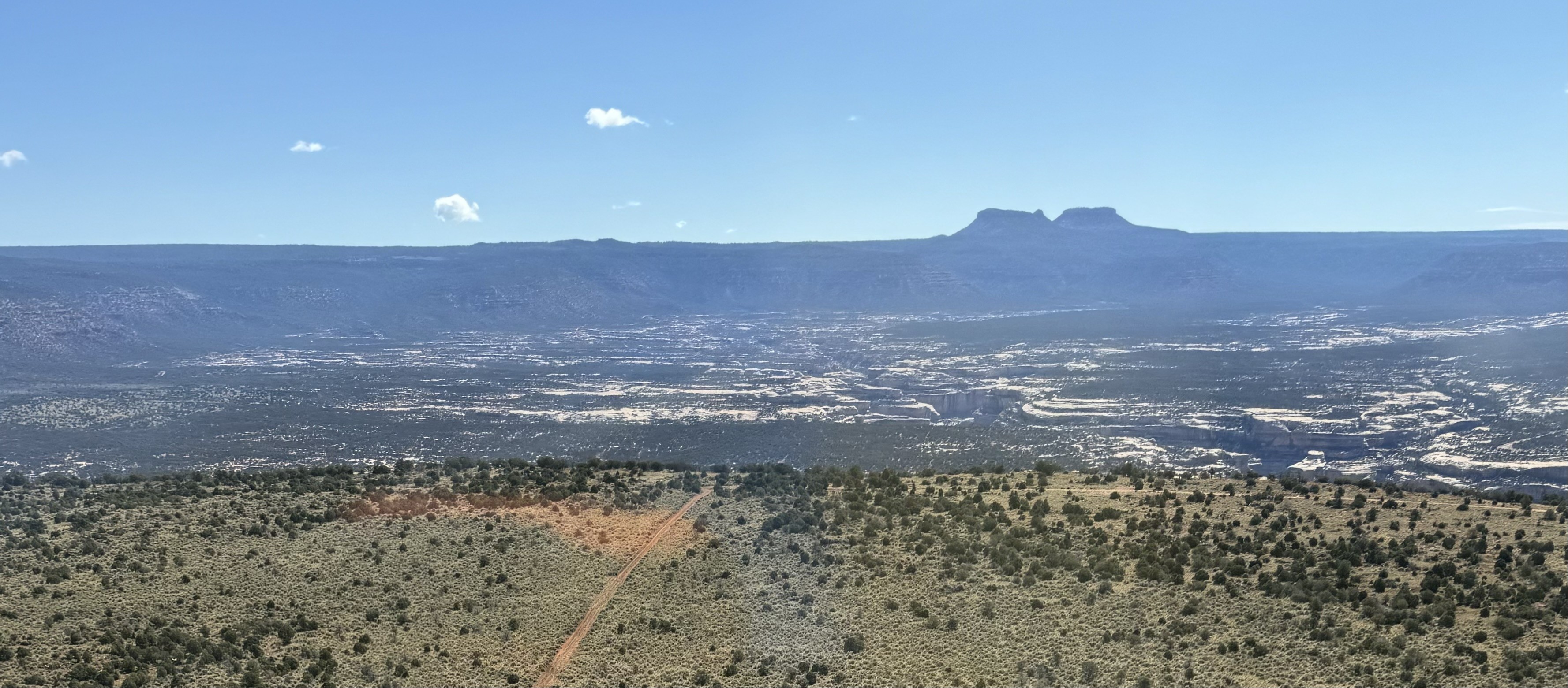
It looks like there are two parallel airstrips, but I think the real airstrip is the one on the right in the photo. The airstrip is not as bad of a condition as it might seem. There is a minor erosion across the runway surface. The center of the airstrip is clumpy grass, landable, but sagebrush is encroaching uncomfortably close on the sides. Spectacular panoramic view of the Bears Ears at the north end of the airstrip. This airstrip is worth saving.

Sipapu Bridge's airstrip has been identified on USGS maps since 1952. You can view this historic map below or download it by clicking here.