Airstrip Info
| Frequency | 122.90 |
|---|---|
| Elevation | 4768 ft |
| Lat/Long |
41.16, -112.3333 41° 9.6' , -112° 19.998' |
| Runway 15/33 |
1972 ft
x 10 ft
Dirt |
| Ownership | Utah DNR - FFSL |
Amenities
Weather
See more at the National Weather Center
Information updated September 20, 2024 @ 5:49pm
NOTAM: The airstrips at Fremont Island are managed by the UBCP in accordance with a Memorandum of Understanding between the Utah DNR - Sovereign Lands Department and Utah State Aeronautics. Because of the nature of the land, there are a few rules that must be adhered to and pilots are required to review these rules prior to departing for the island:
No fires of any kind are permitted
No fireworks or explosive items
No discharge of firearms or hunting
No camping or other overnight use
Taking any plant, mineral, wildlife, or any other objects is prohibited
No motorized vehicles (except aircraft on designated runways)
No items such as geocaches, land art, etc may be placed on the island
Commercial guided tours are allowed through a permit through the DNR
Any commercial filming or photography require permits through the DNR
Furthermore, use of the airstrips atop Fremont Island is open to non-commercial use only. More information about the rules and regulations regarding the airstrips can be found at https://ffsl.utah.gov/state-lands/great-salt-lake/fremont-island/?hilite=Fremont+island. Takeoffs and landings on Fremont Island are restricted to the two established airstrips listed above. Landing or taking off elsewhere on the island is prohibited. Fremont Island is full of history, and we ask that you treat the island just as you would treat a wilderness area, by adhering to the UBCP Code of Conduct.
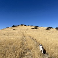
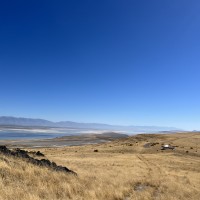
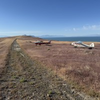
Description: Fremont Island's upper airstrip rests along a ridge that slopes up at both ends, and has downward sloping terrain on both sides of the runway.
Runway: 1972 ft long x 10 ft wide dirt runway that was once a four wheel drive trail that is in good condition. Slopes uphill on both ends. First 500' from the south has larger rocks than the rest of the runway. Last few hundred feet beyond stated distance on both ends is somewhat steep.
Approach Considerations: Weather station on the south end of the runway on extended centerline. Large rock outcroppings and higher terrain to the north on extended centerline as well. Typically land to the north and depart to the south.
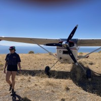
Amenities: None. Suggested parking area is either atop the hill to the south along the trail or just prior to the hill off to the west end of the runway.
Windsock: Yes, located west of the runway at the north end.
Weather: Predominant winds out of the northeast. To view current weather at the island, head to https://mesowest.utah.edu/cgi-bin/droman/meso_base_dyn.cgi?stn=freut
Beautiful conditions at Fremont. We attempted to locate Kit Carson‘s cross. The grass has been healthy this year so after about a half mile toward the High Point, we could no longer find evidence of a trail. After a couple of hours we decided to come back another day and try again. Does anyone know of a source or a published route educating how to find the cross? I’m not finding anything on the Internet.
Go to the top of the highest peak. Bit of a scramble at times. Cross is on the most prominent rock feature and is no bigger than your hand. That’s all I’ll say!fun to explore and find it! :)
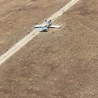
2 months agoI was at Fremont on Memorial Day and then returned this weekend to fun this airplane upside down on the runway We examined the airplane no one was there Notified the authorities and moved on Not sure how long it will be there It’s still possible to land but runway is now about ⅓ occupied by the crashed airplane
The Kit Carson cross is etched into the side of the highest point on Fremont Island, which is a short hike from the Fremont Upper airstrip.
https://mysteryofutahhistory.blogspot.com/2016/04/the-kit-carson-cross-pre-mormon-relic.html
We haven't written a history for this airstrip yet. If you would like to provide us with some information about this strip, please contact us today!
