Airstrip Info
| Frequency | 122.90 |
|---|---|
| Elevation | 4768 ft |
| Lat/Long |
41.16, -112.3333 41° 9.6' , -112° 19.998' |
| Runway 15/33 |
1972 ft
x 10 ft
Dirt |
| Ownership | Utah DNR - FFSL |
Amenities
Weather
See more at the National Weather Center
Information updated April 1, 2026 @ 8:06am
NOTAM: The airstrips at Fremont Island are managed by the UBCP in accordance with a Memorandum of Understanding between the Utah DNR - Sovereign Lands Department and Utah State Aeronautics. Because of the nature of the land, there are a few rules that must be adhered to and pilots are required to review these rules prior to departing for the island:
No fires of any kind are permitted
No fireworks or explosive items
No discharge of firearms or hunting
No camping or other overnight use
Taking any plant, mineral, wildlife, or any other objects is prohibited
No motorized vehicles (except aircraft on designated runways)
No items such as geocaches, land art, etc may be placed on the island
Any commercial filming or photography require permits through the DNR
Furthermore, use of the airstrips atop Fremont Island is open to non-commercial use only. More information about the rules and regulations regarding the airstrips can be found at https://ffsl.utah.gov/state-lands/great-salt-lake/fremont-island/?hilite=Fremont+island. Takeoffs and landings on Fremont Island are restricted to the two established airstrips listed above. Landing or taking off elsewhere on the island is prohibited. Fremont Island is full of history, and we ask that you treat the island just as you would treat a wilderness area, by adhering to the UBCP Code of Conduct.
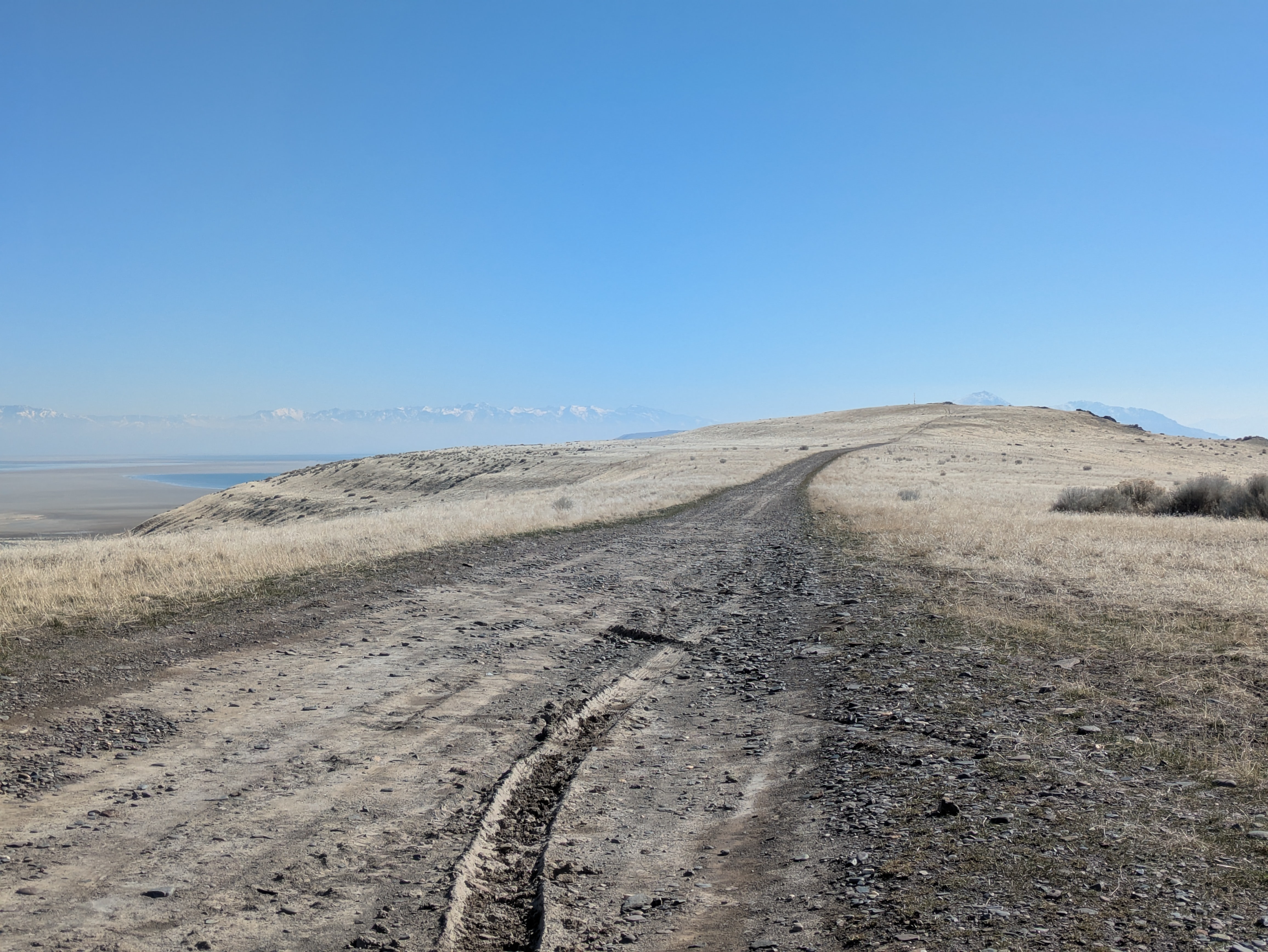
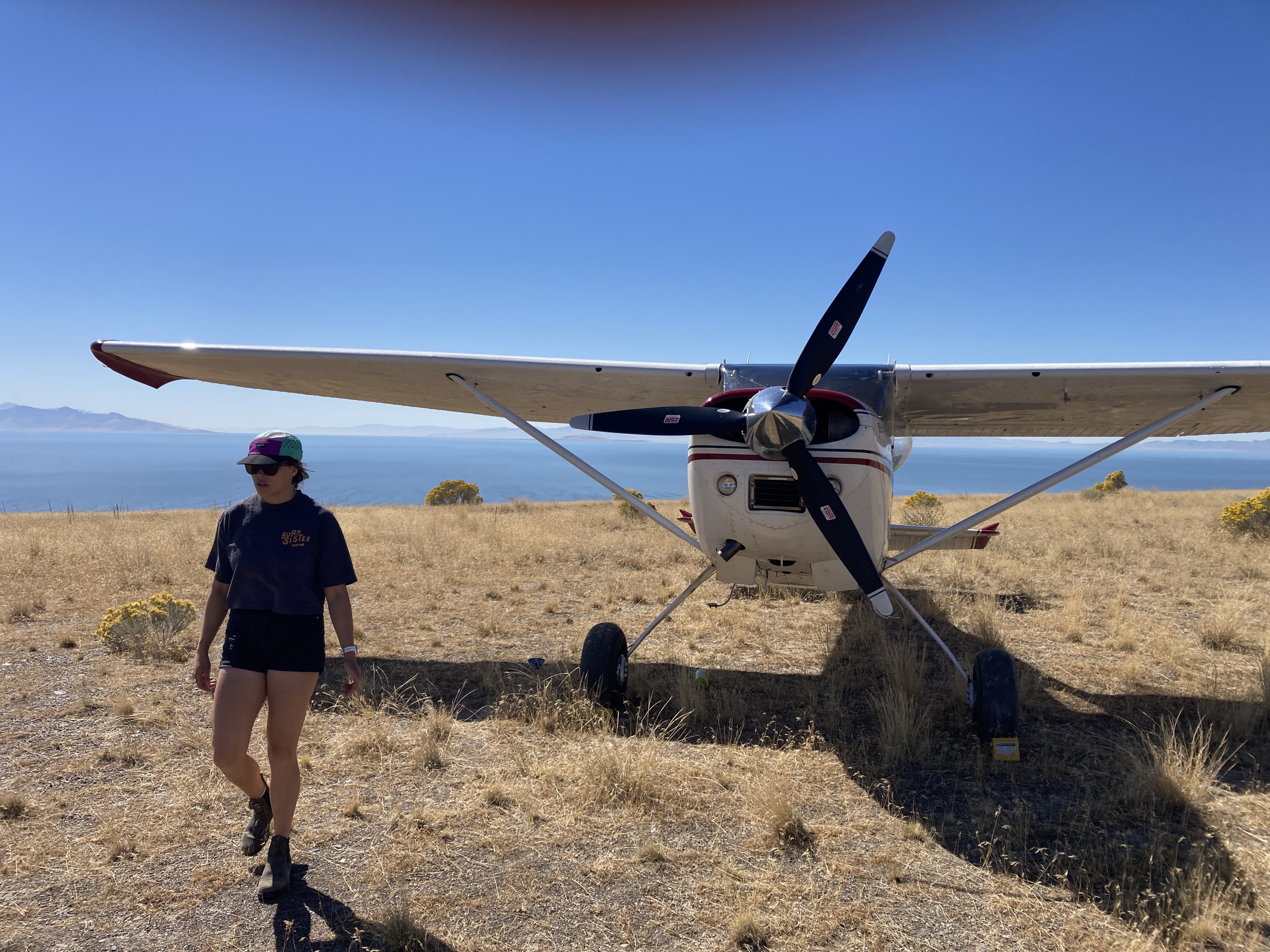
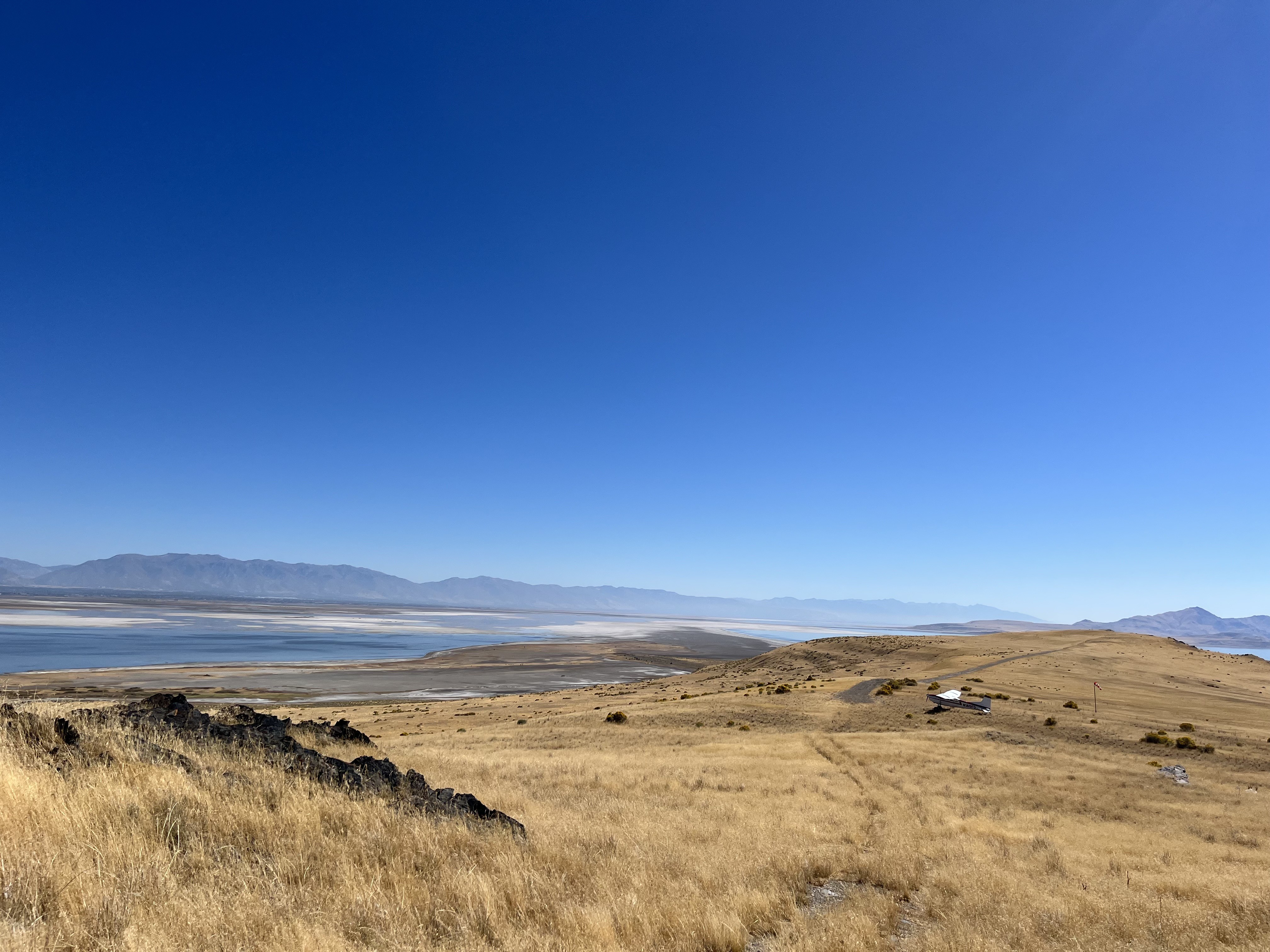
Description: Fremont Island's upper airstrip rests along a ridge that slopes up at both ends, and has downward sloping terrain on both sides of the runway.
Runway: 1972 ft long x 10 ft wide dirt runway that was once a four wheel drive trail that is in good condition. Slopes uphill on both ends. First 500' from the south has larger rocks than the rest of the runway. Last few hundred feet beyond stated distance on both ends is somewhat steep.
Approach Considerations: Weather station on the south end of the runway on extended centerline. Large rock outcroppings and higher terrain to the north on extended centerline as well. Typically land to the north and depart to the south.
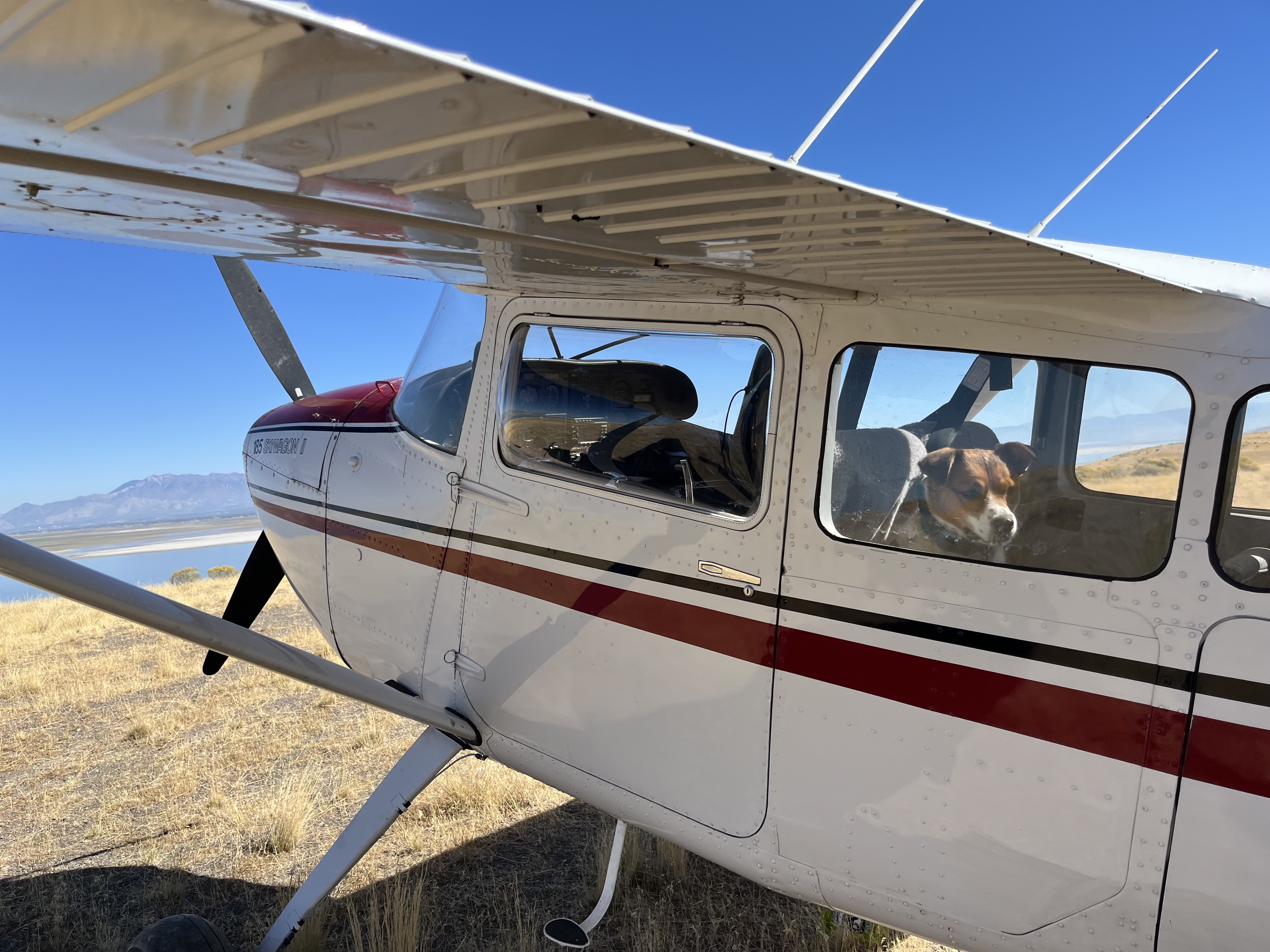
Amenities: None. Suggested parking area is either atop the hill to the south along the trail or just prior to the hill off to the west end of the runway.
Windsock: Yes, located west of the runway at the north end.
Weather: Predominant winds out of the northeast. To view current weather at the island, head to https://viewer.synopticdata.com/map/data/now/air-temperature/FREUT/plots/wind#map=10.34/41.1246/-112.3213 or https://mesowest.utah.edu/cgi-bin/droman/meso_base_dyn.cgi?stn=freut
Beautiful conditions at Fremont. We attempted to locate Kit Carson‘s cross. The grass has been healthy this year so after about a half mile toward the High Point, we could no longer find evidence of a trail. After a couple of hours we decided to come back another day and try again. Does anyone know of a source or a published route educating how to find the cross? I’m not finding anything on the Internet.
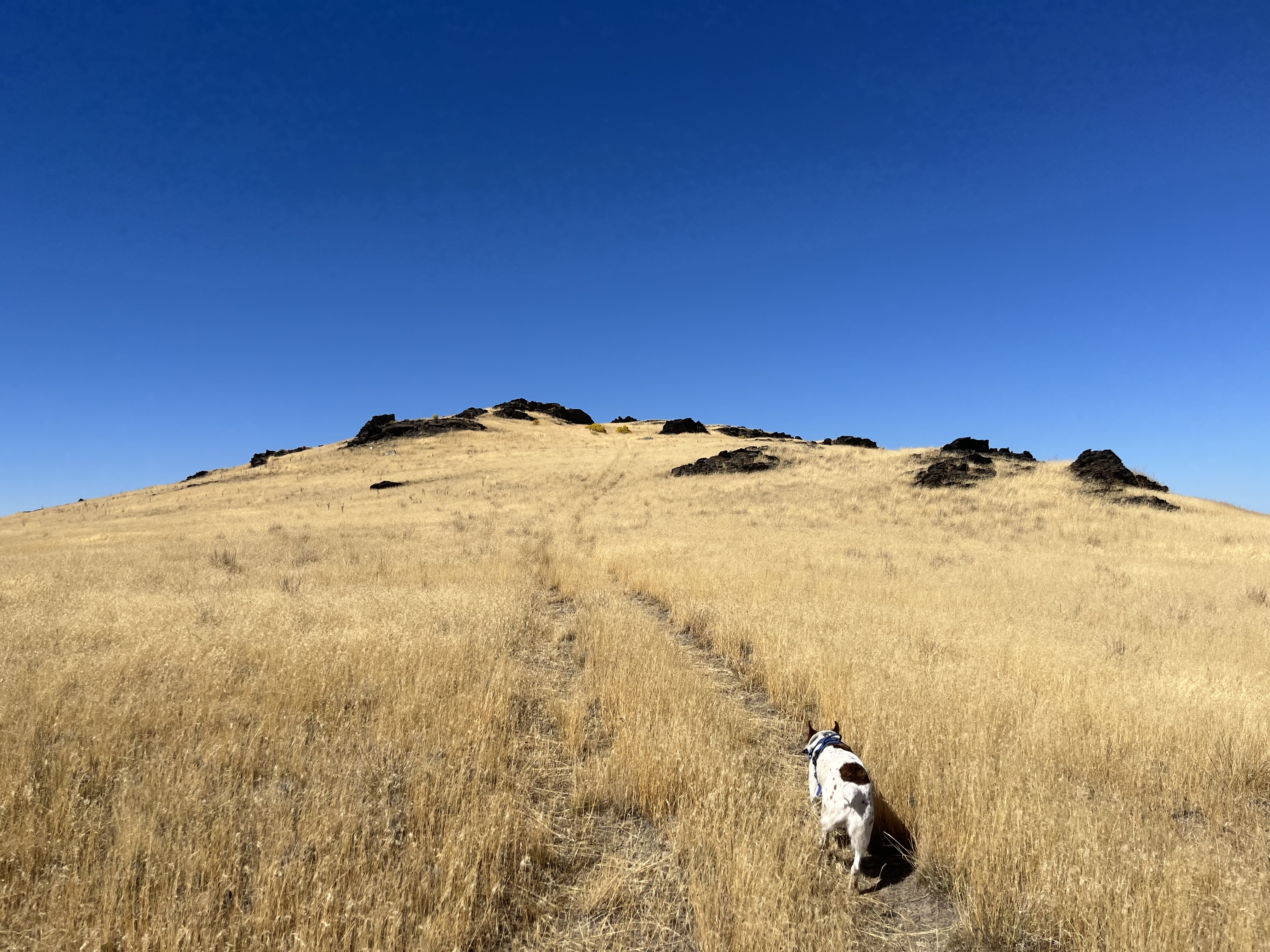
Go to the top of the highest peak. Bit of a scramble at times. Cross is on the most prominent rock feature and is no bigger than your hand. That’s all I’ll say!fun to explore and find it! :)
1 year agoThe history of Fremont Island is yet another one full of adventure written in few books. Certainly the island saw its fair share of visitors and inhabitants throughout the years before the westward explorations of the now United States, few remnants of these first humans to enjoy this beautiful refuge are visible to this day, short of one random etched crucifix left behind from a few explorers whose written history helps tell the story of the island.
On September 9th, 1843, John Fremont and Kit Carson set sail from current-day Hooper, Utah, on their way to the island now known as Fremont. “As is usual with the rappers on the eve of any enterprise, our people had made dreams, and theirs happened to be a bad one-one which always preceded evil-and consequently they looked very gloomy this morning,” Fremont wrote in his journals. Sailing over inches of water (much like one can see today), the two rucked through knee-deep mud dragging their India rubber raft the short distance to the shores of the island. Having to repeatedly inflate the raft due to constant leaks, the two waded through the “skins of worms” and eventually arrived at the highest peak on the island, now called Castle Rock, where Fremont took his spyglass and made copious observations of the lake, a lake that had yet to see such a scientific exploration completed.
The following day, having been awaken by the sound of waves crashing on the shores, observing what appeared to be rough seas and stormy weather approaching from the west, the two scurried down the island back to their raft, a raft they barely entrusted with their lives, and made their way back to their starting point. Having been drunken with the lore of the island housing wildlife, timber, and fresh water, his disappointment in finding none of them caused him to name the island Disappointment Island. Later on in history, the island was named after him, thanks to a fellow explorer Howard Stansbury, the man who had gathered the most information about the island, from the plants that it bore to the birds that frequented the island.
Since then, the island has had a few varying visitors. The Miller family was reported to have used the island to graze cattle, and built a small shed out on the land to store provisions that were stocked regularly. In Dale L. Morgan’s “The Great Salt Lake,” he tells the somewhat forgotten story of one of the more infamous inhabitants of the island, Jean Baptiste. Having been convicted of robbing what some have said was over 300 graves for clothing, the man was booked, jailed, and imprisoned for his crimes. When deciding what to do with the man who created an uproar in the survivors of the settlers graves that he decimated, there is little written about what was done, short of him being banished to the island, having been wagoned to nearby Antelope Island and floated to Fremont. Varying records discuss the possibility he was shacked and left alone, yet Jennifer Jones’ notes on the matter state that the Miller family regularly saw him on the island keeping to himself, only noticing one day that part of their shack was destroyed, a cow’s hide torn to strips, and postulating that he made a raft and floated away to freedom. Best said by Morgan, “Folklore and history alike have turned their face from Jean Baptiste. His story itself has almost sunk from sight. He is a presence on a lost page of history, the only specter of the Great Salt Lake.”
Since then, the island has changed hands, from various private owners to now being under the management of the State of Utah under direction by the new owners, the Nature Conservancy. Aviators have had been given unprecedented access to the two airstrips atop the island for many decades thanks to these private land owners. The responsible use and exemplary stewardship that pilots brought to the island helped the UBCP secure continued access to the island that has been codified in a Memorandum of Understanding between the UBCP, the State of Utah, and the Nature Conservancy.
In August of 2024, the airstrip was recognized by the FAA and was designated 2UT. This is part of an on-going effort for all of Utah's backcountry airstrips to be added to the FAA Facilities Directory and VFR sectional charts to educate pilots on the existence of these historic airstrips while aiding in their preservation for future backcountry pilots to enjoy.
Works cited:
Narrative of Exploration and Adventure by John Charles Fremont, Abridged by Allan Nevins 1956
The Great Salt Lake, Dale L. Morgan, 1947
The Legend of Jean Baptiste: Grave Robber of Salt Lake City, Jennifer Jones, 2024