Airstrip Info
| Frequency | 122.90 |
|---|---|
| Elevation | 4721 ft |
| Lat/Long |
38.0978, -110.3869 38° 5.868' , -110° 23.214' |
| Runway 11/29 |
819 ft
x 20 ft
Dirt/Rock |
| Ownership | BLM |
Weather
See more at the National Weather Center
Information updated May 13, 2021 @ 7:56pm
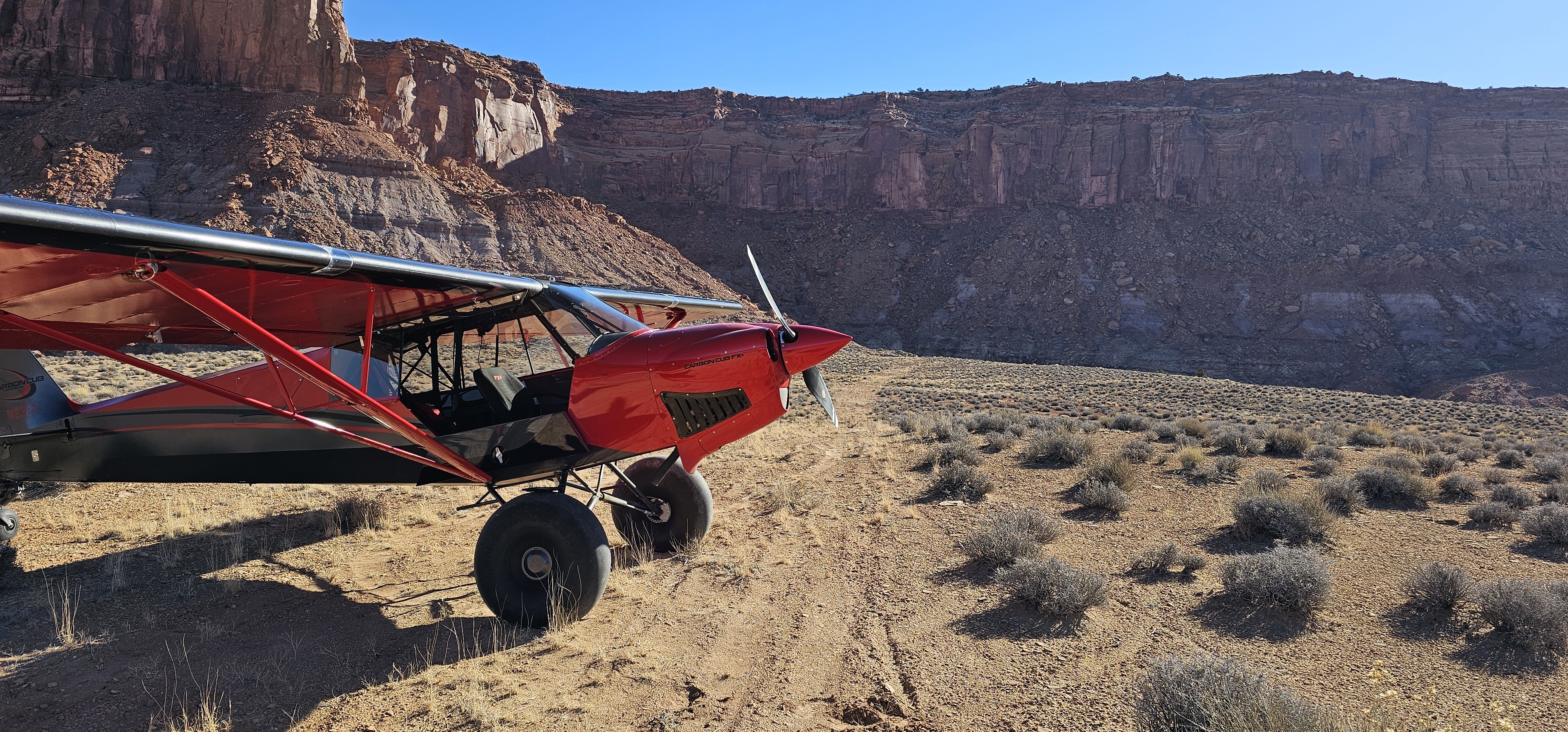
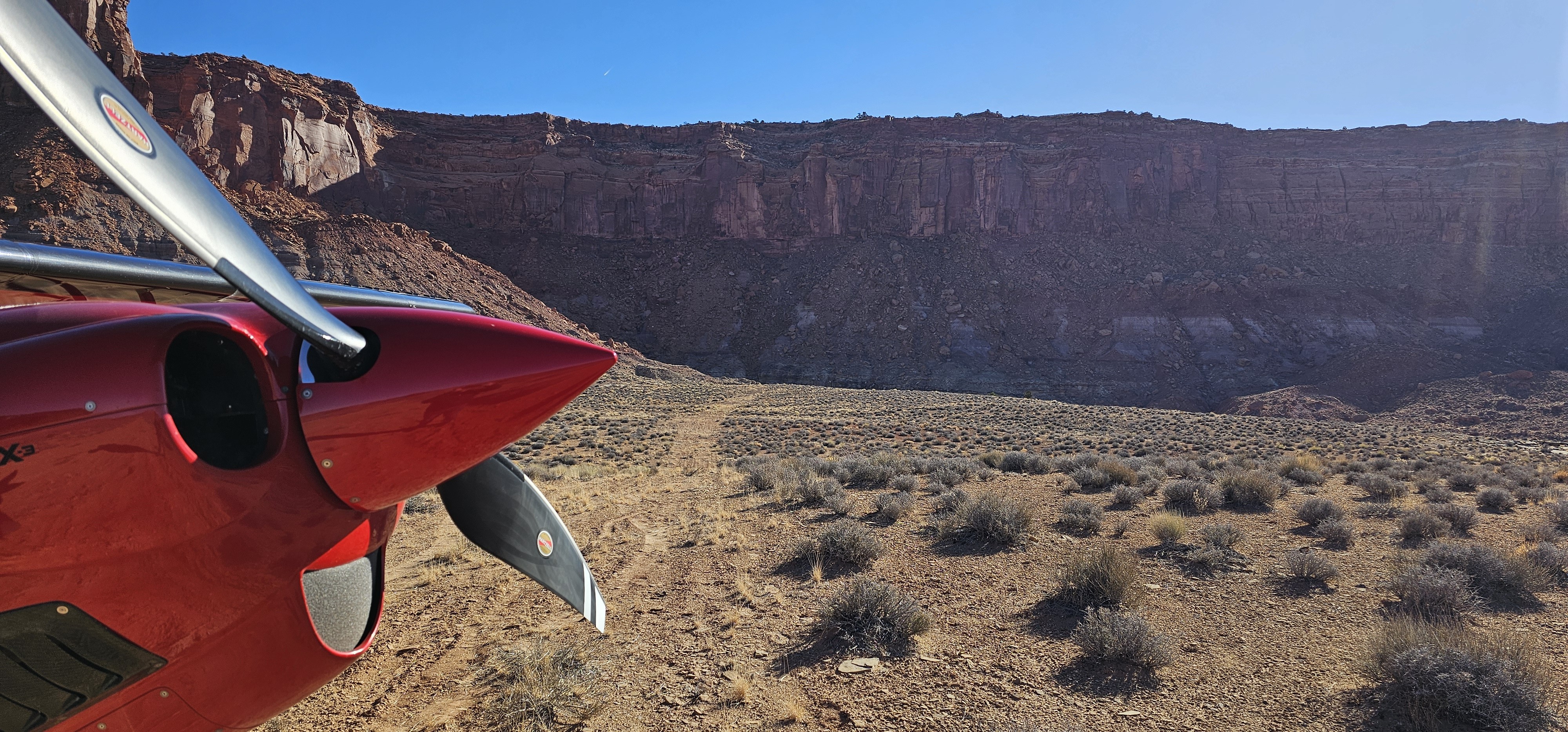
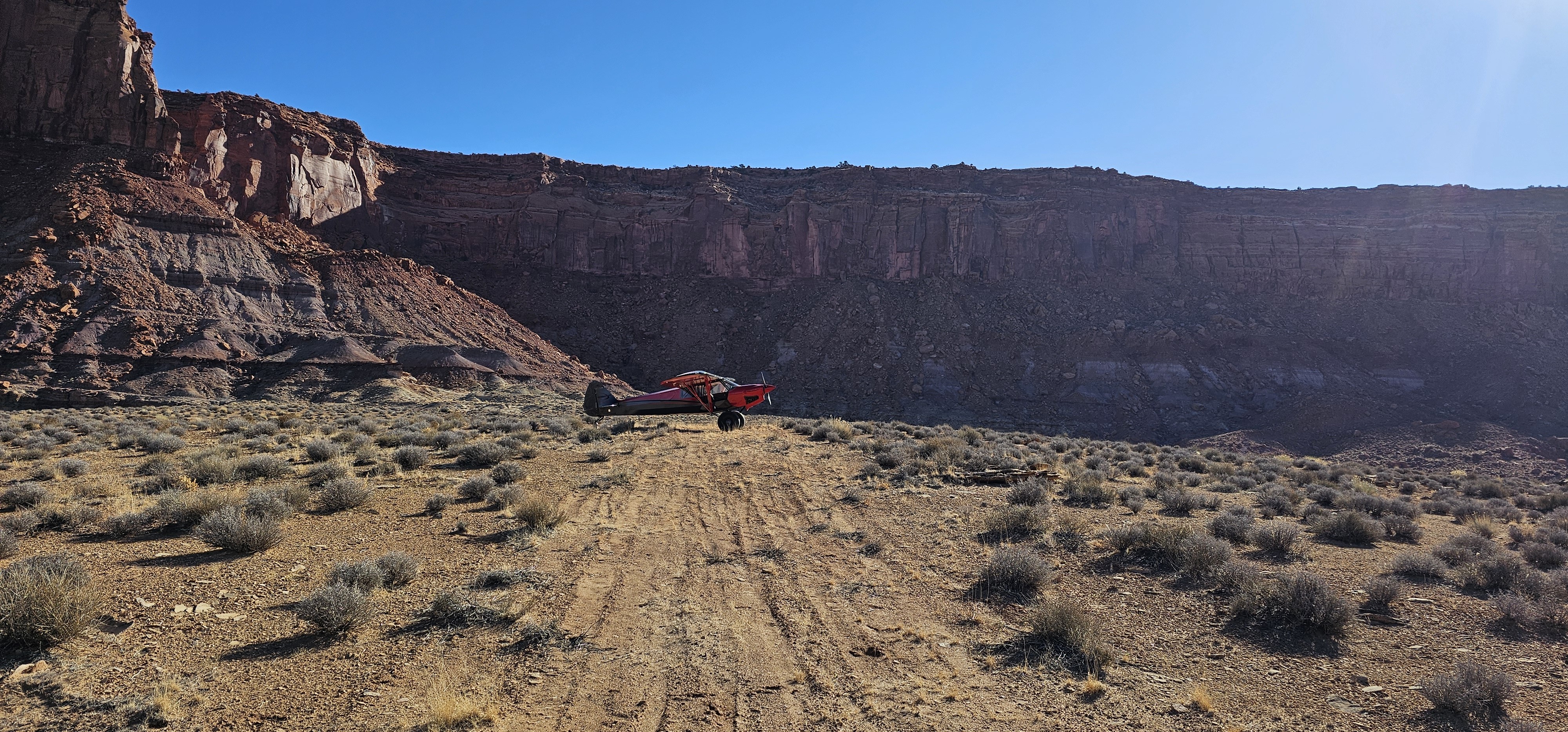
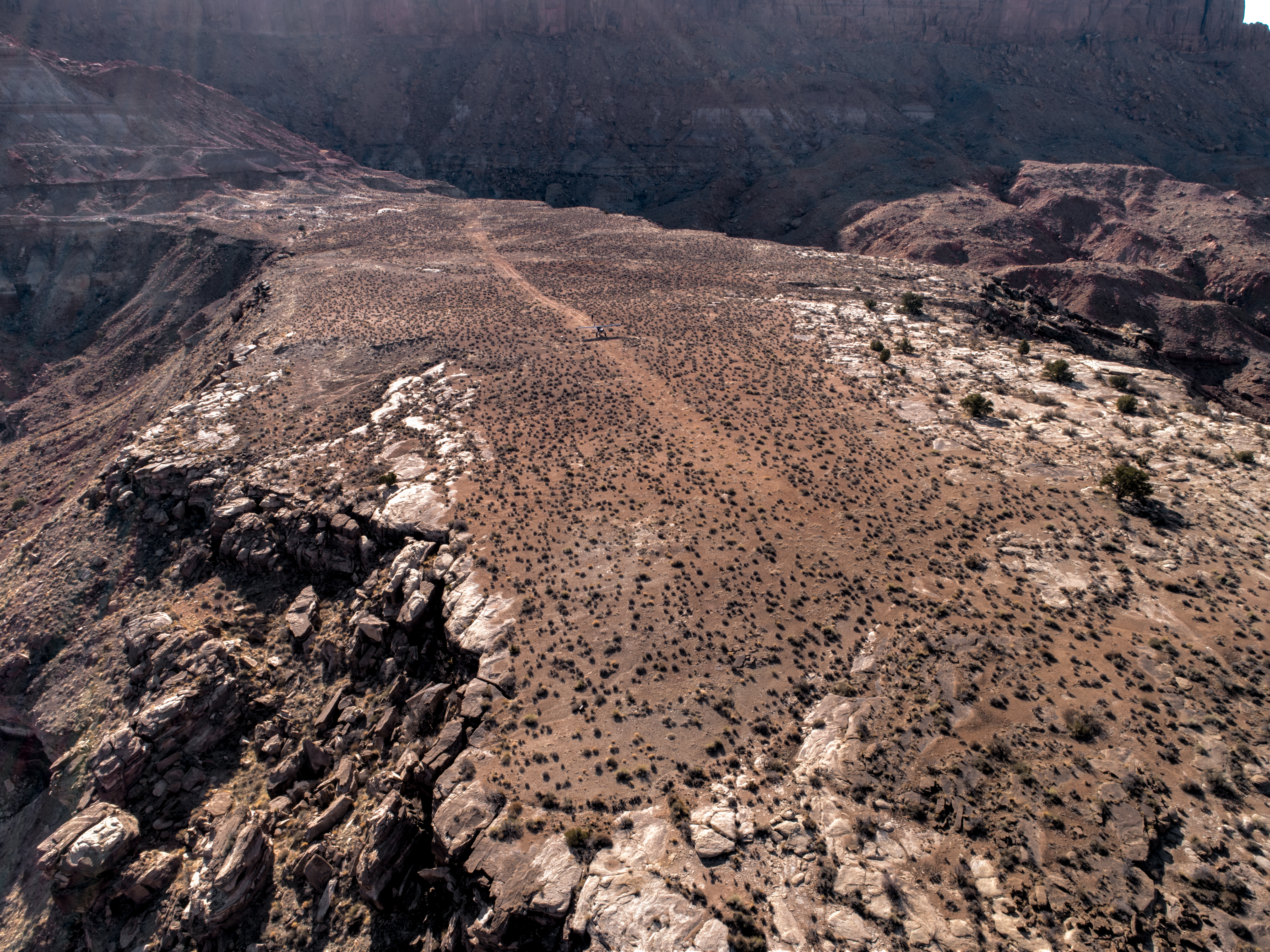
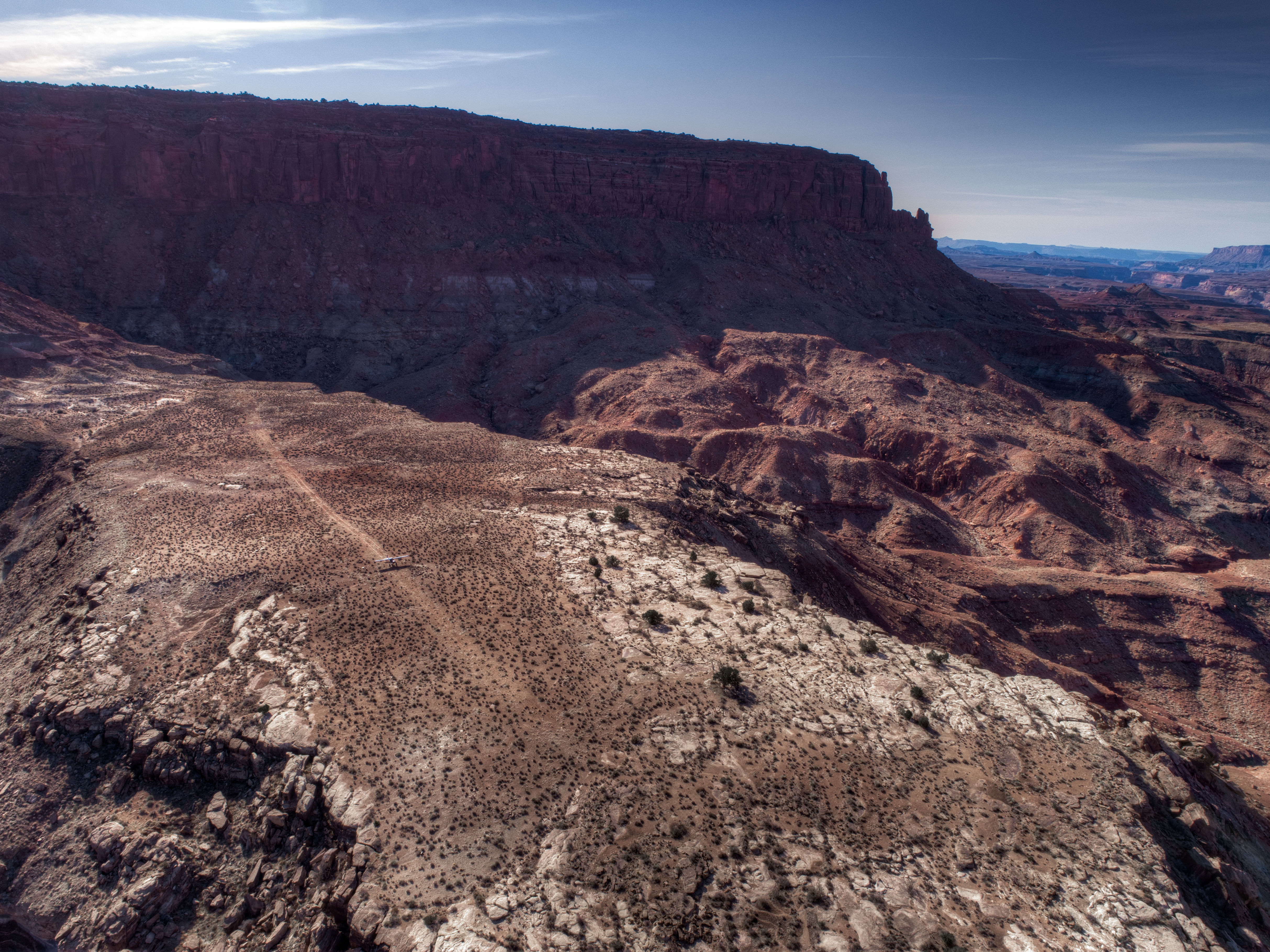
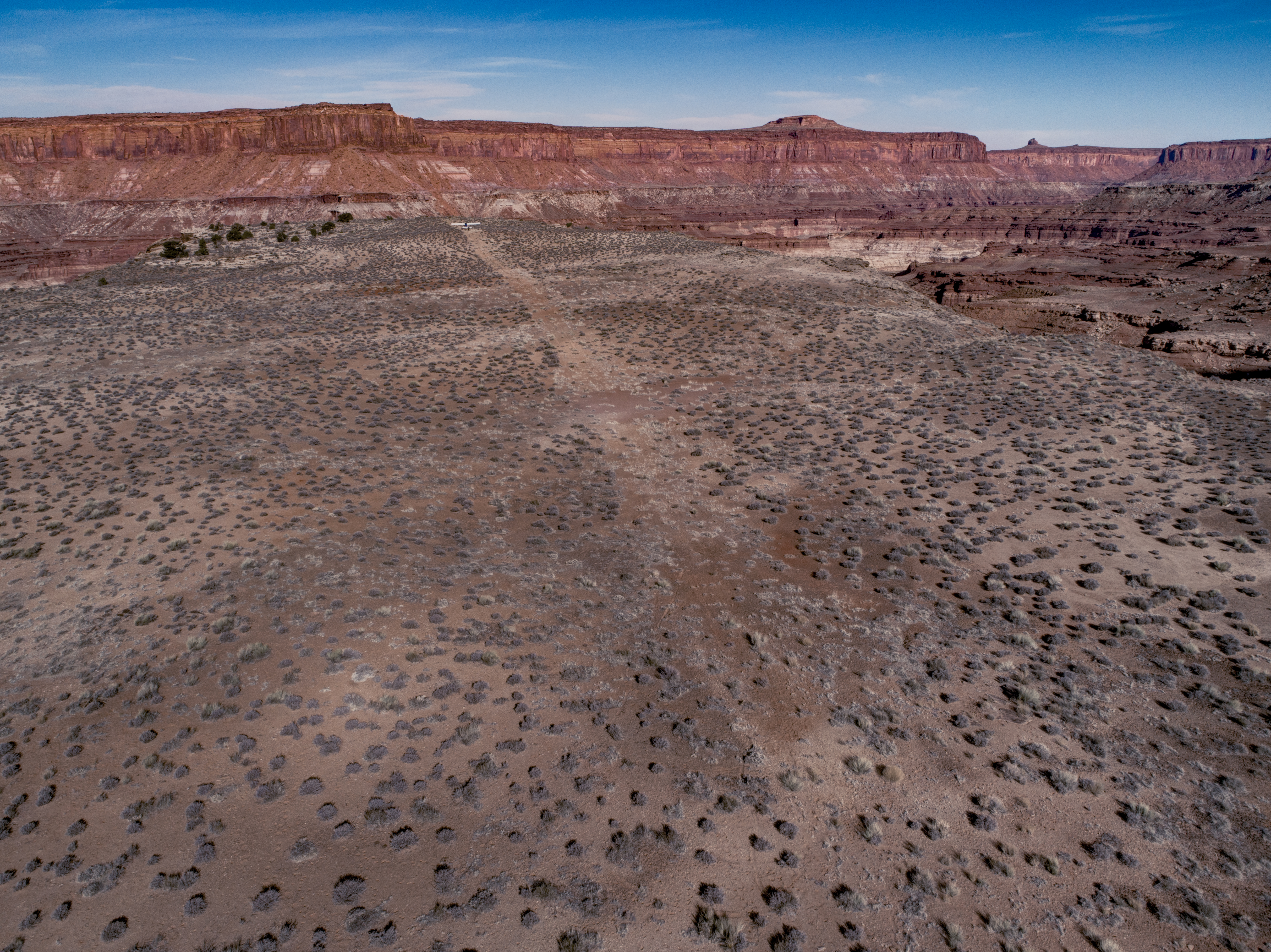
Most challenging “strip” I’ve ever landed. The description/advice is a bit hard to understand in my opinion. Very calm wind, still in the morning shadows, with no thermal activity when I visited. I over flew and rolled it 4 times before committing and landing. Ultimately I decided it was best to land SE end approaching NW end (29), which means I came in on a left base close on the cliff face and talus slope. Turning final was low, slow, and basically touching down right as I leveled out of the turn. Rolled out going toward “the hill” meant also going though a ravine or two that are more suited for an ATV at that speed. Sandy soil helped to absorb and slow, and I only ended up using roughly 1/2 the strip. Took off from the NW end (11) right back at the cliff face. As I rolled off “the hill” the wings weren’t quite ready to fly so I slowly settled back into the strip with a light bounce and then held ground effect for a few seconds before a right turn out to the south. If weather/winds/drafts wouldn’t have been perfect, I would not have landed - not sure I would be willing to land again with my 8.00 mains and stock tailwheel. Probably would feel better with at least 8.50’s and a baby bushwheel.
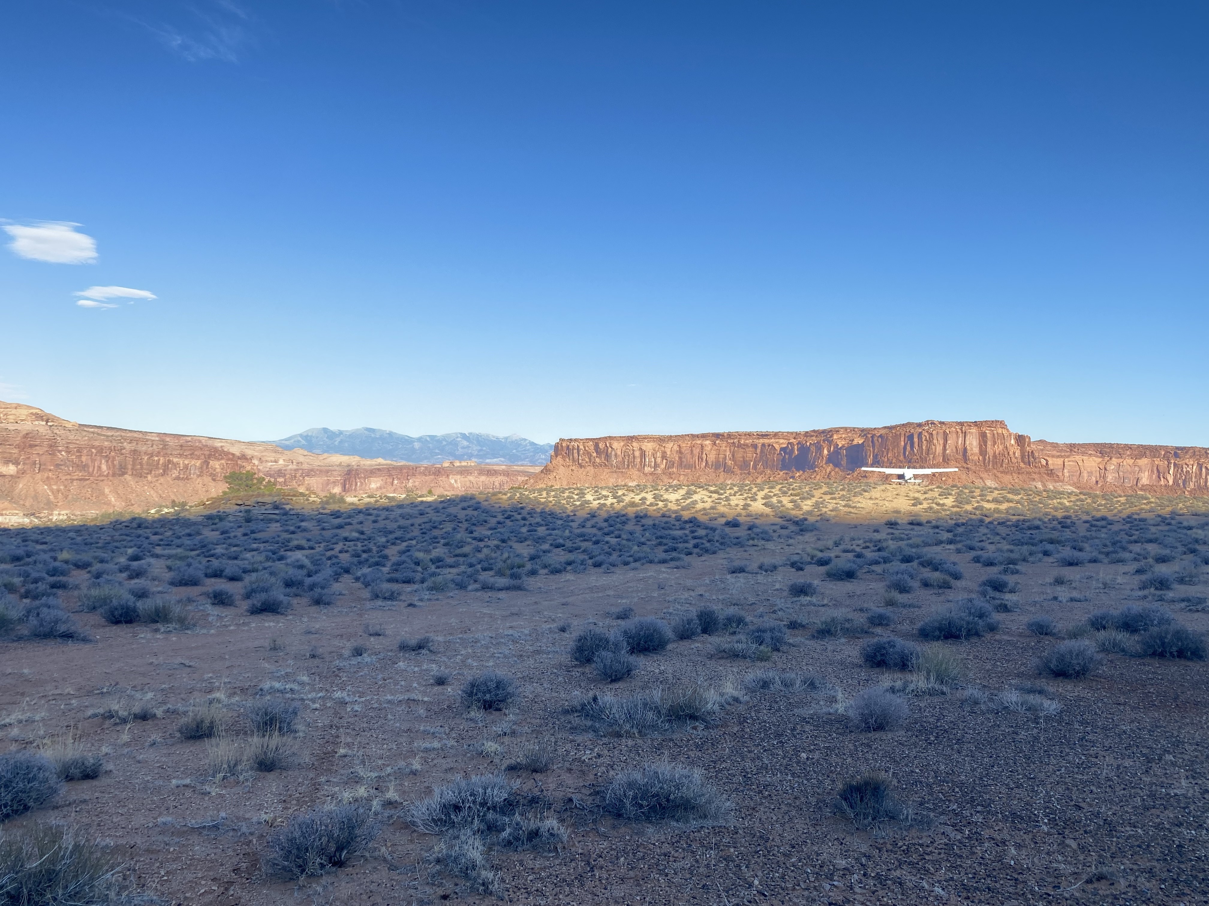

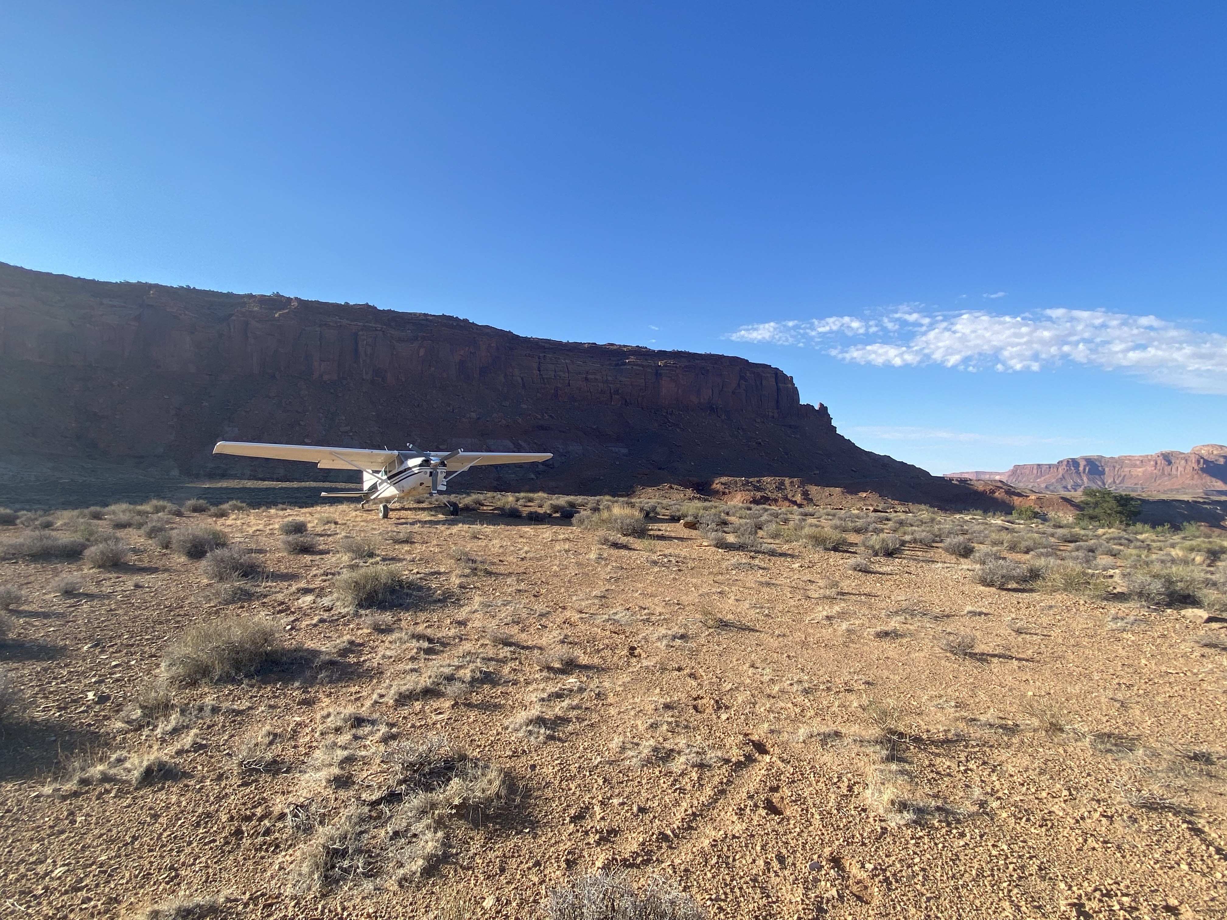
This is the most hazardous strip in my opinion. Extreme caution should be used here and reserved for perfect conditions. The rollers on this strip are in all the wrong spots for takeoff and are much bigger than the pictures look. I normally takeoff starting down the big hill towards the cliff, I am unsure if you can out-climb the hill headed north. Landing towards the hill is best. Large rocks are on either side of the runway on top. A very rewarding place to visit.

We haven't written a history for this airstrip yet. If you would like to provide us with some information about this strip, please contact us today!