Airstrip Info
| Frequency | 122.90 |
|---|---|
| Elevation | 4628 ft |
| Lat/Long |
38.2724, -109.7263 38° 16.344' , -109° 43.578' |
| Runway 14/32 |
1848 ft
x 45 ft
Dirt Road Rwy 14 Uphill 0.4% |
| Ownership | UBCP lease from SITLA |
Amenities
Weather
See more at the National Weather Center
Information updated May 23, 2025 @ 6:55pm
Description: Sitting at the base of the Needles Overlook Rustler Canyon is one of the closest airstrips to the Needles District of Canyonlands National Park. An intense 4x4 trail named Lockhart Basin connects Moab to the Needles District and runs along the base of the canyon. The road passing through the airstrip heads out to Newberry Butte Overlook which is part of the Indian Creek Wilderness Study. A section of the Hayduke Trail which spans from Zion to Arches National Park can be accessed from here. In the evening the light on the cliffs can offer a spectacular photo opportunity. Please be cognizant of the proximity to the park areas.
Attractions: Landing strip is located in Lockhart Basin near the Bears Ears National Monument and is extremely remote. Pilots seeking solitude will appreciate the area. Dark Skys. May be possible to hike to the Colorado River. Estimate 2 to 3 miles. This landing strip is open for recreational use by any pilot. Prior permission is not required but use at your own risk as is not inspected regularly. UBCP does not allow commercial use of the
landing strip.
Inspected: The airstrip was recently bladed by San Juan County in October 2024.
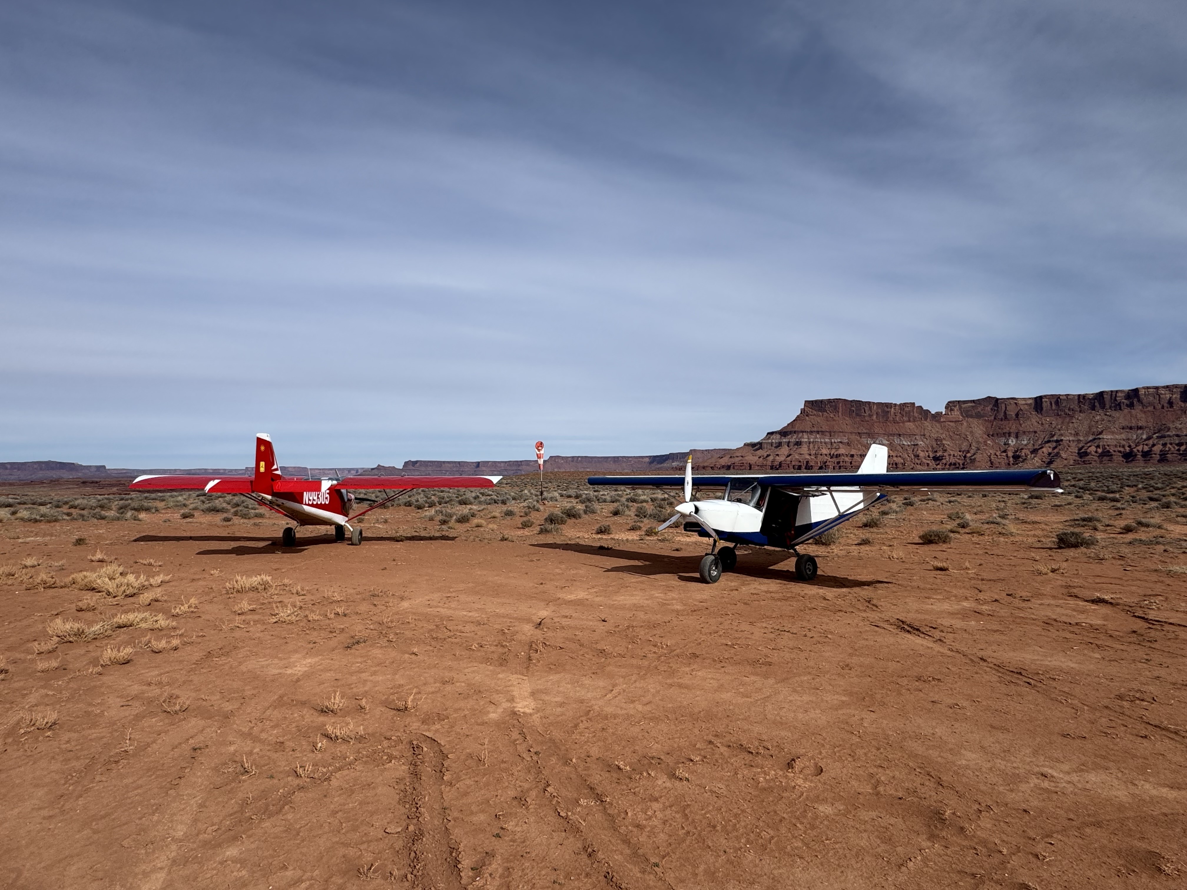
First time landing Rustler in 2026. Runway is in great shape! A winter season of tamping down the dirt makes the surface less soft. Still nice and wide and long! You can see where vehicles drive through as part of the road, but no ruts so far! Parking/camping area still nice and clear. Windsock still visible and in great shape. And bonus: the beautiful canyon backdrop is still there!
The Colorado River is appoximately 5 miles, one way, from the turnaround of runway 13. You can access tributary washes to Ruster Canyon by scrambling into the wash directly to the N of rwy. 13. Follow downstream for about 2.5 miles where there is dry falls that you have to skirt and down climb; look for the small cairn of rocks marking the easiest way down. Continue down the canyon for another 1.75 miles to the Colorado River.
Thanks to the hard work of the UBCP Board, the Rustler Canyon Airstrip is open for private non-commercial recreational use. Through this relationship, the airstrip has been recently re-graded as of October 2024.