Airstrip Info
| Frequency | 122.90 |
|---|---|
| Elevation | 5295 ft |
| Lat/Long |
38.6485, -110.6578 38° 38.91' , -110° 39.468' |
| Runway 18/36 |
3500 ft
x 30 ft
Dirt, brush Rwy 36 Uphill 0.4% |
| Ownership | Goblin Valley State Park |
Weather
See more at the National Weather Center
Information updated April 24, 2023 @ 4:09pm
Temple Mountain
NOTE: The Temple Mountain Airstrip is now located on State Parks land, specifically an extension of the Goblin Valley State Park. State Parks has allowed us to continue to use the airstrip while the UBCP, State Aeronautics, and State Parks work together on developing a plan for continued access of the airstrip. Please be courteous to any Park Officials that may ask you a few questions when operating in and out of Temple Mountain. And as always, thanks for your exemplary stewardship while we work for establishing the first official airstrip within State Parks land.
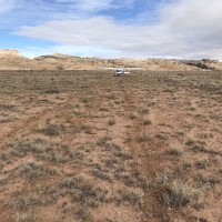
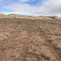
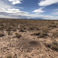
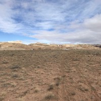
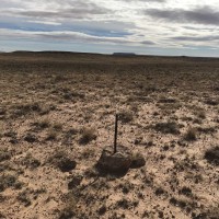
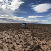
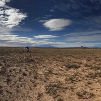
Description: Temple Mountain is a north/south oriented with sporadic clump grass, small bushes and ant hills. The surface is typical Utah desert, slightly soft with some give that can add to takeoff rolls.
Runway: 2,600' long x 40’. The surface is a little soft but is easily managed with 850 tires or larger and is relatively smooth. Slopes to the north 0.38%. Approximately 500’ from the south end there is a small undulation. Land beyond it.
Approach Considerations: The airstrip can be approached from either direction. When landing to the north, use caution for a small undulation approximately 500’ from the south end. Recommend landing beyond it.
Amenities: Primitive camping areas are available along the airstrip. BLM campgrounds are nearby. Goblin Valley State Park is 5 miles to the south. Trailheads to Wild Horse Canyon and Wild Horse Window hikes are located across the highway. The Temple Mountain mining site is nearby as well.
Windsock: No.
As part of our meeting with the Price BLM District, Roy and I visited the airstrips in their district on our way down to meet with them. I had been looking into Temple Mountain for a while and had two planes with bigger tires check it out in the spring. After a few passes to check the surface out, I decided to land. It was actually in pretty good shape. The brush here is by far smaller than what we cleared at Keg Knoll and pretty smooth, although a little soft...but no more than what would be expected. There are a few large ant hills, but they are avoidable. This strip offers great access to a couple of hikes and, a little farther down the road, Goblin Valley.
We haven't written a history for this airstrip yet. If you would like to provide us with some information about this strip, please contact us today!
