Airstrip Info
| Frequency | 122.90 |
|---|---|
| Elevation | 4215 ft |
| Lat/Long |
41.1757, -112.3808 41° 10.542' , -112° 22.848' |
| Runway 09/27 |
1828 ft
x 10 ft
Dirt 0% |
| Ownership | Utah DNR - FFSL |
Weather
See more at the National Weather Center
Information updated September 20, 2024 @ 5:49pm
NOTAM: The airstrips at Fremont Island are managed by the UBCP in accordance with a Memorandum of Understanding between the Utah DNR - Sovereign Lands Department and Utah State Aeronautics. Because of the nature of the land, there are a few rules that must be adhered to and pilots are required to review these rules prior to departing for the island:
No fires of any kind are permitted
No fireworks or explosive items
No discharge of firearms or hunting
No camping or other overnight use
Taking any plant, mineral, wildlife, or any other objects is prohibited
No motorized vehicles (except aircraft on designated runways)
No items such as geocaches, land art, etc may be placed on the island
Commercial guided tours are allowed through a permit through the DNR
Any commercial filming or photography require permits through the DNR
Furthermore, use of the airstrips atop Fremont Island is open to non-commercial use only. More information about the rules and regulations regarding the airstrips can be found at https://ffsl.utah.gov/fremont-island/. Takeoffs and landings on Fremont Island are restricted to the two established airstrips listed above. Landing or taking off elsewhere on the island is prohibited. Fremont Island is full of history, and we ask that you treat the island just as you would treat a wilderness area, by adhering to the UBCP Code of Conduct.
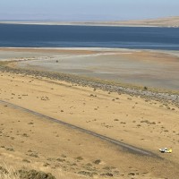
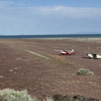
Description: Fremont Island's lower airstrip rests along the northern shoreline of the island.
Runway: 1,828 ft long x 10 ft wide dirt runway that was once a four wheel drive trail that is in good condition. Additional length available on both ends of runway however it is somewhat overgrown and not in as good of condition as the main surface of the runway. Runway has a slight slope towards the lake as well.
Approach Considerations: Terrain on final approach landing west requires a short and/or steep approach. Rising terrain just south of the airstrip as well as on extended centerline to the east of the airstrip. Suggested traffic pattern to the north of the airstrip to avoid terrain.
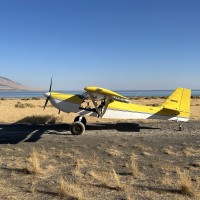
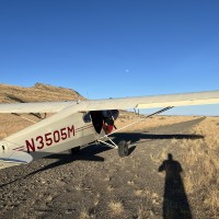
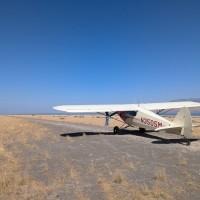
Amenities: None. Suggested parking areas along the southern side of the runway, but be careful for rocks, ditches, or other debris hidden in the grass alongside the runway. Terrain slopes slightly towards the lake.
Windsock: Yes, located west of the runway.
Weather: Winds tend to favor landing to the west. To view the current weather conditions on the top of the island, head ot https://mesowest.utah.edu/cgi-bin/droman/meso_base_dyn.cgi?stn=freut
We haven't written a history for this airstrip yet. If you would like to provide us with some information about this strip, please contact us today!
