Fry Canyon | Utah Back Country Pilots Association

Fry Canyon

UT74
Write an Airstrip Report

Airstrip Info

Frequency 122.90
Elevation 5372 ft
Lat/Long 37.6515, -110.1709
37° 39.09' , -110° 10.254'
Runway 14/32 3400 ft x 80 ft
Dirt
Rwy 32 Uphill 1.7%
Ownership BLM NM

Weather

See more at the National Weather Center

Information updated April 25, 2024 @ 5:31pm
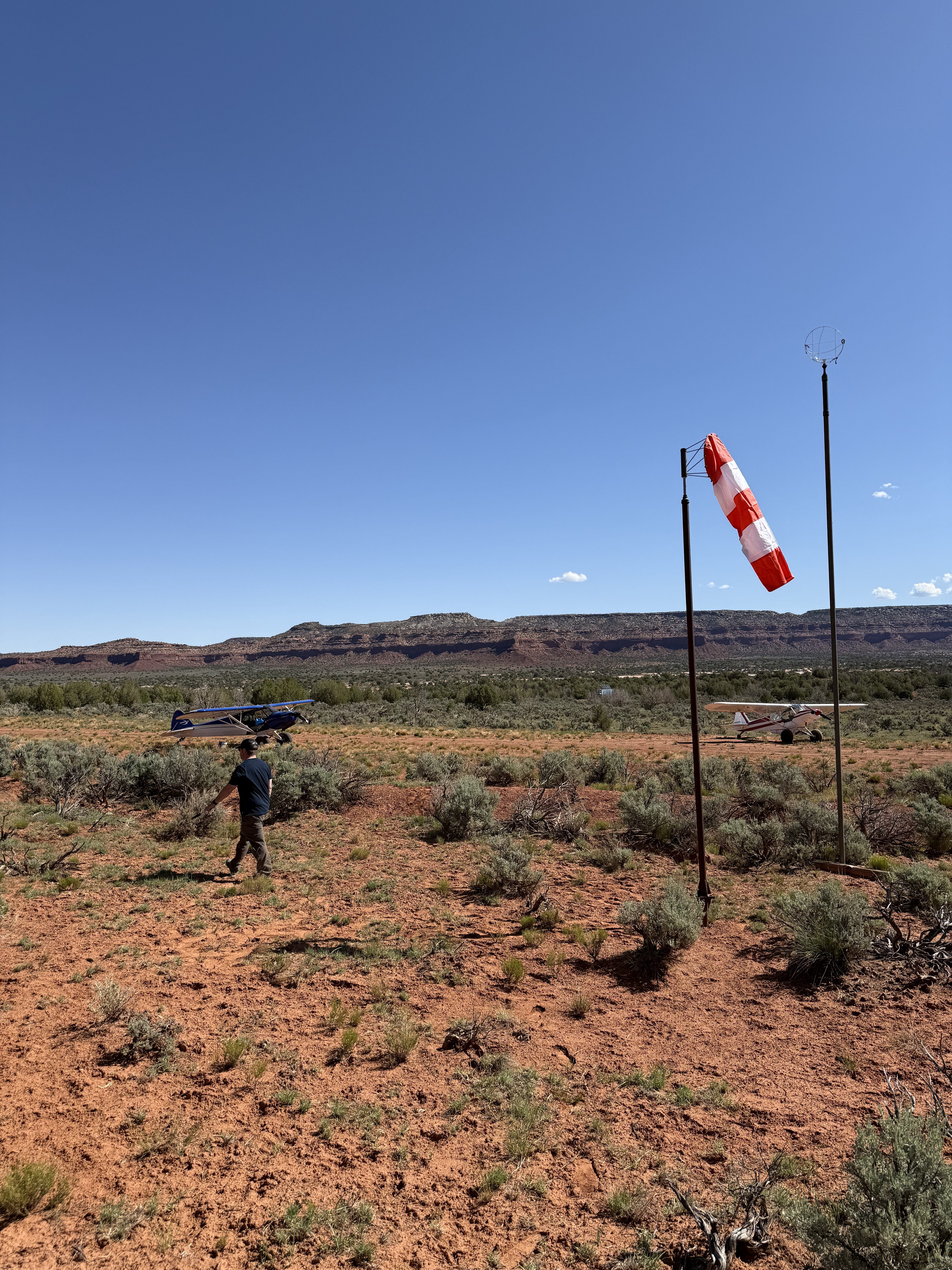
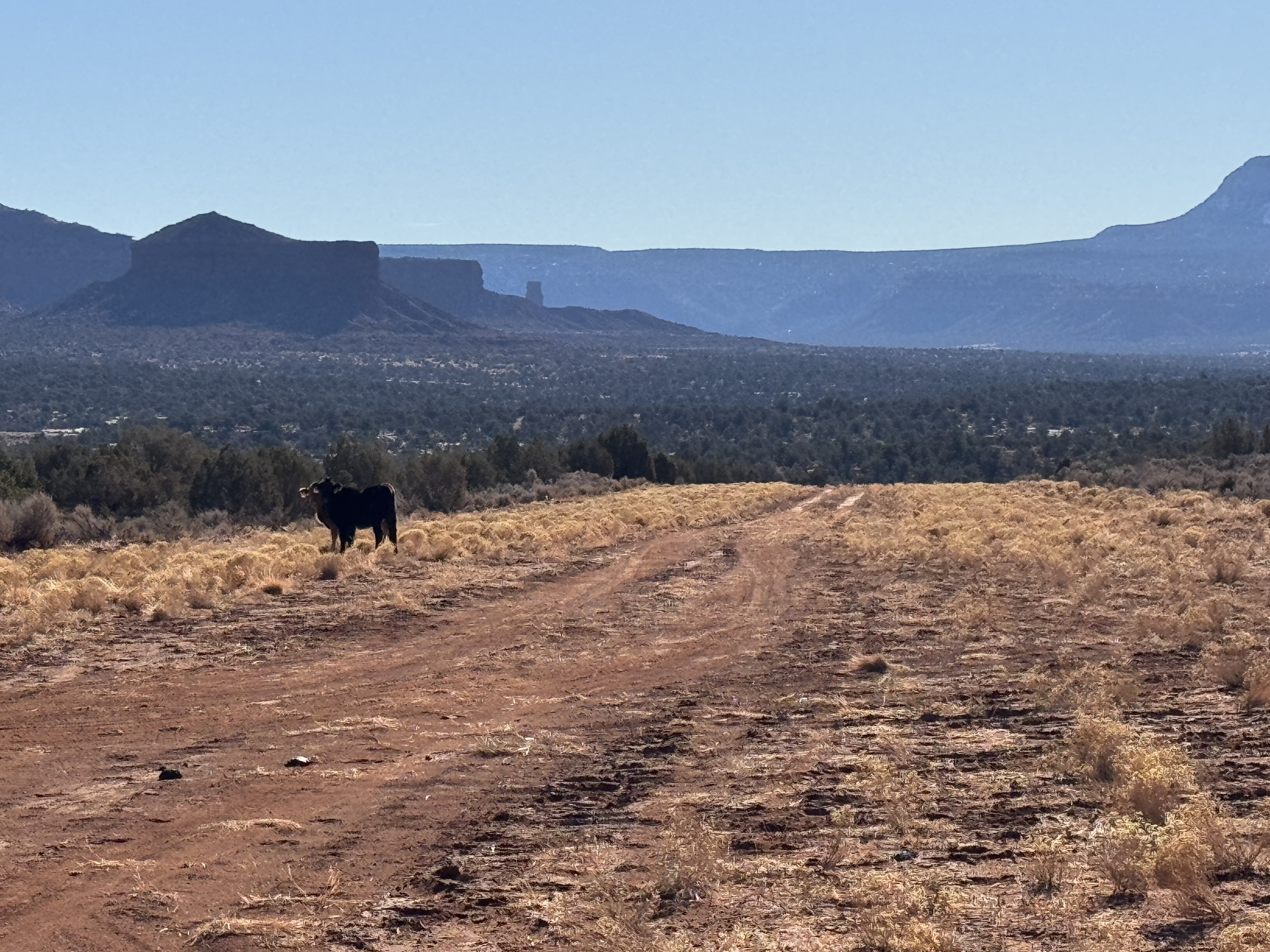
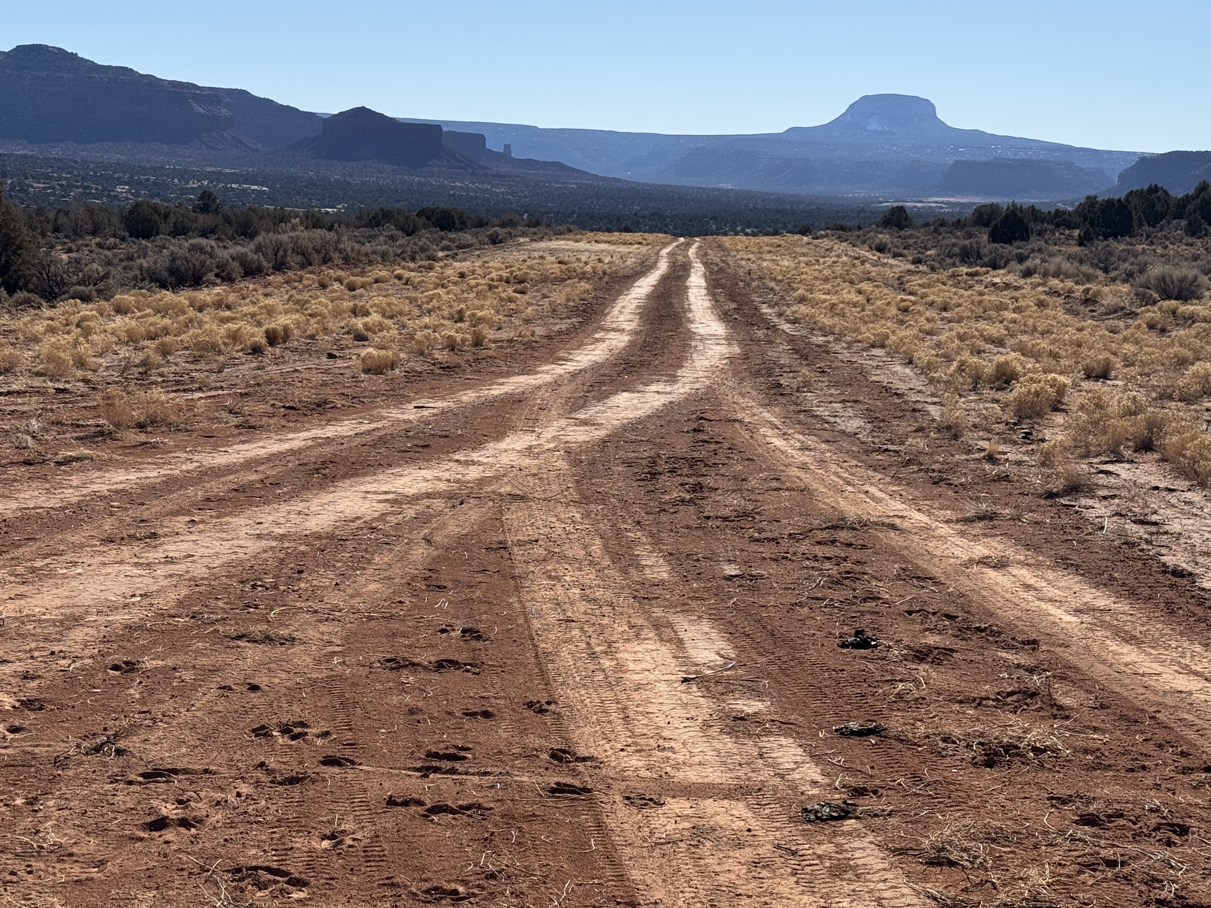
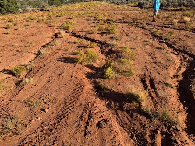
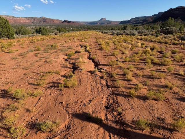
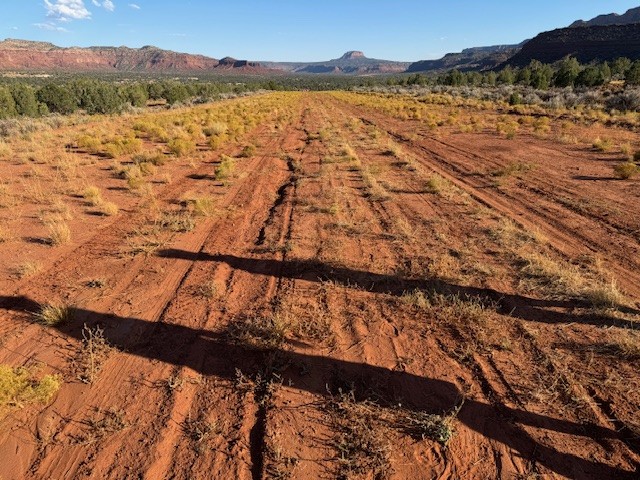
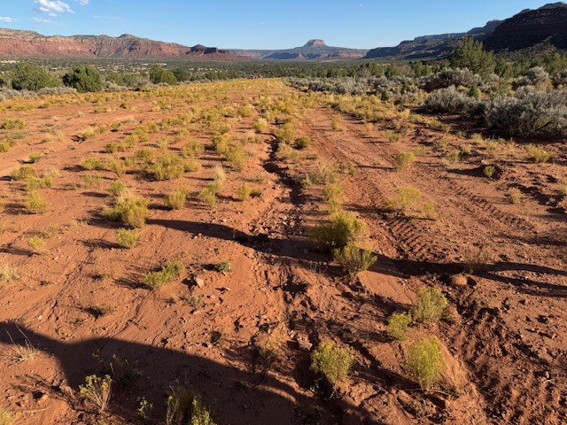
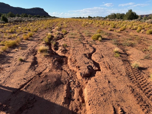
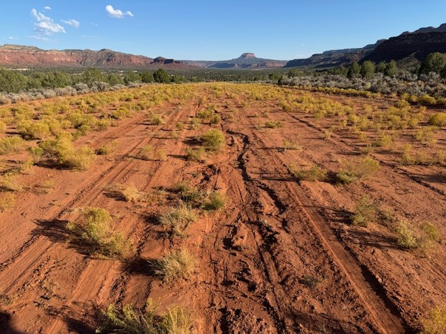
Description: Fry Canyon would be a great start to your Utah backcountry flying adventures. As one of the longer and wider airstrips in the collection it still offers a great opportunity to explore slot canyons, cliff dwellings, and camp with relative ease. 
 
Runway: This runway tends to be soft in the spring and late fall as the frost heaves up the ground. A bit of wind erosion near the base of the grass has made the runway more rough than normal. A little more use and this may correct itself. A important note is an access road crossing the airstrip near the first third landing north but a nice 2,382 feet of airstrip remain after the road. This road has seen increasing activity as the camping and cliff dwellings have grown in popularity and could become more hazardous as ruts deepen. The runway is sloped uphill 1.7% headed to the north. Landings and takeoffs can be accomplished in both directions. If taking off uphill into the wind it may appear your aircraft has reduced performance as the slope of the runway will create this illusion. 
 
Approach Considerations: If you have never landed on a upslope runway I can almost guarantee you’ll find yourself low on approach here.  A downhill landing is possible but the prevailing winds tend to favor an uphill landing. Plan your touchdown after the access road unless your aircraft performance and skill level allows for short landing distances. Before the road the runway has a few larger shrubs and rocks that need to be considered. There is also a large washout near the west side of the runway running the length of this section.
 
Parking: Large enough for a small fly-in there is no shortage of parking on the south end of the strip. Multiple fire rings can be found here with flat and smooth ground for camping. Some of the ground here is dirt covered rock so plan your tent stakes and tie downs according. No cell phone coverage. 
jed ellithorpe visited 1 year ago in a T206H with 8.0-6 tires

A few deep hoof prints. Kinda soft but not bad. Not too many tracks. I am sure with more traffic it will get packed down. Opted to land uphill (32) with a tailwind. Waited until after the road that crosses the runway to touch town. There is a deep cut in the runway on the right side from the road avoid that. If you need the to cross the road cheat to the west.

4 Likes , 0 Comments


Cory Wolf visited 1 year ago in a C205 with 850 tires

Fry was not as soft as I expected. Maybe 1/4 to a 1/2 inch give to foot prints. It’s been graded somewhat recently and recent moisture has firmed it up. Hiked down to look at the cliff dweller ruins across the canyon.

2 Likes , 0 Comments


William Lipscomb visited 2 years ago in a PA-18 with 31" tires

Repaired windsock. Some runoff and erosion on centerline of strip from recent rains. Landing past the road intersection is still the best section of runway. The erosion there is less than a couple inches.

4 Likes , 1 Comment


Roy Evans II

Thanks for being a windsock hero!

2 years ago
William Lipscomb visited 2 years ago in a PA-18 with 31" tires

In great shape.

2 Likes , 0 Comments


Joseph Barrett visited 2 years ago in a Cessna 140 with 8.50x6 tires

For the most part, the runway was in great shape. As previous reports have stated, a road intersects the runway effectively splitting it into thirds. The southern third below the road is becoming more overgrown and has a deep washout area from a previous rain storm. The Northern two thirds are in great condition. There are small clumps of grass on the runway which was fairly firm considering the the temps that the area has been experiencing. Overall, a great strip to check out. You will definitely feel the 1.7% slope. I recommend a minimum tire size of 8.00 x 6 going into this one due to the grass clumps.

2 Likes , 0 Comments


No recreational activities for Fry Canyon yet! Add one now!
Make your Flight Plan at SkyVector.com

Fry Canyon's airstrip has been identified on USGS maps since 1980. You can view this historic map below or download it by clicking here.