Airstrip Info
| Frequency | 122.90 |
|---|---|
| Elevation | 4941 ft |
| Lat/Long |
38.1569, -110.2916 38° 9.414' , -110° 17.496' |
| Runway 09/27 |
1385 ft
x 50 ft
Dirt Rwy 9 Uphill 1.4% |
| Ownership | SITLA |
Amenities
Weather
See more at the National Weather Center
Information updated January 28, 2025 @ 4:53pm
Description: Strongly suggest obtaining local knowledge prior to landing for the first time. Landing strip currently leased to Utah Back Country Pilots for non-commercial use only. UBCP requests no man-made artifacts (drill bits, tools, etc.) be removed, and that visitors avoid the shacks as to not damage them. Emergency water and runway grading tools in shack.
Runways: RWY 9 is uphill 1.38% and has displaced threshold due to overgrown brush. East end 50 feet higher. Touch down point may be difficult to determine by the first time visitor. Threshold markers should be present.
Additional runway 18/36: 845 feet long x 50 feet wide, very soft dirt. Slightly uphill to the north.
Approach Considerations: Unfamiliar pilots should positively identify the touchdown zone as the runway appears to be longer than it is. Recommend land east, depart west.
Amenities: Parking areas are at east end and very soft.
Windsock: Wind sock west of miner's shack.
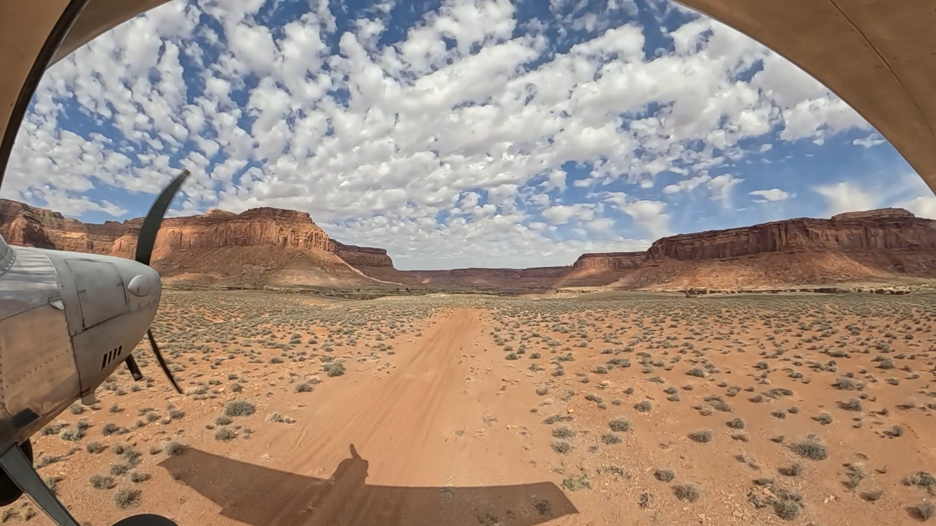
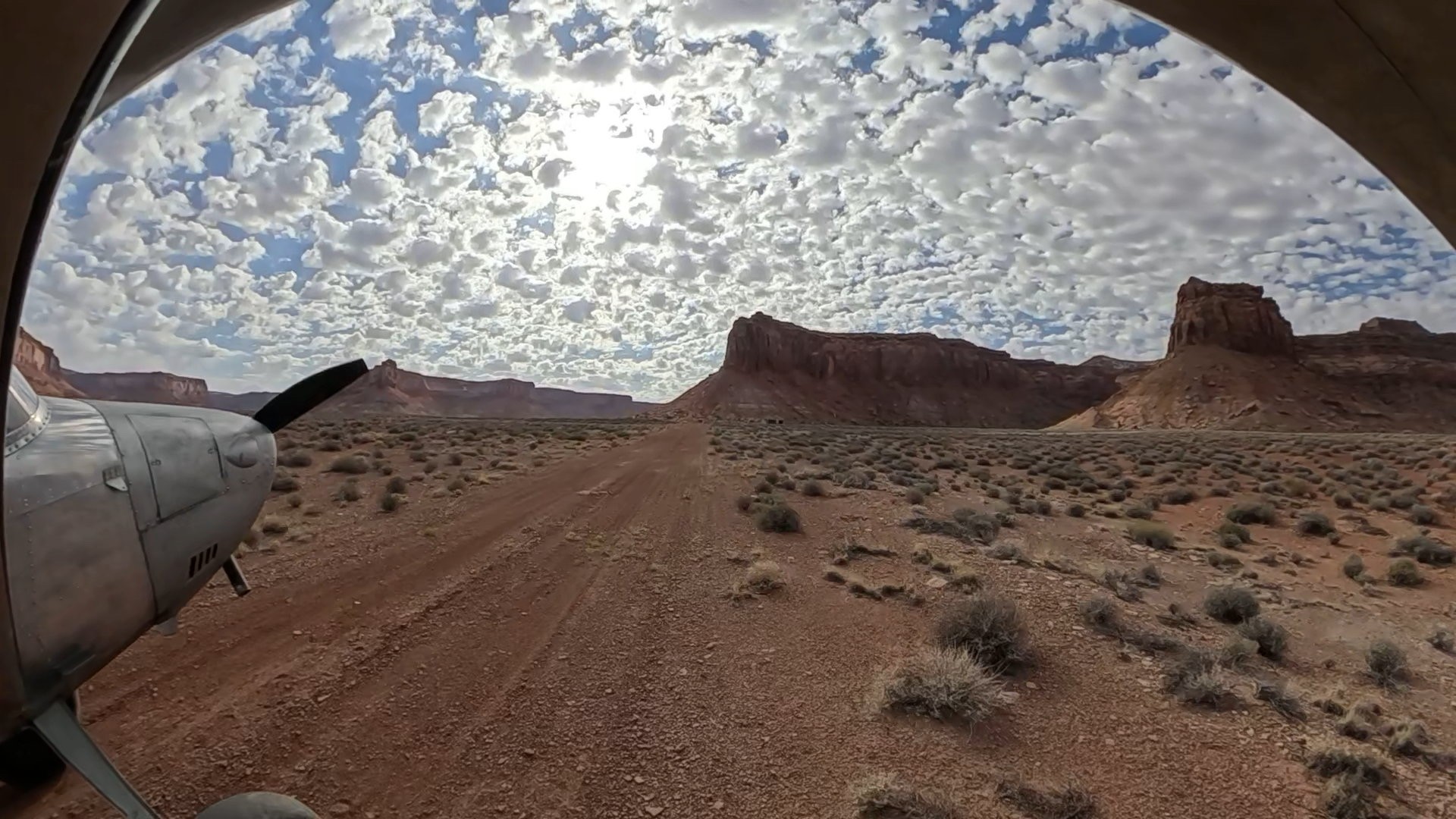
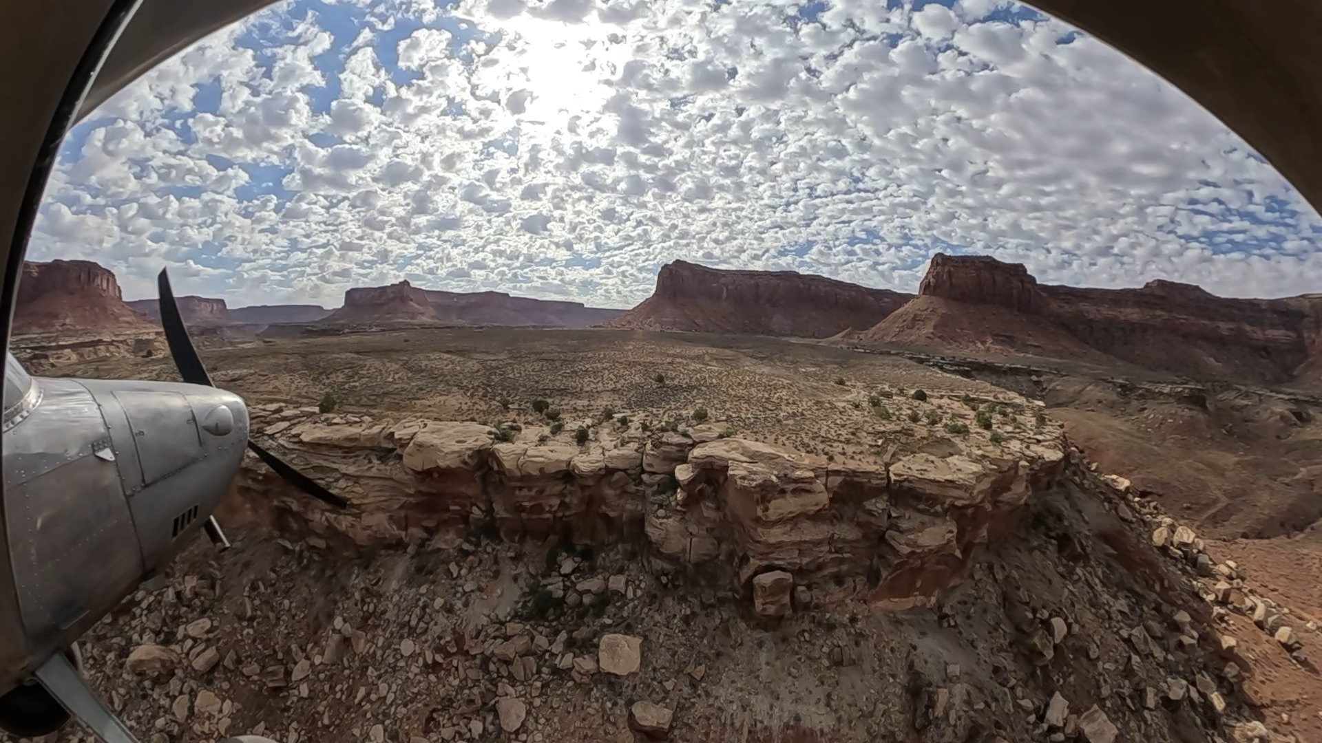
We landed at Happy Canyon using runway 09 and we took off using runway 27. We parked the plane behind the Miner's cabin. We walked on the field, and we found a piece of petrified wood. Our friend Neil made a great landing and take off. The most impressive experience there was the silence and knowing that the place is completely isolated. No roads are near the place... We used a Gopro max 2 360 attached to the wing for the landing and take off images.
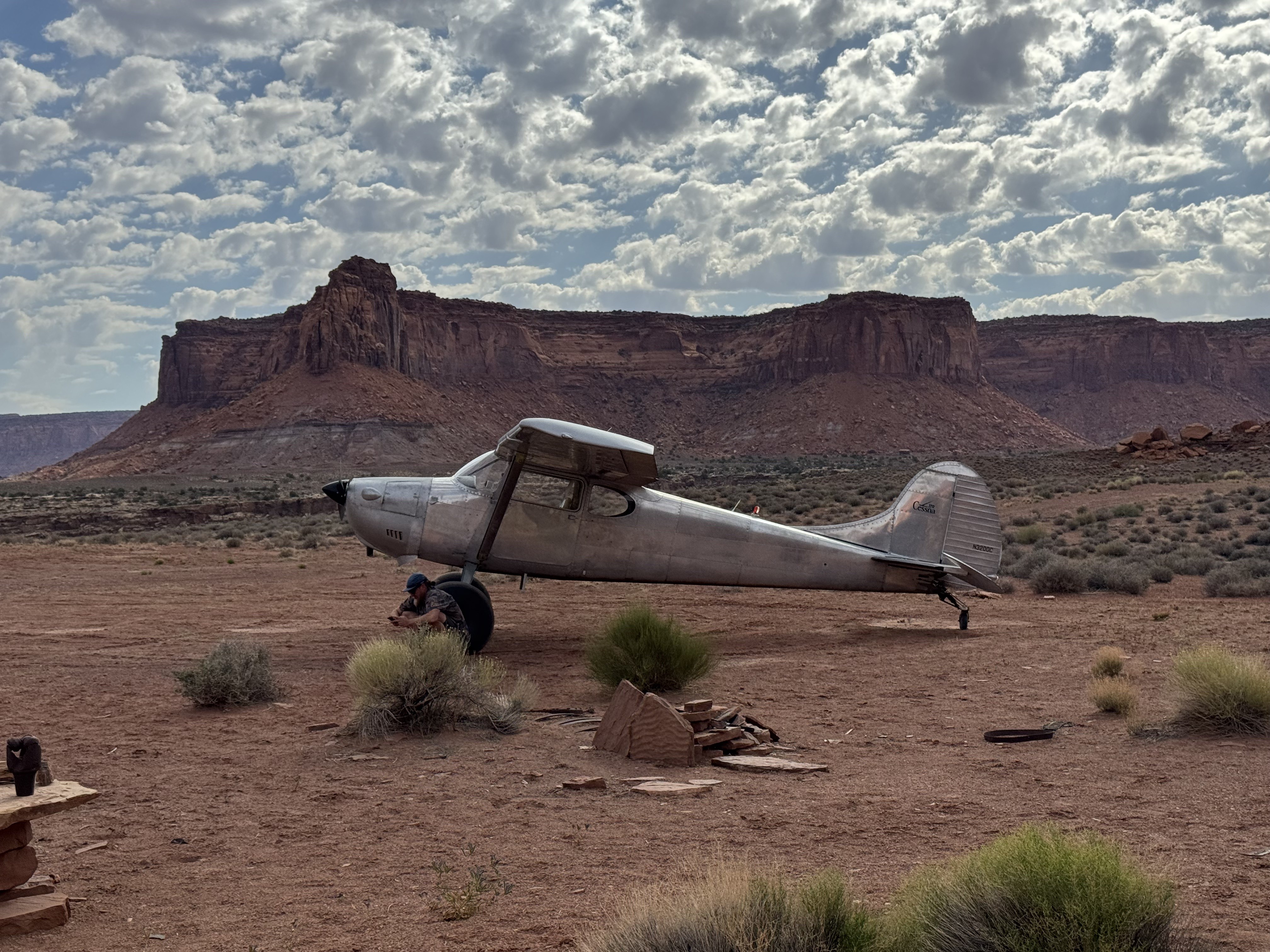
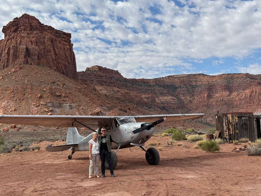


There is a historic mining shack at the Happy Canyon airstrip. It contains numerous historic relics, petrified wood, and paraphernalia from early in the last century, almost like a private museum for pilots to enjoy. There is also a cache of emergency supplies and tools for pilots to use and replenish. Use caution in and around the shack, as it is old and structurally frail. Please do not remove any of the historic relics and leave them for the next pilot to enjoy. Great airstrip for camping & stargazing.
It's an 11 mile hike down to the Dirty Devil where there is a slot canyon with some pretty incredible views along the way. There are NO springs on the way, so water must be carried, making sure you have enough for down and back. You could pull water from the Dirty Devil for the way back, using Alum to filter the silt out first before a water purifier. We split the trip up into two days and stayed 1 night on the trail. A good amount of hiking, but doable. Slot canyon can have water in it so be prepared with extra shoes, pretty muddy. We went end of April and no water above the thigh that year.
We haven't written a history for this airstrip yet. If you would like to provide us with some information about this strip, please contact us today!