Airstrip Info
| Frequency | 122.90 |
|---|---|
| Elevation | 5946 ft |
| Lat/Long |
37.2787, -110.5721 37° 16.722' , -110° 34.326' |
| Runway 07/25 |
2100 ft
x 10 ft
Dirt/Gravel Rwy 7 Uphill 1.1% |
| Ownership | BLM |
Amenities
Weather
See more at the National Weather Center
Information updated May 13, 2021 @ 7:54pm
Description: Add Nokai Dome to your camping bucket list immediately. Located high on a plateau, a steep cliff to the east overlooks Monument Valley and to the west, Lake Powell. A jeep trail that follows the ridge offers some easy hiking.
On two occasions we have seen a desert tarantula near the large rocks on the east side. He offered only a quick photo opportunity before finding cover under a rock. His name is Jumper, and still suffers from stage fright. We happened to notice on another camping trip an abundance of mountain lion tracks around our tent in the morning. So, let's zip up our tents at night and put away any curious cardboard boxes that might attract play time!
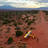
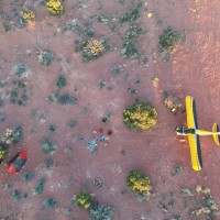
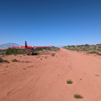
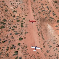
Runway: A soft layer of dirt covers the runway and is normally very smooth. A higher float tire may be required under certain conditions. The strip is narrow with shrub trees relatively close for larger wingspan aircraft. It slopes uphill considerably to the east but is still manageable for a takeoff and landing in both directions. OHV traffic is common here so a close landing survey for any surface defects or large rocks tossed on the runway should be accomplished.
Approach Considerations: Crosswinds are very common and may have negative consequences due to the narrow runway and proximity to shrub trees. The cliff to the east and Nokai Dome itself will create significant mechanical turbulence. The tendency to become low on final may be a threat as the upslope of the runway can create that visual illusion.
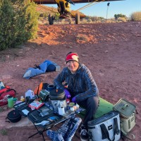
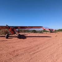
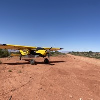
Parking: Several airplanes can be parked here but will block some of the runway. Multiple flat camping areas and fire rings are found on the south side of the runway. Excellent cell phone service here.
Amenities: Cal Black airport, which has some basic services, is only a short flight from here. Based on past experiences, a phone call to Cal Black Airport to ensure adequate fuel would be prudent. A restroom, water, picnic table, and indoor lounge area is available.
Beautiful strip with great views southwest of Navajo Mountain and northeast towards the Abajos. Most folks will land uphill on runway 7 and camp at the uphill end of the strip. Multiple fire rings and soft, sandy spots for pitching tent, which we did. Plentiful firewood to be gathered here, and excellent cell phone service available. 11 miles south of Cal Black (Halls Crossing) where you can buy 100LL & mogas (no card reader, so attendant must be present to run your card in the office). Definitely recommend!
Camping at Nokai Dome is best at the east end of the airstrip, where the ground is more level. The airstrip has a commanding panoramic view of the water pocket fold, which is on the north side of Lake Powell, within Capitol Reef National Park. The airstrip also overlooks Lake Powell and Navajo Mountain. Stargazing is excellent, since the airstrip is at the top of a mesa.
There is a unique artistic curiosity near the Nokai Dome airstrip. Turn right at the east end of the airstrip and after a short 5-min walk down the dirt road, you will behold the Tin Can Tree on the left side of the road.
We haven't written a history for this airstrip yet. If you would like to provide us with some information about this strip, please contact us today!
