Backcountry airstrips are inherently dangerous. It is the sole responsibility of the Pilot in Command to ascertain airstrip conditions prior to use. Be certain to consider environmental, aircraft, and personal factors when determining suitability.
Use of the airstrips is at the sole discretion of the Pilot in Command. Fly safe!
Information updated April 25, 2024 @ 5:31pm
Description: Fry Canyon would be a great start to your Utah backcountry flying adventures. As one of the longer and wider airstrips in the collection it still offers a great opportunity to explore slot canyons, cliff dwellings, and camp with relative ease.
Runway: This runway tends to be soft in the spring and late fall as the frost heaves up the ground. A bit of wind erosion near the base of the grass has made the runway more rough than normal. A little more use and this may correct itself. A important note is an access road crossing the airstrip near the first third landing north but a nice 2,382 feet of airstrip remain after the road. This road has seen increasing activity as the camping and cliff dwellings have grown in popularity and could become more hazardous as ruts deepen. The runway is sloped uphill 1.7% headed to the north. Landings and takeoffs can be accomplished in both directions. If taking off uphill into the wind it may appear your aircraft has reduced performance as the slope of the runway will create this illusion.
Approach Considerations: If you have never landed on a upslope runway I can almost guarantee you’ll find yourself low on approach here. A downhill landing is possible but the prevailing winds tend to favor an uphill landing. Plan your touchdown after the access road unless your aircraft performance and skill level allows for short landing distances. Before the road the runway has a few larger shrubs and rocks that need to be considered. There is also a large washout near the west side of the runway running the length of this section.
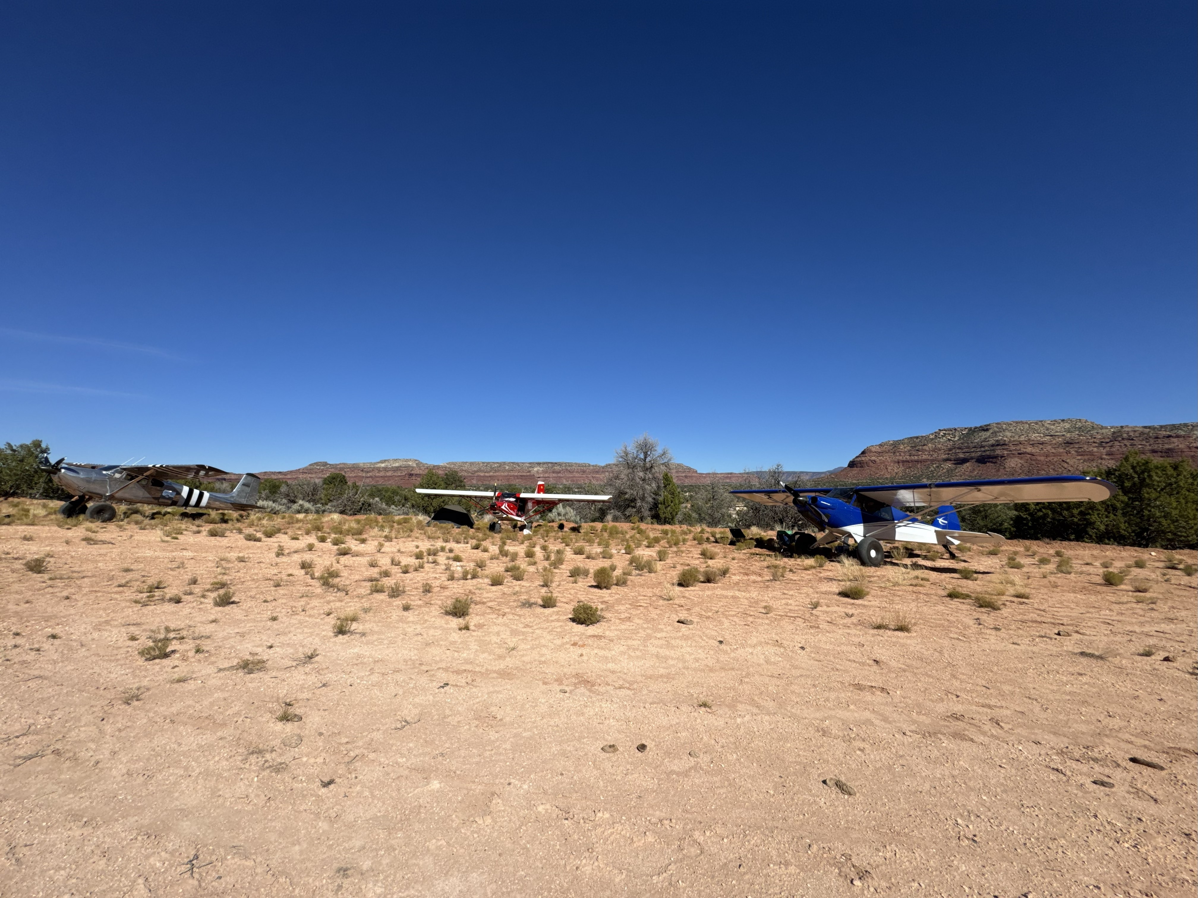
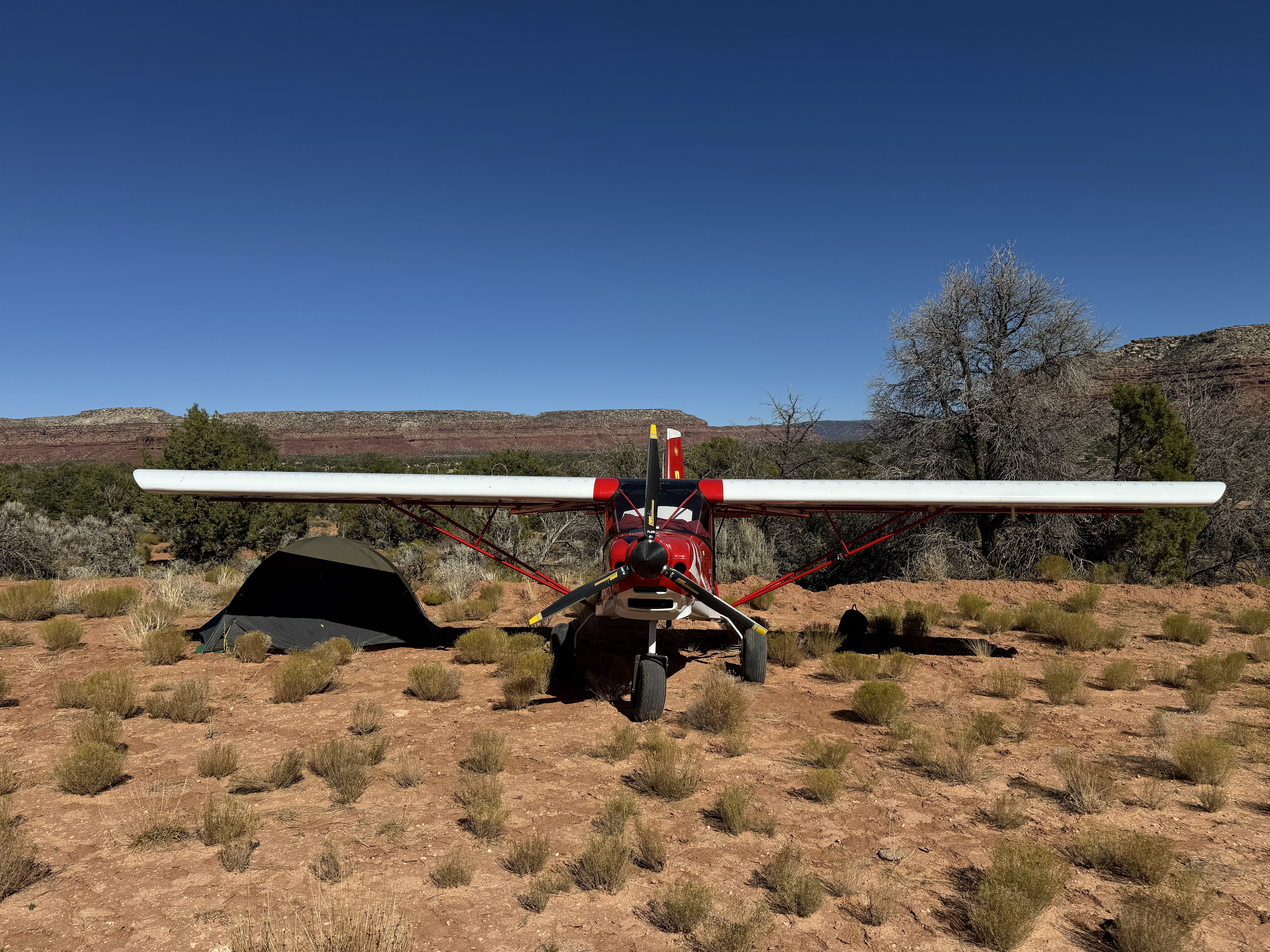
Parking: Large enough for a small fly-in there is no shortage of parking on the south end of the strip. Multiple fire rings can be found here with flat and smooth ground for camping. Some of the ground here is dirt covered rock so plan your tent stakes and tie downs according. No cell phone coverage.
Marc Lassaux
visited
2 months agoin a ICP Savannah Swith 21 tires
Due to quite a little bit of brush and weeds the runway is not good to the SE of the road crossing. After the road crossing the runway gets better the further NW you go. I always love visiting this one. The picture is taken close to the approach end of 32 and you can see the vegetation.
Marc Lassaux
visited
8 months agoin a ICP Savannah Swith 21 tires
Landed and camped at Fry Canyon. Runway is somewhat bumpy due to vegetation and a few ruts. Could use a grading. The NW area of the runway is better than the SE area. Great place to visit.
Josh Kelson
visited
1 year agoin a PA-18 SuperCubwith 31” tires
Nice and long, wide. Firm right through the middle and edges are a bit softer. Seems that someone has leased land right next to the strip, there is a blue container which seems to be a pump for water for perhaps cattle? They access this though through the runway, probably what the 4x4 tracks were. Will Lipscome and Karen Larsen replaced the windsock. Overall in good shape, some clumpy grass growing throughout. A few hundred feet beyond (NW) of the road that splits the strip there are some ruts and water erosion to be mindful of.