Airstrip Info
| Frequency | 122.90 |
|---|---|
| Elevation | 4748 ft |
| Lat/Long |
38.9834, -113.3666 38° 59.004' , -113° 21.996' |
| Runway All |
10000 ft
x 3000 ft
Hardpan |
| Ownership | BLM |
Weather
See more at the National Weather Center
Information updated April 22, 2019 @ 5:27pm
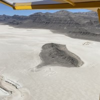
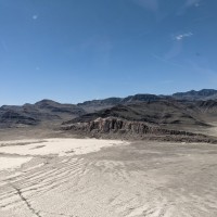
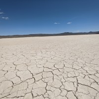
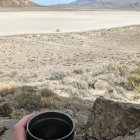
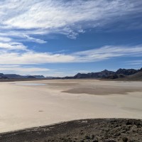
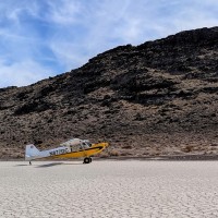
Description: The Tule Valley Hardpan (aka Ibex) is a large dry lake bed just west of Sevier Dry Lake. Ibex is one of the three back country airstrips included in the State's "FLY UTAH Passport Program". To learn more, head to their website.
The Ibex Hardpan Briefing guide is available here.
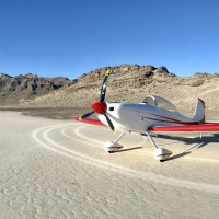
Runway: Generally pilots land north/south on the area south of the island that rises about 200 feet above the hardpan.
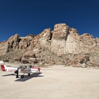
Approach Considerations: Rapidly rising terrain west of the landing surface.
Amenities: None
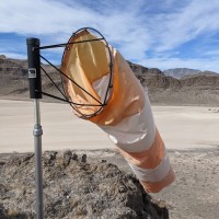
Windsock: Yes, located atop the island.
Hardpan is in great shape for this weekend’s fly-in!
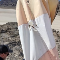
@Charles - my understanding is that the connection between the windsock frame and pole broke. Josh/Roy/Steve are working on getting it fixed.
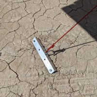
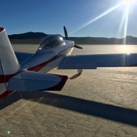
2 years agoCircled around the Island and could not find a wind sock. Rock hard smooth lakebed. Look out for occasional large rocks in the shape of small rocks. Hammered in some anchors so the plane wouldn't blow away while rock climbing for a few hours. Awesome trip and the Delta FBO was a great stop. Microwaved a corndog from the fridge!
Also had cell reception with google fi somehow. but I would not count on it.
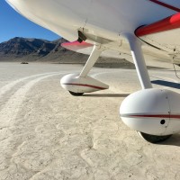
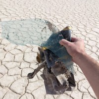
2 years agoFirst time landing here today. Such an awesome place. Very quiet and desolate. A good spot for some solitude. The windsock is in good shape. Has a small tear and faded but it's standing and functional. It can use some extra zip ties for the upper eye loops. It was helpful. Very light winds out of the south. I landed southwest along the southern shore of the island. That spot is by far the smoothest. It was better than many runways I've landed on. No problem at all for my tiny tires and even smaller tailwheel. Walked around a bit. Though the ponds are full of water, the lakebed is hard and dry. The ponds were just starting to freeze. Fresh water! Not salty. Other spots would be suitable for landing as well, though ever so slightly more bumpy with the alligator cracking on the lakebed. There's a very small yet still very saddening amount of trash around. Wish I had brought a trash bag. Walked around a bit and filled a re-purposed gallon zip lock. Lots of tent stakes, plastic, receipts, batteries, wrappers, and beer cans. Look at the base of the bushes and bring gloves.
Lot's of wet spots and pooling water towards the south end of the hardpan. Landed the west side of the island with no issues, more than enough dry surface that's hard as a rock to land on. Windsock pole was a bit cockeyed and was unable to rotate freely, so my friend and I climbed up and leveled out the rock base to set the windsock pole upright, noted a hole in the sock but it's functional now that it's not getting stuck the low point of it's previous rotation. Found a good trash score as well. All looks like very old fabric with the exception of an AAA battery in a fire ring. Also, be advised that Clover Control is unreachable below 8,500ft. Attempted to establish comms several times just north of KDTA before entering the MOA, same on the climb out for the return flight back East over the Sevier lakebed, so keep your head on a swivel.
The majority of the lakebed was dry with the exception of a few small pools here and there. Someone has made a small rock structure at the south end of the lake and there were quite a few ATV’s. A low pass should be accomplished before landing. There is a wind sock and a flag on top of the rock formation in the center of the lake that provides good reference on which direction to land.
We haven't written a history for this airstrip yet. If you would like to provide us with some information about this strip, please contact us today!
