Airstrip Info
| Frequency | 122.90 |
|---|---|
| Elevation | 3946 ft |
| Lat/Long |
38.5293, -109.9946 38° 31.758' , -109° 59.676' |
| Runway 15/33 |
2100 ft
x 25 ft
Dirt Rwy 33 Uphill 0.7% |
| Ownership | BLM |
Amenities
Weather
See more at the National Weather Center
Information updated November 27, 2022 @ 9:17am
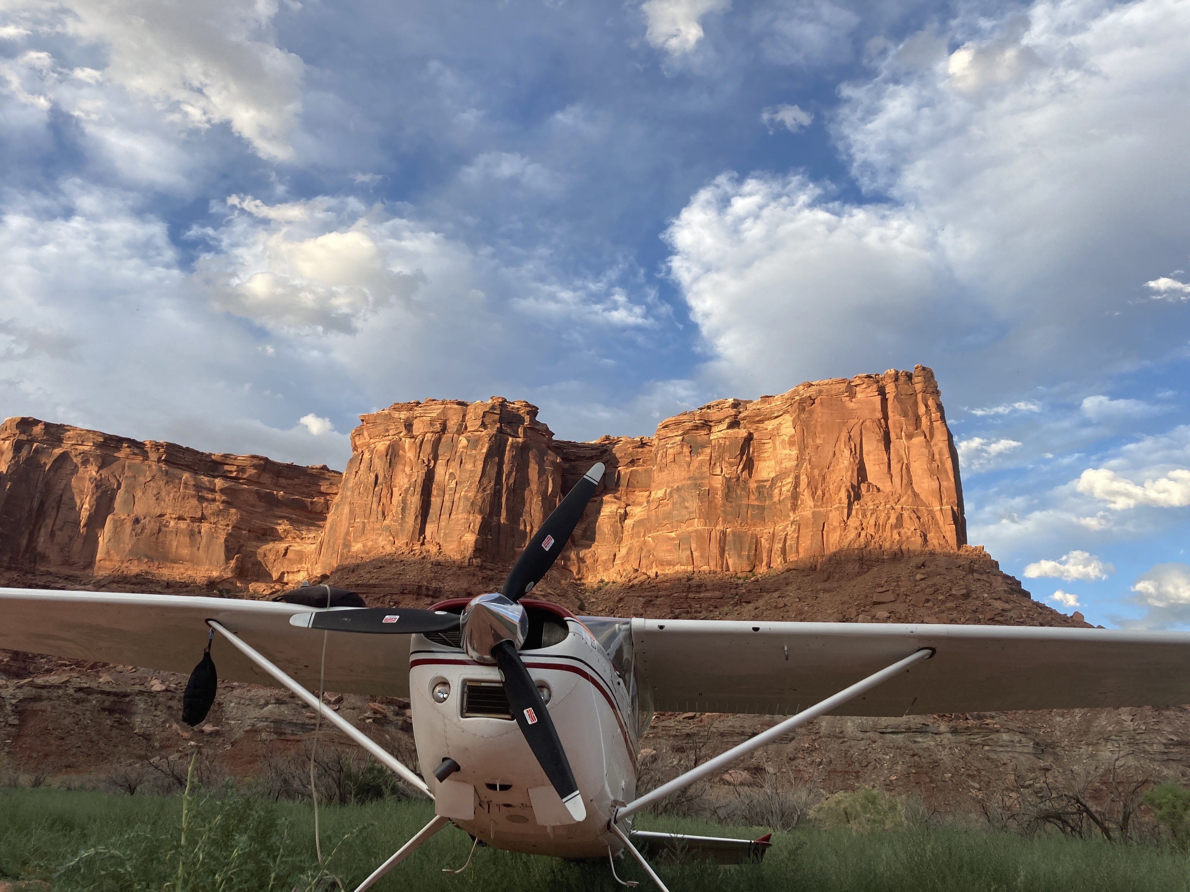
Description: Mineral Canyon's airstrip resides in the Green River canyon just south of the Bowknot Bend. River has a tendency to flood during the summer, so a thorough review of the airstrip prior to landing is imperative. Mineral Canyon is one of the three back country airstrips included in the State's "FLY UTAH Passport Program". To learn more, head to their website.
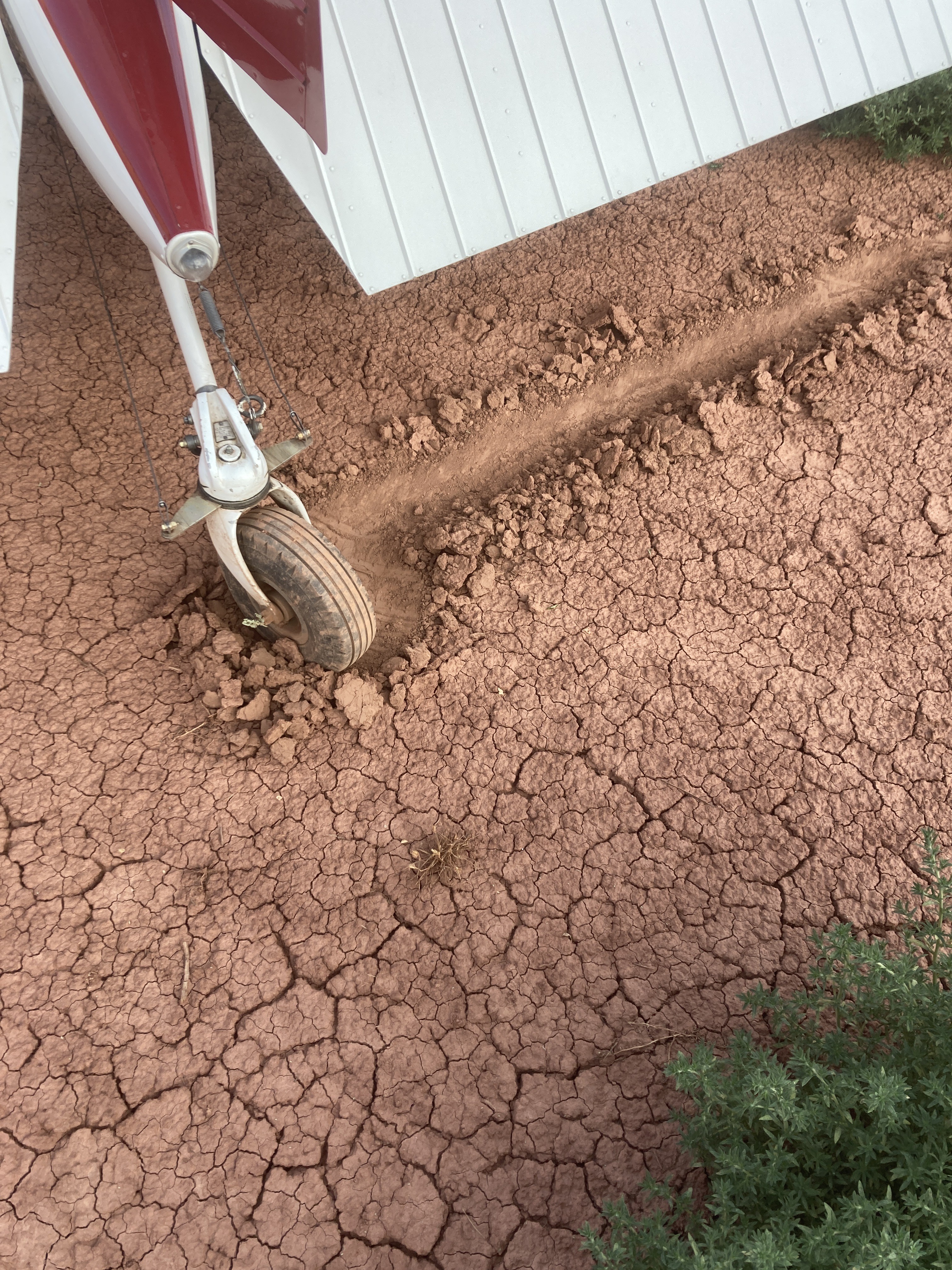
Runway: 2000 ft long x 40 ft wide dirt runway in generally good condition, however can be quite soft due to its propensity to flood.
Approach Considerations: Airstrip resides inside a canyon with rapidly rising terrain within 1000 feet of the airstrip rising over 1000 feet above the landing surface. Base jumping and other low-level aircraft operating around and near the airstrip. Please monitor CTAF and make position reports regularly.
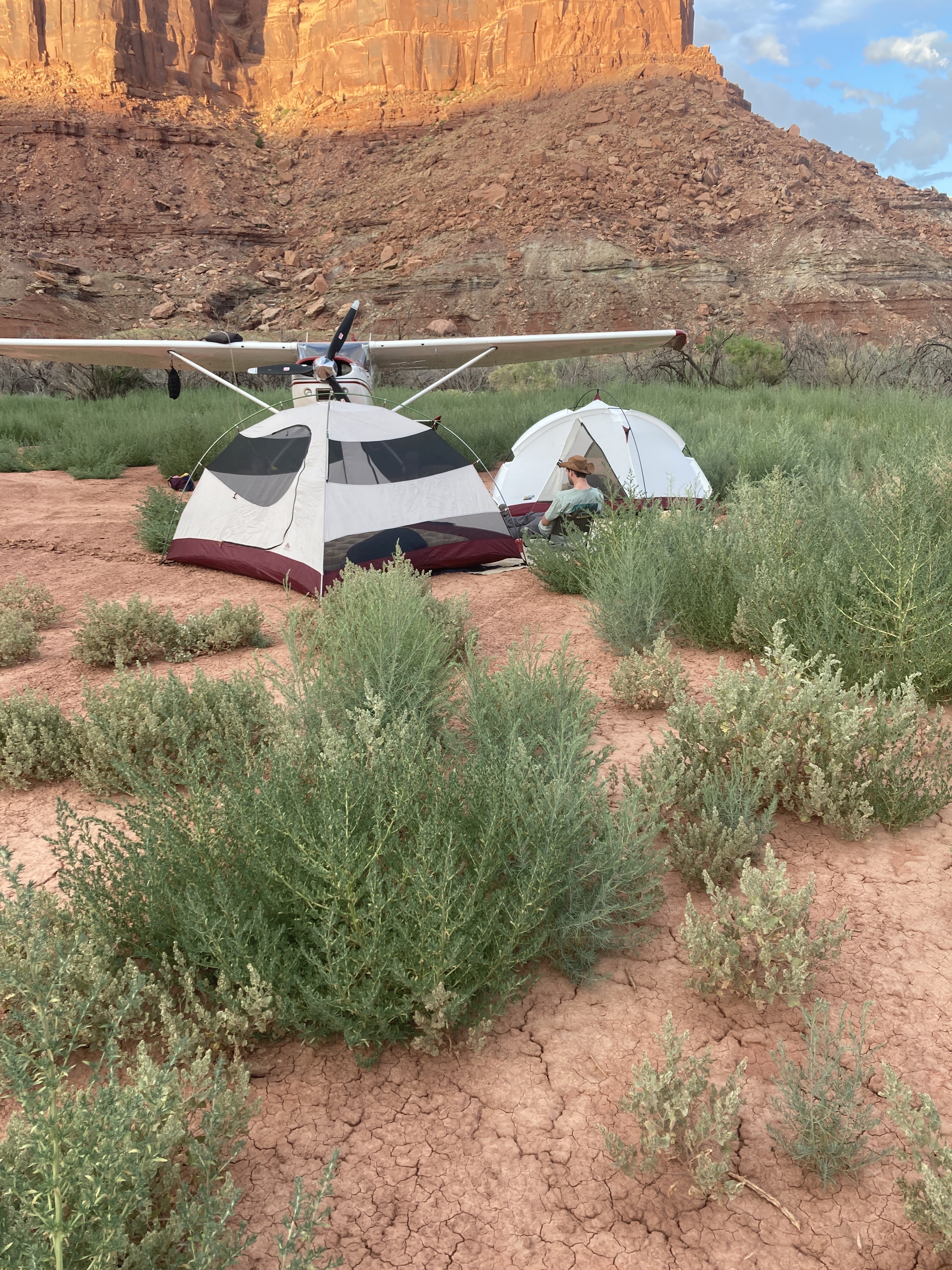
Amenities: None
Windsock: Yes
Spent the night here. Runway is plenty firm but the weeds are getting tall. Prop clearance is becoming difficult in a number of places. They are still very soft and look much worse than they are. We walked the full length and besides the small hole on the south end (previously mentioned) the runway is pretty good. Slightly soft (soft to the point that there was insufficient traction to break the tail wheel out of the detent) but had no effect on our performance. The mosquitoes are out in full force but it still was a spectacular night out under the stars.
Just a touch-and-go from the north; not too rough. At least first 3/4 was good & clear. The very southern portion (last 25%) looked green, so possibly a result of water from the Green River. I was T&gone by then. No obvious vehicle ruts. Can't comment on windsock/parking. We then went to Happy Canyon...separate report..... My second time flying T&G at Mineral. I've been there by road and camped many times. One day I'll camp under the wing of my Taylorcraft at Mineral, but it's a long way from my home airfield EGBG. Rob
I've got no idea about the windsock, the parking area and the camping area which I am obliged to state in the UCBP form.
1 year agoWindsock was a bit hard to decipher form the air: looked like alot of orange (paint?) on the ground around it making it hard to see direction from the air. The first 300-350' for Rwy 33 has growth un the runway. opted to land past it and inspect on the ground. Most of the surface in the grass area is nice but there is a decent sized hole on the far right side est 200' from threshold that needs to be avoided. Unfortunately left my shovel at camp so couldn't fill it in. Rest of airstrip soft sand and in good condition. Parking area is hard pan, cracked dirt from a previous water event. no issues taxiing on it.
We haven't written a history for this airstrip yet. If you would like to provide us with some information about this strip, please contact us today!