Airstrip Info
| Frequency | 122.90 |
|---|---|
| Elevation | 3946 ft |
| Lat/Long |
38.5293, -109.9946 38° 31.758' , -109° 59.676' |
| Runway 15/33 |
2100 ft
x 25 ft
Dirt Rwy 33 Uphill 0.7% |
| Ownership | BLM |
Amenities
Weather
See more at the National Weather Center
Information updated November 27, 2022 @ 9:17am
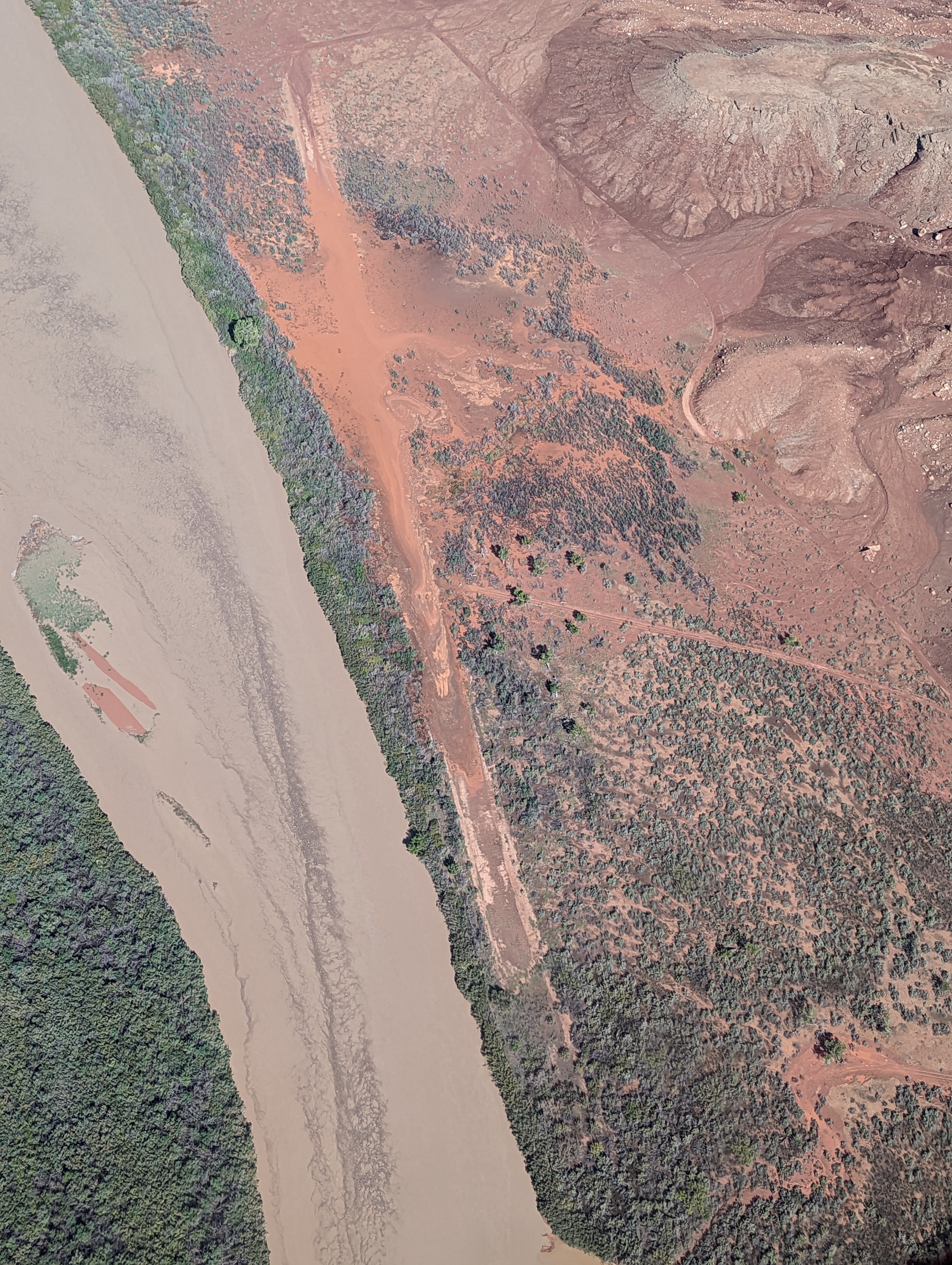
Description: Mineral Canyon's airstrip resides in the Green River canyon just south of the Bowknot Bend. River has a tendency to flood during the summer, so a thorough review of the airstrip prior to landing is imperative. Mineral Canyon is one of the three back country airstrips included in the State's "FLY UTAH Passport Program". To learn more, head to their website.
Runway: 2000 ft long x 40 ft wide dirt runway in generally good condition, however can be quite soft due to its propensity to flood.
Approach Considerations: Airstrip resides inside a canyon with rapidly rising terrain within 1000 feet of the airstrip rising over 1000 feet above the landing surface. Base jumping and other low-level aircraft operating around and near the airstrip. Please monitor CTAF and make position reports regularly.
Amenities: None
Windsock: Yes
Landed right at the beginning of the strip on the downstream end (the end opposite the larger turn-around) It was kinda rough with weeds and ruts making it sketchy for about the first 300'-400' (just a guess since I didn't go walk it to be sure of how long the rough stuff was. Long enough to land past it with plenty of runway to spare. At the opposing end, where the more obvious turn-around is, there is a large rut to the left side... There is plenty of room on the right to taxi past it and take off past it. Overall I'd say to do your low pass and look for these, but landing was fine. In fact, this was one of our favorites.
Landed upstream and took off downstream. There is a large rut in the middle of the rwy on the upstream end. It appears that the strip has had some maintenance, but be very careful of the rut on the upstream end. Plenty of room to go to the North of it and use this portion of the runway. Do a low pass to see for yourself...
Did a low pass on the Airstrip on Sep-4-2022, the surface appeared to be dry, significant washout on the north end of the strip, looks like the rain runs straight off the cliffs onto the north and middle of the strip. There was enough room between the impacted areas that I probably could have landed and taken off, but I didn't feel like pressing my luck. Multiple rafts tied up on the river at the take-out just downstream. Rock climbers also were in the area, they all looked puzzled as to why an aircraft was flying so low (probably not aware of the airstrip just a quarter mile up stream from them). Didn't get a close look at the windsock.
We haven't written a history for this airstrip yet. If you would like to provide us with some information about this strip, please contact us today!